
A mirage
I woke in the middle of a dream to birds gliding gently across the sky, wings glimmering in the sun. There was some sort of figure, though I could only see their legs, with their feet nestling within flowing, fresh water. Bright sunshine seemed to caress them and warmed their shoulders. There was absolutely, utterly no rush. I remember dreaming that sensation the most vividly.
I blinked, felt the warmth against my face, and broke in to a broad smile. Like missionaries who had had their beliefs tested in unfamiliar lands, our faith had returned to sustain us. It was a moment of being at one with the outdoors and luxuriating in that, letting us remember what the Challenge was meant to be all about.
Gabe and I looked at each other, nodding in a way which communicated more than any number of words could have. Breakfast would come eventually, but for the moment, watching the stream gurgle its way down the hillside was enough sustenance for anyone.
What a difference a full night of sleep makes.
We weren’t really expecting it would go all our own way today, with 35 km still to travel, normally nowhere near problematic for us – but with the feet having taken a sustained battering over the last two days, we knew by the time we arrived in Aviemore we’d be relishing getting a proper rest.

This was the first day we shuffled our maps to pull out the FWA (foul-weather alternative) and decided to change from our intended route, which would have involved striking out over a succession of hills, culminating in the 878m Carn an Fhreiceadain, before dropping down and continuing east. No, we’ll be having none of that thank you. Instead a morning amble through the Strathdearn would have to do.
Strathdearn and Coignafearn
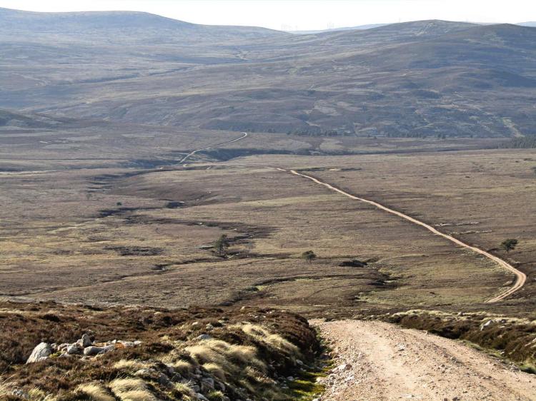
The morning began with a couple of sumptuous hours of walking by a beck, our path punctuated with fords as it snaked towards the bottom of the valley. The Monadhliath has a mixed reputation amongst some, and on the evidence of today, it had been unfairly maligned. In our (admittedly narrow) experience it seemed a tale of two halves, with parts of the western section seemingly developed in to clusters of wind farms – or are in the process of being constructed in to one – with vast swathes of land cleared and turned in to access tracks to get the heavy machinery in. I don’t want to ramble too much about wind farms (spoilers: I probably will), but let’s just say we were glad to get back to enjoying the scenery.
As we approached the valley floor we both agreed it was the right choice to stop ‘early’ last night, with the extra two hours likely to have finished us off. Now fresh, we cheerily greeted a bird-watcher who was out early, and continued on to Coignafearn Old Lodge. We now were walking on the flat, choosing a wide expanse of grass which ran parallel to the ‘proper’ track, being buffeted by a fair amount of wind – handily giving us a push. Ahead, there were three pairs of walkers making their way in different directions – we assumed they were Challengers, as this seemed the middle of nowhere for anyone else to be wandering about.
We thought back to our fellow Challengers on the boat yesterday afternoon. It was likely that one pair may have been the Americans from the boat yesterday, who despite being fit, must have made brilliant progress. They said they were headed to Coignafearn ‘the long way’, sticking to the tracks, although it seemed unlikely they overhauled us being as we went straight over the tops. As we approached, looking forward to catching up with them, it seems we were wrong – it was a mix of day hikers and those who had parked a couple of km further on to get some fresh air.
A good Samaritan
Not long after overhauling this motley crew we took a break to replenish our water, it was around 11am and our now-ritual changing-of-the-socks had to be done, too. Sitting there, re-taping some of more dubious-looking parts of our feet, a motor home passed us, stopped and then started backing up into the little area we were occupying. It was a small space, barely enough for a car, and with the motor home getting closer and closer a thought flashed through my mind – that I would have to explain to Challenge Control I will have to abandon due to being run over. Pushing myself to my knees with zinc tape still stuck to my fingers, in readiness for some sort of sockless leap out-of-the-way, I mercifully heard the engine cut out a generous couple of metres from us, and the handbrake go on.
A gentleman got out of the driver’s door and I had half a mind to tell him about the near miss, but instead he immediately greeted us warmly and asked us in a broad Scottish accent whether we were on the TGO – as he had seen our backpacks and thought it likely. We were to find out this chap was Ian Shiel, unofficial TGO support crew, his brusque bearing and motorhome adorned with a well-placed saltire and SNP sticker revealed a proud Scotsman. He was very surprised to see us, mentioning he hadn’t seen anyone this early and that he wasn’t expecting any TGO-ers until the afternoon – commenting that we must be flying to be here by this time of day. Taking a look at my exposed still-sockless feet covered in tape, I had to agree.
We were just finishing our break and were actually just about to leave, but company was nice to have, and on top of that, most importantly, Ian offered us something to eat. He vanished in to his motorhome and returned shortly afterwards with steaming bowls of soup and a hunk of Scottish bread. I thought it looked a bit like a French baguette myself, but I glanced at the saltire and decided not to mention it. Discussing the rest of our route came next and we found Ian had a strong knowledge of the area, and with our change of route we were welcoming any local advice we could solicit. Our adjusted route was rated favourably; mainly due to it was the most direct (rather than our original jaunt over the tops), with us heading across a bridge 2km from us and then making towards the Burma Road. Soup now finished, we thanked him and headed off, with Aviemore now only 20km as the crow flies.
Saddle sore
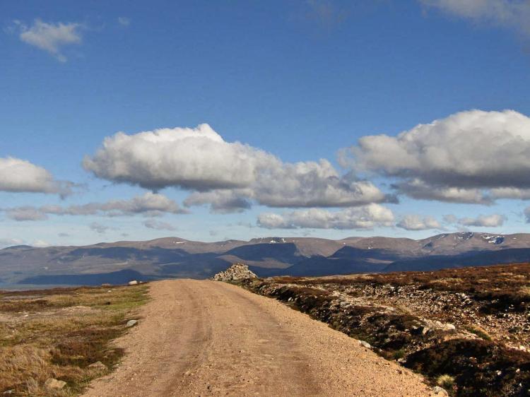
Leaving the glorious River Findhorn behind with its’ water still low we crossed and headed south-east to cross the Allt a’Mhuilinn, done with a stylish leap, now joining the path which wound its way alongside the allt. The wind had dropped, the shades were back on (gold aviators, in case anybody had any doubts how cool we looked) and this unexpectedly became one of the most enjoyable sections of our Challenge. The secluded valley meandered and the stream trickling was a lovely soundtrack in the sunshine as we slowly ascended, before getting ready to strike-out over the Carn Caol saddle.
Heading off the path and over the rough ground we set off on a bearing, determined to get ourselves up and over, intending to use a lochan on the saddle for navigation. Proving rather heavy going we chose to not follow the en-entrant as we had planned and instead took to the ridge, hoping to get some traction on the harder ground and power up in one go – at the cost of being more exposed to the more turbulent weather of the afternoon. The area was covered in peat bogs, miles of them, and winding our way through these bogs turned a relatively simple section ‘on the map’ to a terribly slow crawl in reality.
Once we reached the ridge the wind caught us in full, catching Gabe’s rain cover like a sail, and we decided to switch to making progress towards the northeast with the wind to our backs, not least to get away from the energy-sapping boggy ground, with us trying to seek out rough heather wherever we could. It may have something to do with the cumulative fatigue from the days before or the state of the feet, but this was the single hardest section of our Challenge in terms of terrain, with 5 km across country taking us a long while.
Road trippin’
Over the crest we saw the beginning of a track, disconcertingly heading in the wrong direction to the south-west. As often happens the maps had seemingly not yet caught up to the reality of what was there and we reasoned we’d take it, walking a good half kilometre in the wrong direction (never a good feeling) before the track meandered around towards the north-east and made sense for Aviemore.
We were a little concerned with how long it took us to head over the tops, with it now almost 5pm but still having 18km still to go to Aviemore, much of it hilly. The good news was that we knew we had a rest day tomorrow, favourable terrain ahead (dry tracks), and perfect weather – with the added bonus of wind to keep us cool – but it would still need a big effort to get there in the light.
This part of the River Dulnain certainly had character, with the Cnoc Fraing imposing to the south-east and plenty of streams and features within the valley we were walking through. It was clear we were getting close to civilization as the odd mountain bike was whizzing around in the distance and eventually a whole group of them rode up to ask for directions to Aviemore as they had no maps between them. I’d love to say our navigation skills got these guys out of a potential bind, but it was as simple as pointing out the massive dirt track heading up in to the hills and saying “follow that and you’ll get there”. Seemingly happy they pedalled off, with both of us agreeing we’d have to sort some bikes for the next Challenge, maybe a tandem.
By 6pm we had arrived at the bridge before Caggan bothy and looked to start the Burma road, which should take us most of the way back. It was clear we had to pull something special out of the bag if we were going to avoid another late night. We had a serious distance to cover, yet we had to slowly ascend to 700m before descending back down again, something neither of us relished
This section holds some mixed memories for me because we felt we had come so far, challenged ourselves and managed to not only beat illness, injury and sleep-deprivation on the way – but we had done it whilst helping each other, keeping each other motivated and digging deep. We resolved ourselves to make it to Aviemore in the light tonight even though the feet were in agony, but we were certain nothing was going to stop us now.
An hour later, we had covered 6km, predominantly uphill – mostly powered through sheer determination. It was a storming pace and Gabe, now free from his illness, was now leading the way; with my feet, much in the worse condition, were slowly making me drop behind. We maintained a 5km/hr pace for 3 hours, including stops – a monster pace with a heavy pack – and by the time we were descending to Aviemore my feet were in seriously bad shape because of it. Our thinking was it was better to push it tonight and let us recuperate all day tomorrow, than camp, lose our reservation and have to get back on the Burma road in the morning anyway.
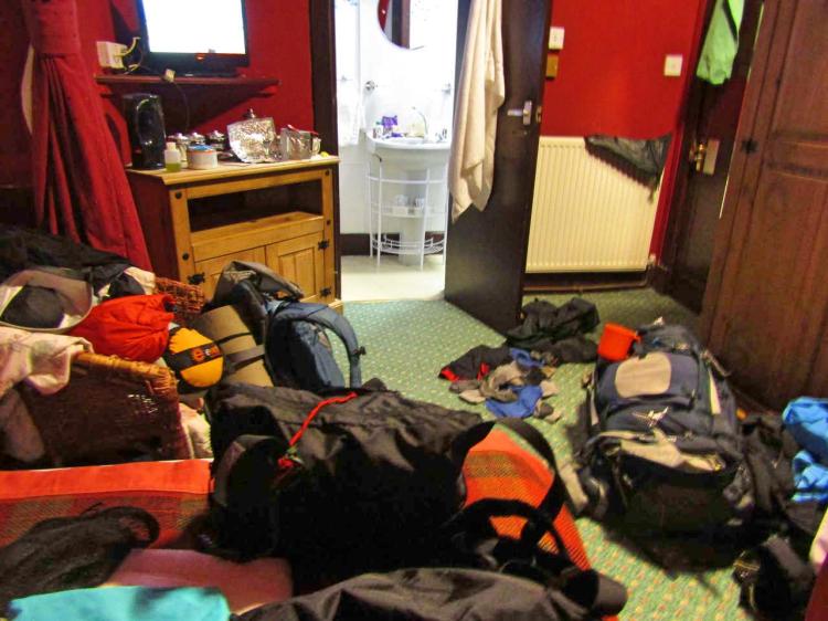
As we arrived in to Aviemore proper civilisation began to spring up around us, road signs gave way to underpasses, which themselves gave way to high street brands as we walked the last couple of kms to our hotel – grabbing some beers and food on the way. Checking in, it was still light (we made it) and we went about unpacking our kit, showering and then washing all the clothes. The room turned in to an explosion of drying tents, socks and trousers – hanging off literally every available corner.
By 11pm I was finishing off a portion of chilli as Gabe relaxed on his bed, a forest of beer cans open and tired smiles on our faces. We felt our TGO was back on. We would resupply tomorrow and have all day to recover, with Ben Macdui and the Cairngorms lined up for two days time..

Just caught up with you.
What can I say?
Wonderfully, completely and utterly mad!
😁
Massive days, great weather, and rotting feet. Every ingredient for a perfect first Challenge.
Just one question. Why did you drop down to below the Falls of Glomach on your first day? It made Day 2 even more huge?
😀
LikeLike
Hi Alan,
It was a bit mad really, wasn’t it? I’d say the quintessential moment for me was walking through Corrimony in the dead of night, with my mini speakers blaring out bagpipe music in order to motivate us to keep going and forget about our fatigue. It definitely was a Challenge with, shall we say, a lot of “colour” to it.
Why we took the Falls of Glomach is a good question. I know you know the area well, as you have been through there on a Challenge, so I’ll assume a bit of local knowledge in the full answer.
Beinn Bhudie and Beinn Bhreac had been done at a slow pace, after G said he was in good enough shape to do them – the terrain was rough, and we actually found it easier going up high than the undulating ground predominantly up the coire. The original route was to skirt around them, but we felt up to making an extra couple of km to get some big views of the peaks to the east. None of this would itself have been a problem except all of the expected lochans along those two peaks were dried up. Our descent to the bealach put us barely 200m away from a potential source, so we decided to go for it. There was hardly more than wet mud, something our filters couldn’t deal with, so we pushed on to the Eas Ban waterfall, assuming a steeper section would draw out some drinkable water. Repeatedly we found little more than a trickle, and by this point we were descending to where the waterfall intersected with the Allt, and decided to take the 1 km downhill to pick up a guaranteed source.
I suppose we could have just continued, but with G in the state he was, we decided to descend for a ‘sure thing’ and filter the river water if absolutely necessary, rather than get caught out on the hill. There were a lot of ‘what ifs’ from the first day, with the illness we were considering walking the River Glennan and throwing our hill day entirely, but we didn’t feel that would have given us the start we craved. We weren’t in Scotland to walk with the crowds, we wanted to find those quiet, beautiful places where you feel well away from civilisation and well-worn paths.
LikeLiked by 1 person
That all makes sense.
Anyway, it’s a glorious rip-roaring adventure, and I love it!
😁
LikeLike