TGOC 2017: Day -1 and 0 – Starting our coast-to-coast across Scotland

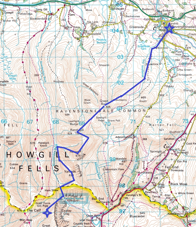
Edit: This post covers our trials and tribulations on our journey to Dornie in order to start the The Great Outdoors Challenge 2017.  If you aren’t much in to the preamble, you can read about our first walking day by reading this post.  Still with me? Then do read on..

Day -1  Arriving in Dornie

For such a well-prepared trip, it started off messy.

All the desks we had covered in maps, the detailed food plans, resupply drops and carefully put-together kit lists ….  it seems no matter how on top of our game we thought we were – there will always be a spanner in the works, or in our case, a whole toolbox.

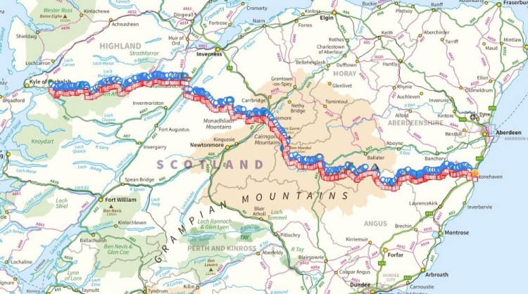
Firstly, and you know nothing good comes after ‘firstly’; whilst going through our train tickets a week prior to departure, we realised the train journey was booked on the wrong day – Wednesday instead of Thursday.  For those not familiar with the TGO Challenge, you cannot “sign out” earlier than the Friday morning, so this meant rapidly making taking an extra day off, and gave us a full extra day with little to do in a village with basically one shop.  After looking for alternative trains, the cheapest at an eye-watering £240, we decided to bite the bullet and set off on Wednesday.

We made our train transfers at Edinburgh, lugging a heavy bag of kit, including eight days of food each – eventually arriving at Inverness during the early afternoon.  We met a couple of American hikers cradling large packs already in the bus queue for Dornie, quickly finding out they were also TGO Challengers on their way to Shiel Bridge (the stop before ours).  Discussing our separate routes we realised it was unlikely we would see them again, as they had a predominantly low level route and planned to finish a day later than us, but we wished each other well all the same.  When they brought up their planned whisky distillery tour on one of their rest days, Gabriel (my hiking partner for the two weeks) and I both felt we missed a trick.  Gabriel (who I tend to refer to as G) and I are both keen hikers, skiers and occasionally climb together – and we met a few years ago as members of mountain rescue, which we were raising funds for on our challenge.

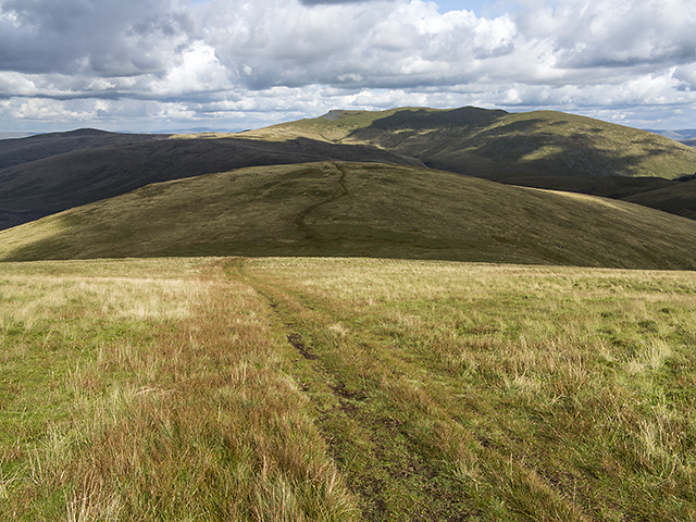
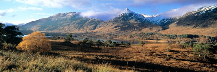
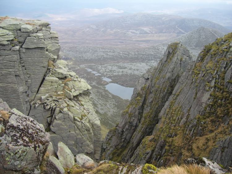
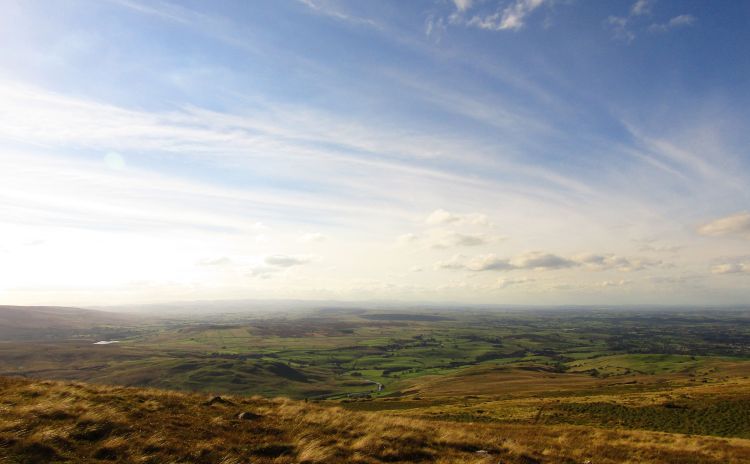
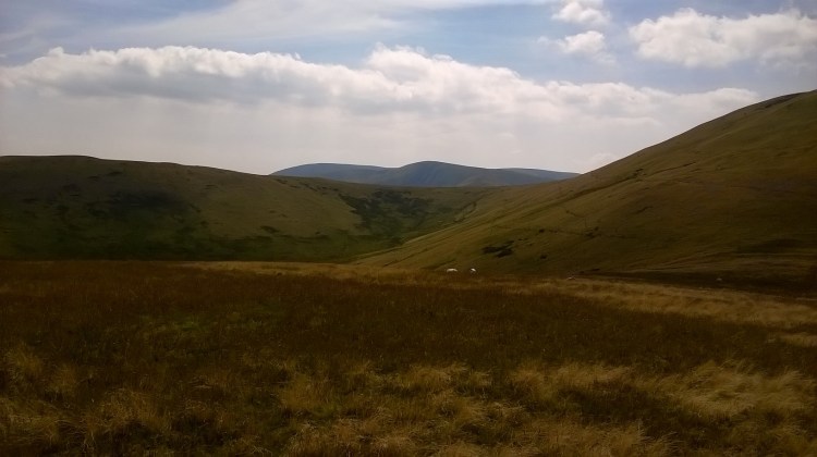
Travelling through the glens in the late afternoon was a tour of what was to come, with every peak, loch and rock face considered for future trips.  It certainly fed our inspiration and put us in the right mood, leaving us with the feeling were we to do 50 Challenges, we would still be finding new places to explore.  A couple of hours on the road we hit our next snag, smoke began belching past the passenger windows, our fellow occupants looking at each other, trying to decide whether It Was Serious.  The driver, to give him credit, quickly pulled off the road and turned the engine off, with us looking around for the emergency release on the window if required, we were on the back row of seats after all and didn’t much fancy pushing past what was a packed coach.  Thankfully, without being in motion there was just wisps of smouldering every now and again.  The driver took a look, reporting back that the the air conditioning system had overheated, and that we would need a mechanic.

TGODay0-5
The View from the Arelve on a still Thursday morning

How many mechanics can there be in the middle of the Scottish glens?  It turns out very few, and we were in for a fair wait.  After an hour and a half, we established it was going to Take A While.  At this point, I took out my iPod and mini-speakers (brought specifically for livening up wet tent-bound evenings), queued up The Bonnie Banks o’ Loch Lomond and the hour long Scottish Bagpipe Medley and let rip.  … A little infusion of the William Wallace spirit to get us through adversity seemed a great idea.  After 45 minutes of the pipes blaring from the back of the coach, and feeling more like two hours, we eventually heard the engine start up again, and with a cheer from the rather fed up passengers we set off again, suitably inspired and all out of Braveheart quotes.

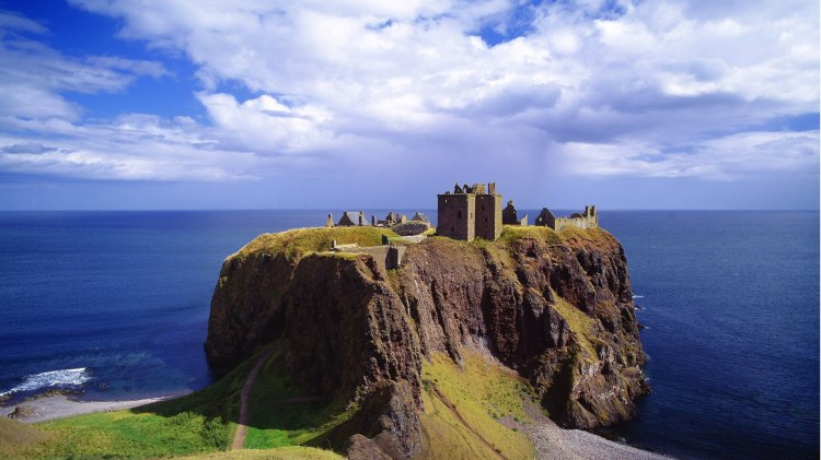
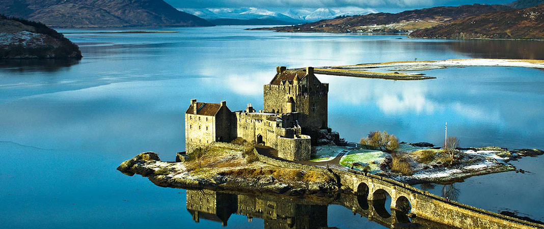
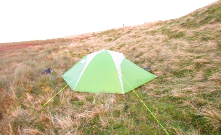
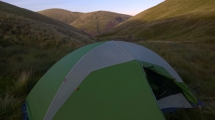
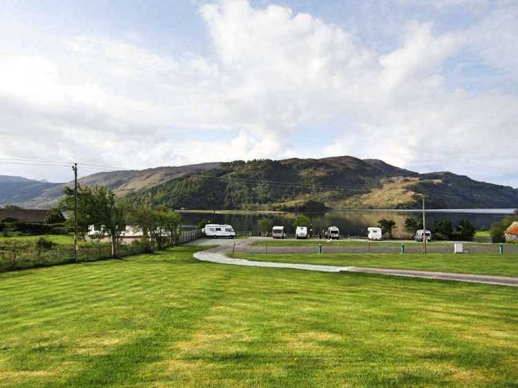
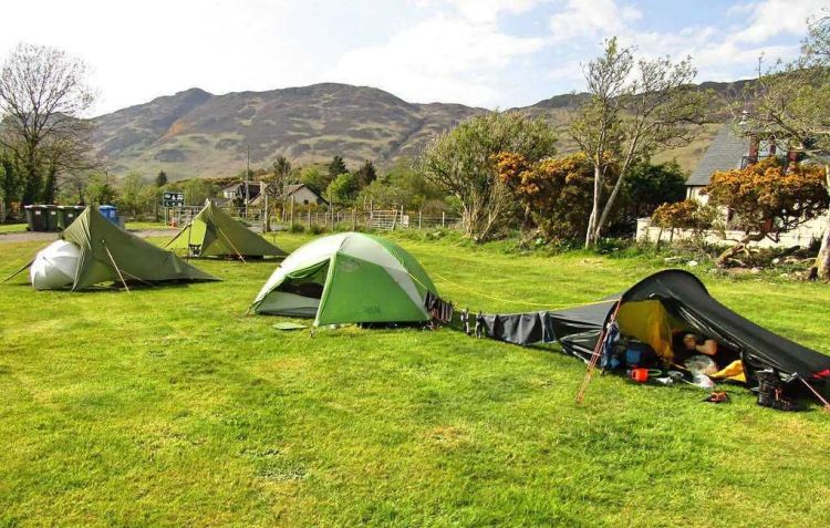
We arrived at Dornie just as it dusk approached, deciding quickly we didn’t have time to scout a decent wild camp pitch as we had intended.  We went to the Ardelve campsite, the Eilean Donan illuminated with lights and looking quite splendid as we put the tents up.  It had been hot most of the day and was still clear & warm as we fired up the stoves for food, having a belated evening meal.  We sat on the grass and raided the Remy Martin XO I was carrying (intended for the east coast, luckily half the bottle survived!).

Day 0: Day of Rest

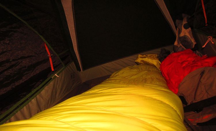
Now Thursday morning we woke early to scorching hot tents, our plan to sleep quickly scuppered, as we needed some air.  The camp site in daylight was a pleasant surprise, with stunning views of the fells to all sides and seemingly (always a risk on smaller sites) recently refurbished facilities.

TGODay0-25
A forest of tents begin to appear throughout the day. Our drying line up for the first of many times.

TGODay0-17

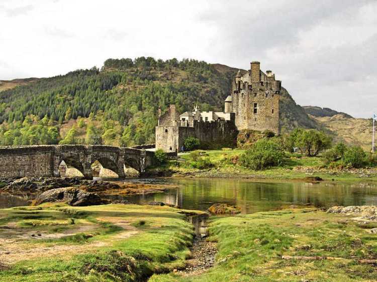
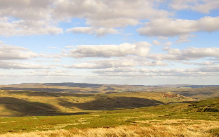
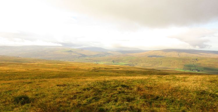
We spent the morning lounging around, took some photos of the castle,  meeting a Frenchman who had been hiking the Cape Wrath trail and now looked sunburned, tired and happy.  We would be lucky to be in similar shape by the time we hit the east coast.  Enjoying the stillness and staring at the hills in almost every direction, the craggy aspect reminded me of living in Norway, it was proving a lovely choice as our start point.   Suitably inspired, we felt it was going to be a special trip.


TGODay0-8

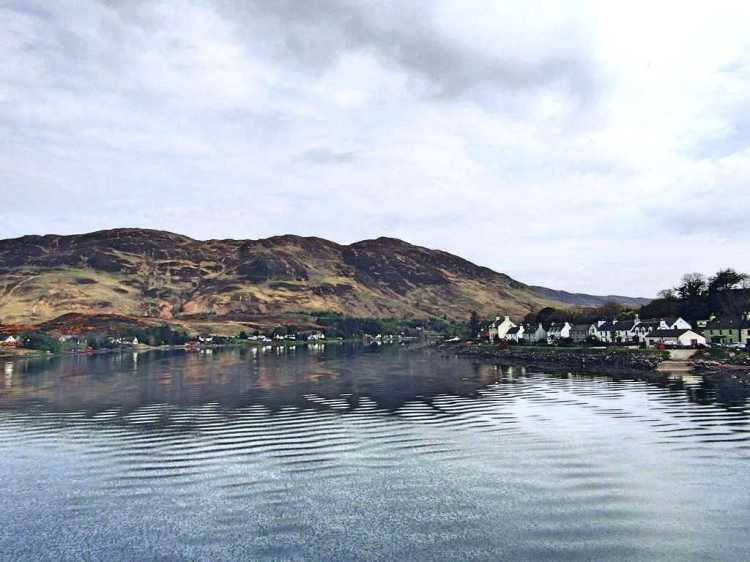
Ambling around Dornie did not take long, simply there isn’t much there (for those of you planning your own Challenge: a local shop, post office, pub, the Dornie hotel and a bakery by the campsite).  We retired back to the tents for an early afternoon nap, intending to catch up on some sleep after arriving late and waking early (which was to be a theme on our crossing).  After a few hours, we woke to unfamiliar voices discussing the merits of tarp tents, seemingly right outside my tent.  Crawling out we were met with three backpackers, sturdy fellows, two of them assembling tarp tents in close proximity, and said our hellos.  Mike, Darren and Dale were three Challengers who had met on the bus together – with Mike doing his crossing solo, Darren and Dale together, with Dale a newcomer to the whole thing like us.

TGODay0-13
Looking to the east from the Dornie bridge.

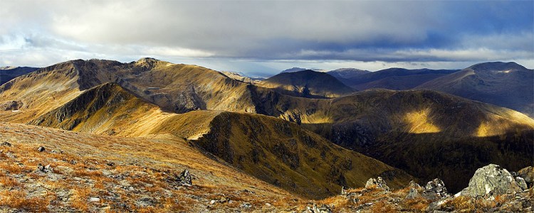
We had plenty of time to talk and the guys offered some tips on our route. The Fetteresso was an unknown quantity at the time of planning, with many dissuading comments mentioning both the supposed tainted water and lack of good camping (more on the Fetteresso in future posts). With our route, we would have one or two nights in the forest depending on how fast we were going and weren’t relishing this potential pitfall area – although we were reassured it was a beguiling idyl on a good day.  Not to ignore that the majority of Challengers heading to Stonehaven went through it due to having little alternative to roads as we get that far east.

TGODay0-22

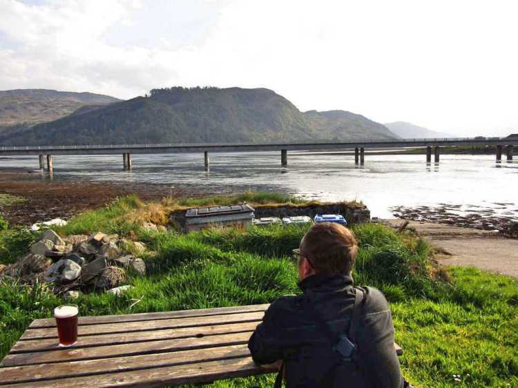
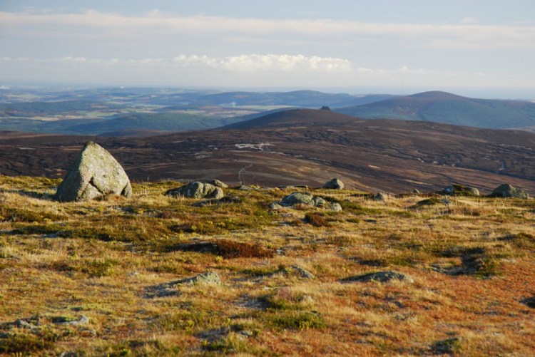
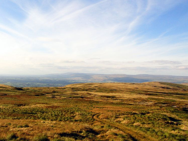
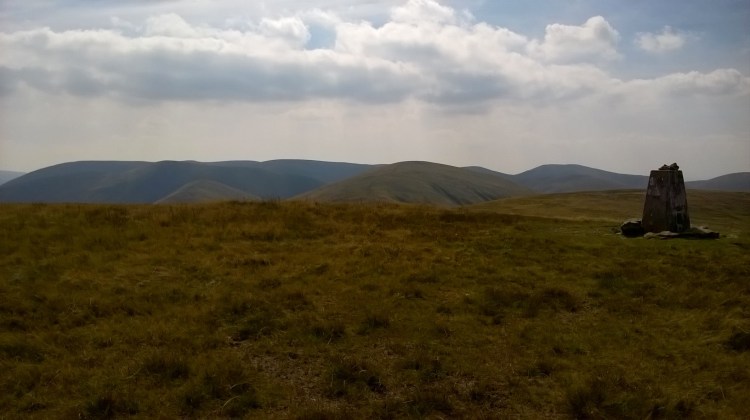
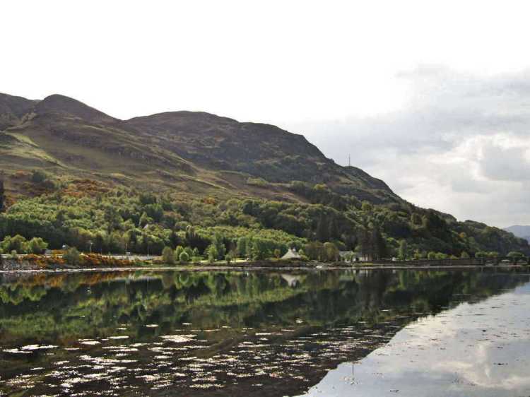
The guys headed off for some food and we decided to stretch our legs, heading for the high point at Carr Brae, sentinel over Loch Duich, around 10 km there and back.  G wasn’t in the best of form and wasn’t feeling right with an illness, something he mentioned on the train, now seemingly it was in full flow.  We decided to put our medical training to good use, picking the best available option of  ‘treating it’ with a few pints from the local pub and plenty of sunshine.  Sat overlooking the loch, the pub was busy (the queue was 10 deep at one point) and we took the only table free, overlooking the loch.  We had brought our FWA (foul weather alternatives) with us to go over, as we had made late changes to some of them, though fully intending never to use them unless absolute calamity struck.  Despite the difficulties in actually getting here, we were (mostly) in good shape, excited for the morning and finally heading off into the wild.

It was going to be a very challenging route, later we would find it was to be one of the more challenging routes taken, but we knew we had prepared well and were relishing it.  Back at the campsite we retired to bed, taking one last look at the Eilean Donan, illuminated by spotlights, now looking forward to the challenge properly beginning.

Day 1: We set off

TGODay0-29


Lake District – Pre-TGO warmup hike. Bowscale Fell to Skiddaw round

As part of our training for the TGO, we penned in a few weekends to improve our fitness and slowly cull intended kit (there is a huge pile of stuff we ‘may’ take but don’t want to carry!) to ease our legs across bonnie Scotland.  Some challengers seem to take 35L backpacks, which either means they are absolute miracle workers with PhDs in rucksack packing, or they simply take much less with them – shocking, I know.   We no doubt will pick up some of the forbidden knowledge from these backpacking otakus (though we won’t be drilling holes in our toothbrushes to cut weight as someone of the Ultra Lightweight Backpackers are known to do).

When looking at areas, one which popped out was the Northern Lakeland fells.  I’ve done Skiddaw and Blencathra plenty of times, yet never quite headed to the fells behind these – in part as I seem to gravitate to the central fells on most of my trips, and the Northern Fells’ reputation of being boggy didn’t help their case.  Once looking at the maps, there is plenty to get our teeth in to, ending with an interesting route (viewranger external link for gpx file) of 15 Wainwrights over 2 days, a pretty sturdy challenge of around 45km with plenty of ascent.

overallroute
Northern Fells Round

The intention was to tick off as many Wainwrights as possible with a circular route whilst not wasting a large amount of time driving deeper in to the Lakes. Heading off at 7am was in order, though we made some time for only a brief stop at the Little Chef outside Penrith for a bacon sandwich to help propel us more quickly up that first fell! (note, they were rubbish, should have tried the Llama Karma Kafe instead).

032_Bowscale_Tarn
Bowscale Tarn

Bowscale Tarn was a superb little place, and would have made a fine wild camp spot – tranquil and well protected with a bubbling stream running away away from the tarn down the mountain side.  We took the steep ascent straight to Bowscale itself, and quickly hit hill fog.  This meant getting the map and compass out a little earlier than we would have wanted and we proceeded towards Bannerdale Crags in full clag.

The general dampness turned in to a persistent drizzle, rain jackets were put on, and we continued to navigate via compass in dense mist. The original plan was to stride out to Mungrisdale Common, an uninspiring Wainwright in terms of height but potentially lovely views on a clear day – though we both agreed this would be nothing more than a plod across boggy ground in the thick fog – instead, we went directly to take the Foule Crag route up Blencathra.

It was blowing a gale by now (a theme for most of my hikes), so this seemed a good time to take a stop out of the wind just below the ridge and grab lunch.  The bothy bag was pulled out but was somewhat ineffective on uneven ground in such high wind – I use the 2-person version due to it being easier to handle in high winds, yet it isn’t great if you’re on a slope due to you needing to sit opposite each other in a fixed position, making you likely to slide down any slope you happen to be on!

We took a direct descent to the due west of Blease Fell, a steep route which cut off 3-4 km by directly hitting the main track even if it a careful descend was necessary in the wet conditions – though by the bottom we at least got a reprieve from the rain.  Once at the bottom we were on the supply track for Skiddaw House (probably the most remote Youth Hostel in the UK) we made good progress and gained height towards our campsite.  The site itself wasn’t fixed at that point, it was more a group of little circles on the map with hopeful question marks immediately above them!  The low fog rolled in thicker towards the mid-afternoon, and by the time we reached Skiddaw House YH we realised Lonscale Fell wasn’t going to happen that day due to pretty much zero visibility and still heavy rain.

We started to search for a camp site which put us in a good position for the second day. There seemed to be precious little choice though with many potential areas were either covered in heather or about to become waterlogged.  We put up the tents on high ground by a stream and decided to give ourselves half an hour for the rain to ease, each retreating to our tent – warm kit thrown on and slowly drying out.  Making some food (fresh pasta and cheese sauce has to be a backpacking high point for anyone) put us in a good mood despite the weather and as the heavy rain returned we hit the sleeping bags early.

The next morning was glorious without a dark cloud in sight, a welcome change from the damp fog of the night before.  Stoves quietly lit and cup of coffee in hands, the second day was discussed and the bright morning gave us enthusiasm to keep to the planned route, hit the peaks and to finally enjoy the views.  We packed up and left reasonable early to make the most of the reprieve in the weather, first ascending Sale How which was marked by hardly a handful of rocks at the summit.  Turning around, this panorama was brilliant with the ‘feel’ of the back of Skiddaw making it seem secluded,  cushioned on all sides by groups of fells in a way particular to the North Pennines.  Taking a moment to enjoy it after the climb from camp, it was time to crack on to Skiddaw Little Man, cresting into the windward slope with high winds and low mist greeting us again – the views slowly fading behind us as we switched to navigating from the compass again.

4131876_d618dfa3.jpg
Sale How

Skiddaw Little Man was a painful climb with a painful knee, a slight injury from a slip on the first day.  Steady winds at the top buffeted us as we headed up Skiddaw, a hill which has some glorious views on a clear day, but we weren’t to be blessed with them.  Cracking on from the summit wearrived at another Wainwright in Bakestall during the descent toward the valley bottom – with a view towards Bassenthwaite which would have been a nice spot to linger on a still, sunny day.

The original plan was to head straight down to the valley and take the steep climb to Little Calva.  At the bottom of the valley we broke the stove out and rehydrated our first ‘creation’ since buying a dehydrator – a vegetable curry.  I was expecting an unpalletable mess, so was surprised to find not only did it rehydrate properly, but it tasted like a solid vegetable curry! It was just as well, as with a good seven Wainwrights to hit for the afternoon so would need our energy.

The climb to Little Calva wasn’t doable with my knee as it was so we took the more reasonable path up to Great Calva, walking a km up a track past several DofE groups (carrying mountains of kit) all looking rather subdued in the rain.  A muddy trail intersected with the path and headed north towards the summit – a route which quickly became an unremittingly heathery/bog trudge, with the weather now properly coming in as wind swept rain.  It was providing to be a useful training hike for typical Scottish weather!

29.04.09-182
Great Calva (not our pic, we basically could see the fence and thats it)

Wind shirt quickly made way for the rain shell, with hood fastened tight and gloves on firmly as we took the waterlogged path to Little Calva, and from there the two km to Knott felt like a much greater distance due to the boggy ground.  The weather was really coming in and it was necessary to take a stop in the bothy bag – grab some food, put some warm clothes on and make a brew – both mulling over whether we’d change the plan for the afternoon.  With an honest estimation of the torrential downpour and the painful knee, which wasn’t getting any better, we agreed to change it up by cutting the most northerly fells off the list.

As we descended in to the valley, the clouds started clearing and we almost decided to make a push for High Pike, a Wainwright with an excellent panorama (were we to get it) – but knew it was already late afternoon and I didn’t want to be carrying a heavy pack over steep, wet ground for longer than I had to.  The last hour was a flat walk along the mining road back to the car, fortunately with a full moon.  One by one the constellations unveiled themselves and listening to the water of the fast flowing streams in the background it became an unexpectedly relaxing experience, with the odd owl contributing the odd hoot.  It was amazingly peaceful, and just made me want to come back and finish the rest of the fells even sooner.

Some good lessons from a heavy kit list and some items were culled after the trip.  Top performers were the Bergans shell kit, the jacket will be “a bit heavy” for some of the ultra light back packing crowd at about 750g, but the inner mesh lining is brilliant for keeping the skin feeling dry (and therefore warm), even with the top fabric totally wet out.  Also, for those fabric nerds (yes, guilty), the NX fabric puts it up there with the latest edition of Goretex Pro in terms of breathability. During the 2nd day we hiked in wind blown rain for hours, and I was worried the trousers in particular would start leaking, as I hadn’t reproofed them since I got them.  Fortunately, they were absolutely solid, totally wind proof, and after reproofing them expect them to be a core part of the Scotland kit.  Onwards to the coast-to-coast in May.


Hiking  — Route Approved for Scotland Coast-to-Coast 300km challenge

eilean-donan-visit2
Eilean Donan – Our start point

So here we are, the revisions have been made, the maps bought – and we are all ready to head across Scotland, a 300km two week hike from west coast to east. With the way the political climate is going, it may be our only chance at it, before First Minister Sturgeon decides to build a wall south of Edinburgh … and no doubt bill England for the trouble.

Part of the TGO is creating your own route, as I have detailed in this post— which you then submit to the organisers. After a couple of weeks, you get back a list of potential suggestions, and potential pitfalls along your proposed route from a “vetter”, a knowledgeable person who has done many challenges in the past.

It is worth mentioning the patience of our vetter, Roger, and his suggestions to adjust our demanding original route — gently reminding us it is a two week backpacking trip, not a weekend hill bagging ultra-marathon. Suggestions, some as simple as an alternative route up the peaks; all the way to a redesign of some of our FWAs (foul-weather alternatives, a required part of any route to keep you out of trouble), were all welcome.

We’ve ended up with a creation we are pleased with, a patchwork-monster of mountains, glens, forests and likely a smattering of mist-clad moorlandto finish it off (it is Scotland, after all).

1-WZseq5FHdSWonzPS4Gh_3w
The route – TGOC 2017

The route itself, is detailed below in an outline for those who are either fascinated by the area, or are walkers themselves and appreciate a window in to our decision making and route finding.  I do appreciate it became quite long, but I included some fantastic pics of the area we will be going through – so if nothing else, scan down and enjoy the beauty of the place.

Day 1 — Dornie

We begin with a Dornie start, somewhere we are able to get to via bus from Inverness.  The beautiful Eilean Donan castle will serve as inspiration and allow us a settlement with a few shops and a pub before we leave civilisation for a few days. Looking at other blogs, routes and discussions from those who have completed the TGO more than once, it was decided a more sedate first day to get used to a full pack stuffed with food, fuel and good intentions was in order.

It seemed prudent to eschew the common route out of Dornie, the path alongside the River Glennan, which we expect most to be walking who leave from the same start — and instead cast ourselves amongst the fells immediately, pushing through Coire Dhunnid towards the Falls of Glomach, letting us camp as close as possible to day 2’s peaks.

Day 2 — North Glen Affric ridge

carn-eige-pano
Carn Eighe panorama

This day originally had 7km of additional ridge walking in our first submission, and would have been a dawn-till-dusk massacre-of-a-slog we’d be telling tales of till we reach 80 (no doubt about how ill advised it was). Fortunately, our vetter put us right and politely asked us to reconsider, reminding us that will be 10 days ahead of this and that crashing on the first corner wouldn’t help us.

We begin with a severe pull up towards Sgurr nan Ceathramhnan, a 1151m Munro, before ridge walking most of the day at around that height towards Carn Eighe at 1183m, a peak known for fantastic views on a clear day. Rather than continue the ridge walk for a further 7.5km as originally planned — we decided to double back half a km and drop down to lower ground, a steep descent which takes us towards the beautiful Loch Affric, and a couple of hours of Loch-side ambling prior to finding a campsite and resting weary legs.

affric
Glen Affric, with the north ridge on our route in the background

Day 3 — To Loch Ness

Probably the day with the most changes in the route, once we realised our first attempt would have us going through one of the ever-expanding wind-farms in this area, helpfully constructed in the middle of (formerly) beautiful rolling countryside.

The start of the day has a gentle meander through the lowlands of Glen Affric, shadowing the river, before striking out to higher ground at Carn Bingally, finding little hillside paths to descend, and join the Affric Kintail Way for several hours of walking through woods towards Loch Ness, and the little village of Drumnadroicht (affectionately known as ‘Drum’).

Whilst it’s unlikely there will be much spare energy in the tank after day two, there is a little fort on the hillside above Drum, meant to offer beautiful views of the Loch, which we may run in to on our descent in to the village. It’ll be on the list to visit, provided time and daylight agrees (not to mention the legs!) — before we head for our campsite, the first warm shower for four days, and a restock of supplies

Day 4–5 — Crossing the Monadhliath

Glen-Banchor-edge-of-Monadh-Liath.jpg
View of the Monadhliath from Creag Dubh

In many ways regarded as an untapped vein of beautiful countryside, with only a smattering of Munros towards the south east of the Monadhliath, this area has nevertheless become an attraction for power companies keen to place their windfarms. Several years and a whole host of developments and constructions later, it was necessary to try and plan a route around these metal creations. Fortunately, blogs exist which are dedicated to resisting the expansion of these farms, and have maps of existing developments which will let us avoid the majority of them.

Despite this blight, there are plenty of beautiful little glens in this area, and we shall wind our way over the modest hills towards Aviemore with a combination of hill tracks and stream-following, letting us take advantage of the natural protection of the land if the weather turns against us and allow us to pick a slightly easier route if the legs are painful, with a network of tracks appearing the further east you get.

One such track is the Burma Road, built by prisoners of war in the 1940s, and apparantly a fantastic mountain biking route. It’ll be our backup route if the weather becomes dreadful, with the Coignafearn Forest then heading east cross-country our main route through to Aviemore.

Day 6 — Aviemore

This was intended as a strap-the-boots-on and keep going day, before considering our need to rest, take care of the likely aching feet and enjoying some food which doesn’t need to be rehydrated.

It’s been absolutely years since I’ve spent any time there, too, so having a look around without a massive pack will be a luxury.  If we are running behind, because of weather or injury, this should give us a day to recouperate and arrive ‘late’, too.

Day 7 — Cairngorms

lairigghru
The Lairig Ghru

This is where the rest day will come in handy, with day 7 starting out through the woodland to the east of Aviemore, before proceeding towards the Cairngorms proper, hopefully full of energy as we start with the Lairig Ghru and a steep ascent (either meaning the “Forbidding Pass” or “Red Pass” depending who you talk to).

This day also should contain one of the highlights of the trip, climbing Ben Macdui, the second highest mountain in Britain, with a gentle descent afterwards to one of the quieter parts of the Cairngorms, Glen Derry.

Day 8 — Forest of Mar

Compared to the previous day this should be a relatively relaxed amble towards Sgor Mor, to the south of Macdui, something which will require going back on ourselves and heading west for a couple of km.

This will then take us towards the Linn of Dee, a gorge cut through by swift water, and then progresses on a level route below a green canopy into Braemar, where we have accommodation sorted.

3_25_5l.JPG
Bridge over the Linn of Dee

Day 9 — Munros and Lochnagar

From the predominantly low walking of the previous day, we will set off south of Braemar towards Glen Callater, the source of so many potential routes with mountains for miles in every direction.

SAMSUNG DIGITAL CAMERA
View from Carn Cac Mor

We’ll be heading to the east once we hit the Loch, with four Munros to bag, a challenging ridge walk providing the majority of the day — as we look down to Lochnagar from the sheer peaks above. There are a couple of mountain bothies in this area it would have been nice to visit, but the route was a little close to Braemar to bother stopping overnight at the first — and the second bothy was too far north of Lochnagar, generally a bit out of the way to detour towards. The end of this will mark the last of the 1000m+ hills on our route, and they will make way to heathery moors further east.

Day 10 — The Route to Mount Keen

mount-keen-1
Mount Keen

This was easily the day which caused the most consternation during the planning. It has an unreasonably long slog across rough moorland, but the access paths are way out of the way from our previous day’s excursion. What this will mean is a long day of hiking over rough terrain, which I hope won’t be hindered by the weather, as otherwise it’ll be fairly bleak.

The terrain does look a lot like the Pennines in aspect, with slow rolling hills topped by the Munro, Mount Keen itself, with an approach which will no doubt quickly become boggy in a downpour. Yet the view from Mount Keen should be special, marking the last Munro of our crossing, with perhaps even the sea in sight on a clear day..

We won’t simply be shuffling off the peak and camping, which is what makes this one of the more challenging days.  Instead, we’re planning to keep heading towards Tarfside, a haunt for other Challengers, which will mean a 30km high-level day and a likely dawn start.

Day 11 — Tarfside and Mount Battock3_1_6l.JPG

Tarfside is meant to offer a purveyor of bacon sandwiches, and I can think of nothing better to set us up for another hill day ahead, with a tracked ridge walk from Mt Een, towards Mt Battock. Depending on our stamina we can keep on ridge walking to the east if there is plenty in the tank, or descending towards Glen Dye and our likely only use of a Scottish bothy.

Anyone else is going to be pretty weary by this point, and I’m sure the extra weight of a bottle of whisky is going to come in useful by the time we get there!.. Battock (or the associated ridge to the east) will be the last of the hills as we rapidly approach the east coast..

Day 12 — Descent in to the Fetteresso

Fetteresso_Forest

Once we wake up, I’m optimistic it’ll feel like being on the cusp of finishing, yet it is hard to expect anything but weariness after so many peaks over the previous few days. The good news is the packs will probably be light with most of the food now eaten, letting us enjoy the greenery of the Fetteresso unfolding as we tackle 20km of forest paths over the next day and a half.

In case you had forgotten about them, the Fetteresso does in fact have a wind farm in the middle of it, though thankfully only in one small part of it — we will route past that, though we are aware of some questionable access issues and whether access gates may be locked by the power company. Unfortunately, my kit list doesn’t include bolt cutters nor lockpicks, so we’re hoping for no surprises and a relatively enjoyable flat day of forest walking with a camp amongst it.

Day 13 — To the coast, and the finish.

The last day is going to be an easy half day, waking up and putting away the tent for the last time, before one sore foot is put in front of another.

For the end point, at the start of planning the whole thing we wanted something iconic, somewhere we felt was worth it when we put our feet in the north sea — and certainly, we think we found all that and more with Dunnottar Castle, perched on a bluff, partly ruined yet still iconic.

dunnottar-castle
The finish – Dunnottar castle

Over 330km in total, and of course I hope we both stay free from injury and enjoy ourselves for every moment (*cough*). It is meant to be a holiday, after all!

Scotland and the TGO – About the hiking route planning process and gear

The route’s finally finished. Or rather, pending the vetters approving it, it is (!).

After looking at maps of Scotland, both of the Ordnance Survey variety, as well as satellite imagery and books of trails and advised routes to climb Munros – we are there.  I am generally pleased with the route, even if minor changes need to be made, and worryingly I am already considering future Challenges (yup, they say the bug is caught easily) so I can explore areas of Scotland I didn’t get to include.

Every outdoors blog seems to focus on the ‘where’, and I will no doubt detail the route in another post, but first I want to share a little about the process of getting it finished and in to the vetters.

Looking at the whole of the Challenge area and working out where to start and finish was a daunting process, and in retrospect, we were drawn to the castles more as “anchors”, than worrying about what was in between and how they would link together.  At the start, it felt more like ‘connect the dots’, almost you are designing a puzzle whilst simultaneously solving it, rather than taking enjoyment in looking at every kilometre of the map and understanding, at a basic level, the route would be largely responsible for my enjoyment of the trip itself.

Scotland TGO Maps
Tools of the trade

Make it too high level and challenging early on and we’ll be exhausted for the next few days. Have a daily mileage that is too challenging, and we will feel it is a route-march. Realising that happy medium, knowing our fitness level well, our intention of making it feel like a “true challenge” without burning out, by climbing everything in sight, was something I had to consciously avoid.

I know I’ve gained a lot from the process. I’ve written in other posts that my “walking ethos” tends to be about getting from A to B as fast as possible, and it is something I feel I’ve acknowledged, and want to change to something focused more on enjoyment first. Planning this two-week hike, looking at other trip reports from previous Challengers – the constant mention of the need to pace themselves, take rest days, etc – makes me feel that I’m on that journey from unlinking kilometres walked with enjoyment gained.

Another challenger wrote that the logistics were made significantly easier if you consider it as three, back-to-back, 3 to 4 day hikes, with supply opportunities in between them.  Which in retrospect was the perfect explanation, and took a lot of the difficulty out of it.   Yet the beauty is we are still able to travel in total isolation without visiting any of the social hubs if we wish.

Without getting in to the route in fine detail, as mentioned in my last post we wanted an iconic start and finish – choosing beautiful castles on each coast of Scotland. That is the probably the one thing which remained constant throughout and we ended up shelving a lot of our ideas. A large question mark was how “high level” to make the route. On one hand, we are both competent moving at a high level in poor weather, and want an iconic route in case we never do it (either, the TGO, or a coast-to-coast across Scotland) again. A huge part of wanting an iconic route, for us, is having the opportunity to enjoy the big views, assuming the weather cooperates.

The other side of the coin is the extra kit this requires due to ice-axe and crampons, items which may not even be used for more than a couple of days (or even at all).  Neither of us are local to Scotland, however, so “just do it on another trip” may never come. We resolved to bring them, and plan a route including as much high level as we could to get the use out of the kit.

At this point, we are thinking about tweaking a few kit choices, transport, and of course food.  There are many decent backpacking food providers, and we are also looking in to food dehydration.  Dehydration seems to give so much more control when it comes to eating what we want, not least making the portion sizes we feel comfortable with – and of course is much more cost effective than buying pre-dehydrated meals. Kit wise, neither of us are what I’d consider “ultralight”, however have good kit, with kit weight of the other Challengers in the 11-14kg range at the low end (including food and footwear).  Currently, I’m expecting to be carrying a pack in the 18-19kg range, which includes a mammoth 1.3kg pair of 13.5 leather boots, 350g ice axe, 400g gas canister, and a 2.3kg Bergans expedition backpack.  It certainly all adds up, and this will be adjusted as we get closer to our departure.

In the medium term I do see going down the UL route as attractive, and I am not far from being able to do that, with a change of shelter, backpack and footwear cutting 3.5-4 kg minimum. Obviously, the biggest weight we are going to need to move cross country will be ourselves, so there is a conscious effort to work on fitness, keep up the daily cardio and make sure we can manage 10 hours of hiking in a day, then wake up and do it all again for two weeks.

The Great Outdoors Challenge 2017: Accepted!

We’re there! Or at least, we are at the start.  G and I have been accepted as a team, to join what will be our first The Great Outdoors Challenge, a coast-to-coast jaunt across Scotlands’ nature, exploring the lovely wilds.  It “officially” ends in Montrose, where everyone has the opportunity to meet the other Challengers and have a well-deserved celebration, probably with much limping.

The route planning process is now firmly on our plate, and needs to kick it up a gear.  At the moment we have a few vague ideas of what we’d like to see on our travels, but little else firmly agreed.  The attraction of the TGO is that there is no set route, you can make it as challenging, or as simple, as you like.  Or in other words, you have just enough rope to hang yourself; by making your crossing too ambitious.  We’re looking to put a route together without it being too high-level, or finding it too benign by not challenging ourselves enough.  As part of this whole process, I admit I need to up my knowledge of the Scottish wilds.  I have taken precious few trips to many of the places we shall be hiking through, with the entirety of the Affric area new to me.  Scottish Hill Paths has been duly added to the book list and shall be perused with much brow-furrowing, I am sure.  At this moment in time, we are at the early route-planning phase of what appears to be a 300km+ trek.

There are loads of questions up in the air, “Do we take the Lairig Ghru?”, “How many days do we want to be walking for ?”, “Do we want to join the other Challengers at Aviemore?”, “Will our feet be in one piece if we take a high route over that distance?” (likely, no).  Having dipped my toe in the water of route-planning, I have quickly realised this phase is as involved as the hike itself.  We can set ourselves up for a brutal two weeks where the second week makes every bone in the body ache and scream at us for our careless route finding, or look to streamline the endeavour.  The trick is to know this ahead of time, before finding out the hard way.

dunnottar-castle-images
The superb Dunnottar Castle.  The finish line.

One thing we have noticed is the opportunity for a little symmetry at the start and end of the Challenge, by starting and finishing at castles.  The vague route so far will start at the majestic Eilean Donan; and end many days later at Dunnottar Castle, pictured above, on the eastern coast. No doubt tired, but having experienced an area of the world so beautiful, many Challengers walk across it every year for more than two decades to quench their thirst to try and take all of it in.

Yorkshire Dales – A Mallerstang Common round

Summer, it seems, is staying late this year.  It is sunny, a beautiful clear sky, and despite being late September.  Time to get some new fells beneath my boots.

The plan was to be the northern Yorkshire Dales, an area I have yet to set foot in properly other than the odd day trip. Having driven from Kirkby Stephen to the Yorkshire Dales often, I’ve admired the beautiful hills, but so far have never actually went up them.  There were a few good days in the forecast, and decided it was time to get some use out of the gear.

One hill I keep being drawn to whenever I look at a map of the area is Nine Standards Rigg.  The gentle ascent doesn’t grab my hiking passion as much as the Lake District or a holiday to Scotland, though that said, Nine Standards does have many compelling reason to visit. Famous for having the nine stone cairns at its summit, the history of these stone towers is fairly patchy, yet fascinating. There are rumours they were markers as part of a route system for tea traders in the area hundreds of years gone by; where other sources claim they were boundary stones between Westmorland and Swaledale.

Yorkshire Dales Nine Standards
Nine Standards Rigg with the Pennines behind

Looking into this a little further, there is clearly plenty of history in this area. The Romans retreated here to form a beachhead after losing Hadrian’s Wall, in order to use the natural boundaries of the Pennines and Howgills to protect their southern territories. Later, the last Viking King of York, Eric Bloodaxe, died on a local plain, Stainmore Common, an area linking Nine Standards Rigg itself with the backbone of the North Pennines – it is said he was cut down “by an agent on the orders of Earl Oswulf of Bamburgh, supported by the King of Wessex”. Later still, in medieval times, the rampaging Scots attacked the area too.

The ‘Standards’ themselves were mentioned in 16th-century land registries of the area, and have stood in wind, rain and snow for centuries. It was about time I added my muddy footprints and explored that great sense of history.

On the Ordnance Survey map, Nine Standards is marked as a ‘viewpoint’, for those not familiar with OS maps, this indicates it having a superb all around view of the area, with an especially pleasant view to the west towards the edges of the Howgill Fells and the Northern Fells of the Lake District. With that in mind, I took a look at the local list of Nuttalls (something I should probably write a separate post about entirely). There are a series of four Nuttalls to the south of Nine Standards, over a distance of a good 10-12km of mostly high ground, alongside two Nutalls on the opposite side of the valley. A plan was formed, bags were packed, and it was time to head off into the hills.

Shadows over the Yorkshire Dales
The rolling, fast moving clouds with their shadows on an otherwise scorching day

As much as I like a slow ramble, with the hills as unwalked (for me) as they were, and the weather brilliant, I wanted to see as much as I could.   The route started at Nabeby, then a succession of – Nine Standards Rigg – High Pike – High Seat – Archy Styrigg (otherwise known as Gregory’s Chapel, due to a pretty extensive chapel ruin close to the summit, and still very much evident). Before proceeding to Hugh Seat and Ure Head where I hoped to find a spot out of the wind for the evening. As it turned out, the view from Nine Standards was superb and I rested for a few minutes taking in the views. As a hiker, supposedly a ‘leisure’ pastime, I am definitely guilty of hiking just to reach the top, and often neglect those moments where the clouds part, a shaft of sunlight grazes the surrounding area and you can’t help but smile.

Yorkshire Dales - The view towards the Lake District
The beautiful view to the Lakeland fells in the west

Continuing from Nine Standards, which was exposed in high wind, I carried on southwards to Lamps Moss, passing a laden hiker on the way. Proceeding up Mallerstang Edge was a joy, with beautiful views, and finally some decent protection from the brunt of the wind. I kept on the edge itself towards the south for most of the afternoon.  The the first couple of kilometres were rough ground towards High Seat, a place I would like to revisit on a calmer day, as it had gorgeous views to three sides.

A lone path to follow. Mallerstang Edge, Yorkshire Dales
A lone path to follow.  On Mallerstang Edge.

Upon arriving at Archy Styrigg I was most surprised to see Gregory’s Chapel, which after walking for several kilometres with little around, seemed a more ‘intact’ ruin that I was expecting. There is definitely an eerieness about the place with the high wind whistling past the fallen walls, thinking of those who resided here during winter days, heavy rain and freezing snows.  Certainly pretty bleak.  By this time, it was approaching late afternoon, and on the final km to Hugh Seat I knew I was starting to lose the light.

Yorkshire Dales Sunset
Beautiful colours as the evening draws in

The original plan was to go further to the south east, away from my day 2 start, to find a stream I could draw water from and camp – however with the winds high, the only available water source was boggy and in exposed wind.  My back up plan was to try east of Hugh Seat, still high enough to be protected – but hopefully having flowing water.

Unfortunately by 7 pm, now in fading light, my search for water was looking unlikely, with the best I found being a bog with the sound of trickling beneath. With the option either walk another 2km for a chance of a better site, or go back to the sheltered summit, I decided I’d stay high and enjoy the views.

Sunset in the Yorkshire Dales. From Hugh Seat.

I was a little concerned with the wind direction changing overnight, and so pitched tight to the hill, put a few extra guy-lines up and rested my feet. Incidentally this was my first use of Line-Lok guyline adjusters, which seemed to do a great job, a lot simpler than the usual metal things.

Yorkshire Dales camping
Pitched to the lee of Hugh Seat, awaiting a windy night.

I am definitely no camping gourmet when it comes to preparing decent meals, and the evening meal was a work in progress, to be kind. A large amount of decaff coffee with me was welcome due to being pretty tired, but the spicy noodles/cous cous/spiced beef concoction with extra spices really won’t be seeing another outing.

The camp itself was pleasant, if a little uneven, but was warm throughout and happily listened to my iPod. Unfortunately my CREE head torch was flat, I assume the power button was knocked whilst in the rucksack. Not sure how to fix this, many of the CREE models have ‘easy access’ power buttons which tend to be susceptible to this.  In almost all situations, my Petzl Tikkina seems the better choice.  Lighter, smaller, harder to turn on by accident, and runs on AAA batteries instead of the large CREE ones.

Yorkshire Dales - Tent camping.  Snug.
Interior of the Skyledge

Plan for breakfast was drink the water I had left, eat a cereal bar and continue till I found a water source.  I didn’t much fancy the boggy water around me at that point.  There are plenty of long-distance hikers ‘ultralighters’ who swear by this method of light, dry food and then focus on cooking later in the day, but I don’t seem to function especially well without coffee, so I’ll stick to what works for me until I find a particularly tasty coffee-flavoured breakfast bar. Despite waking at 6am, there was low fog on the fells which obscured the view, and I zipped the tent back up until the sun cut some of that away.  Now packed by 8am, I travelled 2-3km to Ure Head over boggy ground, probably the worst terrain of the two days in the notoriously damp Yorkshire Dales. Still very windy but no more than a spot of rain.

Early morning, Yorkshire Dales camp.
Around 8am once the mist cleared.  Another beautiful day.

Ure Head had a remarkable view to the south and west of the Dales, and has remarkably easy access from the southern Dales for anyone in the area.  I took a couple of quickly snapped shots before getting moving, as with the high wind I didn’t want to stop too long and chill.

from_urehead_to_swarth
From Ure Head looking towards my 2nd day of Swarth then Wild Boar Fells

The second day was planned as Ure Head – High Hall – Low West End – High Shaw Paddock (across the valley) – Swarth Fell – Wild Boar Fell – and back to Nateby.  The steep ground between the fells hopefully would make for beautiful countryside, and hopefully a view of my whole day 1 walk from the other side of the valley. The descent from Ure Head was unremarkable, with a pleasant downhill until I could restock water and have some porridge with dehydrated milk and raisins. I must admit I didn’t think much of it when I packed it, but this fuelled me for the rest of the day.  As I headed up the other side of the valley, I did see a couple of hikers in the distance, taking the more standard path to the south west whilst.  I was working hard on the boggy ground, gave a wave, looking well wrapped up whilst I was being blown around by the gusts.

Swarth Fell itself is a beautiful summit plateau to relax on, with sublime views to the north east.  By this point of the day it was beautiful sunshine yet still gale force winds, and coming back had to be on my list for the future. To the north of Swarth, a lovely descent opens up on to a saddle which again has spectacular views across the valley. I took a long break here, wanting to lose the two hikers who were setting a solid pace ahead of me.  I took a few moments to change my damp socks and appreciated just how gorgeous the Dales can be.

The wind of Wild Boar Fell was the most intense of the two days, and I was glad of the shelter, due to having had to lean severely into the wind to avoid being blown over. The fell itself was beautiful, with views of the north Pennines, Lake District national park, and beyond.

View to Mallerstang Edge
View to Mallerstang Edge from Wild Boar Fell

I caught up the couple from before at the summit, where they were dawdling, happy to be out of the wind, and caught a well earned break for lunch. I sat there, admiring the view of Mallerstang Edge and decided I would like to go back another day without the high winds.

After getting out of the wind, I enjoyed the peaceful valley to the north as I took the Pennine Way route by Croop House. A good 4-5km of green fields, farms and riversides followed, at which point I was really keen to grab some food and rest my legs. It was still scorching hot, and the return in to Nateby felt fantastic now that I was out of the wind. Unfortunately, the Hikers Bar appeared closed, as was the pub, so the pint I had been looking forward to most of the afternoon was scuppered. Still, a very pleasant trip indeed, even if the feet were playing up during the second day.

Estimate 15km the first day with a start point of around 1pm, and 20km the second day but  very slow going over bogs as part of that.  Route below.

day1

day2

day2b


A jaunt through the Howgills

This August I looked at the forecast prior to my birthday, and it’s usually a question of mixed success.  You’d expect being born in August was an advantage for summer trips, with warm, lazy evenings – but no.  It actually seems to mean every alternate year you are due a good downpour rather than weather for a BBQ.  I had planned a trip to previous year to the Tan Hill Inn, the ‘highest inn in Britain’, with my family – something which turned to a dreary, soaking wet day, so this year I had my fingers crossed the weather gods would be in my favour.

Looking at the app on my phone, sun was forecast every day, not a patch of rain in sight, it seems my prayers were answered.  I have replaced a lot of kit this year from older stuff, and have decided it was time to pick some of that kit off the shelf and get my boots muddy – the question was where…

Having looked at a few maps over a cup of coffee, I settled on the Howgills.  I’ve been wanting to complete the Nuttalls as a long term project, a list of 254 hills in England and Wales over 610m in height, a list which is slowly reducing week by week.  So whilst heading off to the Lake District or North Pennines was an attractive proposition, I wanted to see what all the fuss was about the Howgills.  Outdoorsy friends and forum users on UKC/walking forum keep mentioning how the Howgills have impressive fells, especially in winter, yet the solitude to let you enjoy nature without the crowds getting in the way.  Something the Lakes definitely suffers from, especially on bank holiday weekends.

Looking at the maps of the Howgills, it’s immediately noticeable how difficult the access can be.  You have one major path (The Dales Highway) through the fells running north to south, which ends at Sedbergh to the south, which takes you across saddles between the fells – and little else.  The rest of the Howgills require sharp descents to access, and with the hot weather forecast, I knew this was going to mean heavy going.  With it dry, I knew I could make good progress on the flat. my curiosity got the best of me and I started to sketch a route.

map_day1.PNG
The route for the first day, ending with a wild camp at the stream above Cautley Spout

By the end of it, I had a monster couple of days planned, especially considering I’ve not done a wild camp for a while, and it would be the first test of a new dome tent, a ME Skyledge.  I decided I’d rather make the most of the weather, even if it cost me a little skin on my heels, and planned to climb most of the Howgills in one go.

I intended to start with Green Fell from the North East, after parking in Ravenstonedale, and then continue towards Randygill Top (the first Nuttall of the weekend).  Then keep heading towards Kensgriff, the steep Yarlside and then drop down to Cautley Spout for a camp near quick running water.  The second day would be spent ascending the southern most Howgills – starting with Bran Rigg Top, then visiting Calders to the south, before turning north for The Calf.  At this point, the intention was to swing to the north east, follow the saddle to Hazelgill Knott and West Fell, drop down to Bowderdale and turn east to follow the footpaths towards Ravenstonedale.

Packed up some gear and set off, eventually choosing to drop a sleeping bag (I only had a few larger synthetic ones and couldn’t find my tiny McKinley summer bag) and bring a cotton bag liner with an ajungiak cotton bivvy bag.

I arrived at around 11am, slung my 55l Montane Grand Tour across my shoulders and headed off, sun hat and shades out due to the heat of the sun. Presumably, the recent introduction of the area into the Yorkshire Dales National Park has made people far more keen to live there, and I passed quite a few houses under construction, huge things with views of the fells blessing their large windows.  Not surprising, as it is a lovely little village with two pubs, shops and a stream running through it.

WP_20160816_001.jpg

The route to Knoutberry, to the south of Ravenstonedale, was the usual mess of farmers tracks, with gates needing a little work and the track faint, and I switched to walking alongside the stream instead of bothering with indistinct paths.  Knoutberry was a fairly windy summit, with pleasant views to the east, making a note to climb them in the future.  This ended in a steep ascent of Green Bell, a fairly bland fell with superb views.  This seemed a good spot for lunch, sheltering out of the wind behind the trig point.  Just after finishing, I found the first walking party of the day, four hikers, probably two couples.  We exchanged pleasantries, I asked where they were headed, and they replied that they did Randygill Top, and were now heading for Harter Fell before finishing.  I assumed they must have had an early start and taken the Dales Way, and wished them well.

wp_20160816_002
Shadowing the gill upwards Knoutberry, with Green Bell behind to the right

I continued south west towards Randygill Top, a hill with pleasant views to the south, showing the extremely steep northern slope of Yarlside, before dropping down out of the wind to the saddle between Kensgriff to the south east, before reaching Kensgriff’s cairn – only passing a few surprised sheep on the way.  By this time it was mid afternoon and quite warm.  I took one look at the ascent towards Yarlside from the summit of Kensgriff, a fell known for being an extremely arduous climb, and made the decision to skirt around to the north side and try to ascend with a slightly steeper ascent.

wp_20160816_003
The saddle between Randygill Top and Kensgriff, with Yarlside in background

In hindsight, this was likely the harder route, and it was heavy going on an already scorching day.  At the time, though, I had half an eye on my water supplies and wasn’t sure I could ascend Yarlside from the even steeper east side or whether it would leave me forced to double back.  Dropping to the west gave me access to a fast running stream to restock the water bottles, before heading to the peak.

wp_20160816_004
Green Bell trig point, with Randygill Top and Kensgriff in the mid picture, Yarlside and The Calf on the skyline

I arrived at the summit with the feeling that it couldn’t have come sooner, though I had used a fair bit of my water on the way up – and was greeted by gales as I crested the top, unfortunately stopping me from lingering to take many photos.

At this point it was getting on in the afternoon, I took a look at the map with a few marks for potential campsites, with a few areas near Cautley Spout which had potential.  Considering it was dark around 9pm I knew I had plenty of time, but not if I had to double back for water, or double back to the bottom of the valley for a better site.  I ended up taking a steep descent from Yarlside, intersecting with the valley floor path and then heading for the waterfalls themselves.

I had read when planning the walk that Cautley Spout was the highest waterfall in England – and considering I come from a county with High Force and Cauldron Snout, both impressive specimens, I was a little disappointed once I finally got to it.  Perhaps it was due to there being precious little rain lately to reduce the flow, but I cracked on quickly to find a good site.

cautley_library
Cautley Spout

The waterfall itself has several hundred metres of ‘rolling’ waterfalls above it, with quick water churning rapidly downhill over a rocky bed, cut from the bottom of the valley over the years.  I followed this up to a flat area, protected from the wind, where it joined another high stream, around 500m up, and decided to make camp.

wp_20160816_005
The view towards The Calf (left of picture) and Great Force Gill Rigg (right)

I took a ground sheet with me, which was a bit of an indulgence these days with ultra-lighters using the bare minimum – but was glad I did. -the only significant flat area was pretty damp.  I stuck the mat in the tent to inflate whilst I enjoyed the evening view, the sunshine slowly receeding from the hills.

wp_20160816_006
Evening sun across the fells
wp_20160816_008
The view downstream towards Yarlside from the campsite

I had a pretty early night, looking for an early start the next day, got my thermal top and leggings on, and relaxed in my liner bag a little, with my cotton bivvy bag (with a waterproof bottom) on top for some extra insulation, put my iPod on and expected to drift off after a lot of steep walking miles done.  Unfortunately, it soon became obvious it was going to be a cold night.  The combination of a clear sky and camping at 500m was dropping the temperature from a conservative 20-22C during the day, to around 5C at night.  I put my spare kit on and decided I’d have to take it as it came.   I curled up, kept the iPod going all night and didn’t get much sleep.

Day Two

The light slowly appeared in the early hours, but I stayed put, I knew if I had to leave the tent I needed some sun to warm me up, and by 8 am I felt a little better.  Leaving the tent was suddenly attractive, along with starting some breakfast porridge asap.

I warmed up, packed up and made a move, glad that the food and coffee had done its job, but also knowing a steep uphill would do a lot more to warm me up fully!  I headed toward Bran Rigg Top straight up between both converging streams, before heading south to Calders, again in high wind, and continued north again to The Calf and the trig point.

wp_20160817_001
View from Bran Rigg Top towards Yarlside

The Calf summit would have been beautiful on a still day, and food for any artist who enjoys a good landscape, though still in high winds I carried on to get out of the wind.  I continued north east to a beautiful viewpoint at the head the valley’s stream, looking across the rolling fells was fantastic in the morning light.  This was when I saw my first person of the day in the distance – who must have started early to be ascending that point by 10:30am!

wp_20160817_002
View down to the valley with Hazelgill Knott to the right

I now had a relatively easy hike over a succession of fells to clear, now late morning, all of them with fantastic views.  It’s a shame I didn’t have much battery left to take photographs, but I would recommend anyone who has a half day to do the hike up to the Calf and back.  Relatively easy walking, with one leisurely ascent at the start, and views which open up slowly and continue to do so all the way to the top of the valley.  Gorgeous.


map_day2

I passed a group of ramblers, around twenty, twenty-five of them, stopped for their lunch break.  I came stomping over the hills, covered in sun-lotion, wearing my sunhat and no doubt looking rather tired after the sleepless night.  With the views behind me and now on stone paths, to be honest I wanted to get back to the car due to my night of little sleep.

Bowderdale farm led on to around a kilometre of road walking, which I did unaccompanied other than a Yodel driver, flying around the corner to drop off a parcel at high speed, at one of the local farms.  For a moment it occurred to me how many miles those delivery guys must be doing to deliver to people in the middle of nowhere.  He flew past me on the way back, and I continued to Scar Sikes, through a functional plant nursery and back for some more road walking.

map_day4.PNG
Replace the high fells with road walking.  The nursery was pretty, though

By this point I was pretty fed up, the combination of tired feet and lack of sleep wasn’t helping.  I continued eastwards through several fields, finally returning to Ravenstonedale extremely tired and needing water rather badly!  I dumped the pack in the car and drove to have a look at the pubs,

It was a fantastic couple of days, I saw fells I had yet to explore, and realised why some hikers swear by the Howgills when you want a quieter alternative to the Lake District.

A few learning points in gear choices, such as it’s always worth taking an insulating jacket regardless of the weather.  If anyone is in the area, pull your boots on and go have a look.

Onwards

Hello to those of you reading this!

I am starting this blog – with two main intentions.  One, keep it relatively active.  Sometimes in between everything else, you don’t sit down, take stock and actually enjoy writing about it.  The second is to give readers insight in to the area I visit, to help them with their own planning – as well as showing my process of planning (hopefully) progressively longer trips as I develop my long distance walking.  With a little luck, this should turn parts of the blog in to an archive of larger and more epic trips.

I come from a family with history of loving the outdoors, my father did plenty of technical climbing in Nepal, and part of that allure has rubbed off – the big hills are no less part of the long term plan for me. In the short term though, those technical skills need developing bit by bit, and none of this should let me forget the fundamentals: that I just adore being outdoors, with a clear sky above my head and sublime views to soak up – wherever it may take me.

The goal is for this to be part interactive log of my trips, but also a list of future plans where others can chime in about their experiences. I enjoy planning hikes, pouring over maps to find interesting routes, good campsites and historical quirks like ruins to explore.  Sometimes you want a simple A to B, with the destination being the goal, but I am slowly coming around to enjoying the route, taking detours, exploring the area because in many cases I know I won’t be coming back again.

Before this becomes too lengthy and rambling, I’ll leave plenty of that for later.  I hope you enjoy reading, and feel free to mention your own experiences as comments.  Many people can walk the same hills, but experience them completely differently.  Some are social hikers, some like solitude, some like technical challenges, all are welcome.

Lets see where this goes.