TGOC2017: Day 8 – Derry Lodge to Braemar

We had done the hard bit, with two-thirds of our Munros climbed, some massive hill days and the huge effort needed to catch ourselves up.  Now, beginning to slow ourselves down was starting to bear fruit. All that was now dashed upon the rocks, like a galleon in a storm, with me arriving in to camp yesterday barely able to walk and forced in to using my walking poles as crutches. This was looking like the time to bring the curtain down on our Challenge effort.

Cairngorm morning
Cairngorm morning

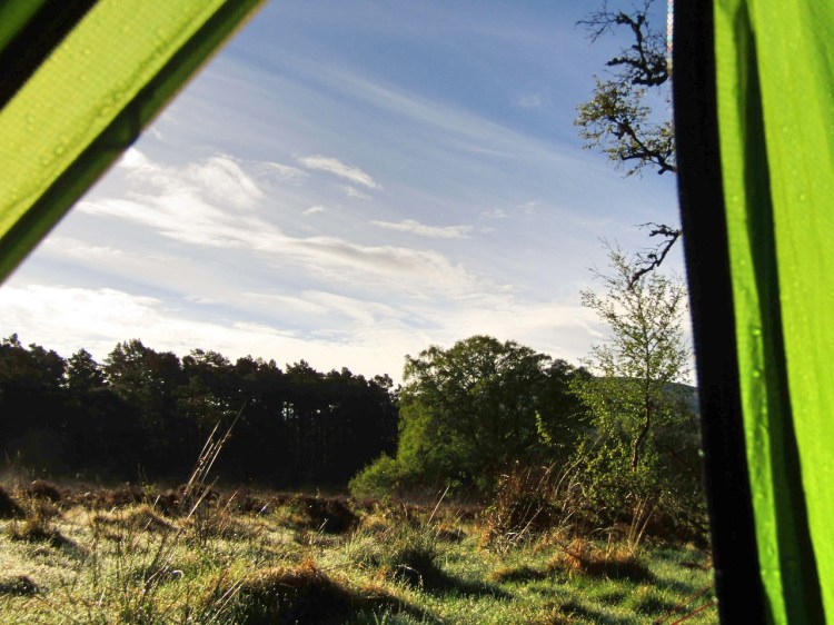
I woke up early, immediately noticing it was bloody cold, with my breath forming a mist in front of my face. Reaching for the down jacket and hat, I lay in my bag and considered the options. I wasn’t yet sure what was wrong with me, and began slowly working through the options I vaguely remembered from Dr John Ellerton’s ‘Casualty Care in Mountain Rescue‘, a 400-page tome on fell medicine.

Day 8 - the route
Day 8 – the route

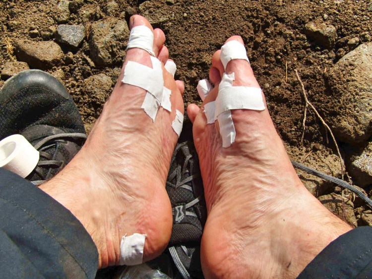
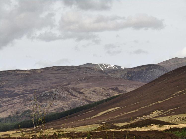
I ran through the symptoms in my head, pain when I touched the area, no deformity to the limb and swelling present in the lower shin. I was able to walk on it relatively fine, but as soon as it started to bear weight it was significantly painful. There weren’t any ‘crunching’ sounds and no ligaments appeared to hurt – it all pointed to a minor stress fracture, or certainly the beginnings of one – not comforting at all. Looking at the Route Sheet we were expected to finish by Wednesday next week – still 5 days time- something which seemed much, much too far away.  Putting aside whether I would be able to complete the Challenge at all, if I couldn’t improve the pace from my tortoise-like hobble it was liable to take me the best part of 2 weeks to arrive at the east coast anyway.

Derry Lodge camp
Derry Lodge camp

Fortunately, all of this was tomorrow’s problem, or at least tonight’s – as today we needed to get to Braemar village to the east and rest there for half a day. We began packing up lethargically, noticing the German guys were having a lay-in, and the two other Challengers both began to stir before quickly exploding in to activity, bustling around camp making food and generally seeming in much better spirits than they were yesterday – they both had looked shattered.

I felt I’d be able to get to Braemar – albeit slowly – so I assumed I’d make a judgement once there as to whether it was time to call it a day or not, but for now I wanted as much information as possible to make that decision. Walking over to the Challenge lads to say hi we were fortunate to find they had around 10 crossings between them, opening the door for me to pick their brains for alternative suggestions on ways to change our route.  Ten minutes later we had a host of ‘potential diversions’ scribbled on the Route Sheet before they headed off, mentioning as they went that we should drop in to Mar Lodge for tea and cake, which wasn’t an invitation we intended to turn down.

Attempt at an artistic hidden-tent-in-the-wilderness-shot
Attempt at an artistic hidden tent in the wilderness shot

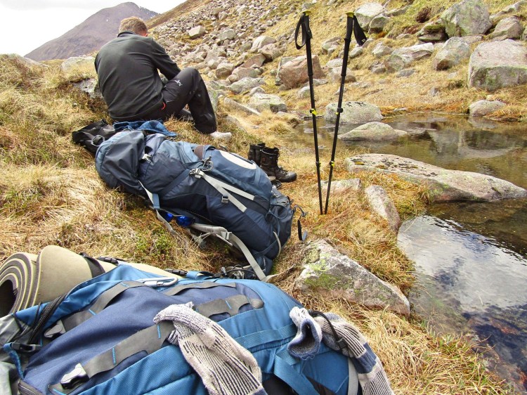
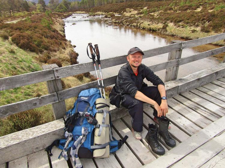
We began gently moving, painfully slowly at first, being careful to use both poles to take as much weight off the leg as possible. I remember being quite distraught during this first half an hour, Marr was only 7km, but this could easily have taken me all day;  I knew it wasn’t going to work like this and I was on the cusp of retiring.  I could practically feel my determination and optimism draining away.  Gabe was absolutely brilliant, returning the help I had offered him during his struggles with illness during the early part of the Challenge back, with interest. He patiently helped me hobble onwards, kept me motivated, despite likely wondering whether I would ask him to continue solo by the end of the day.

The view back to the Cairngorms

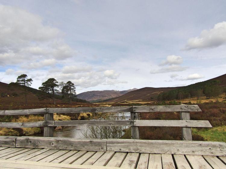
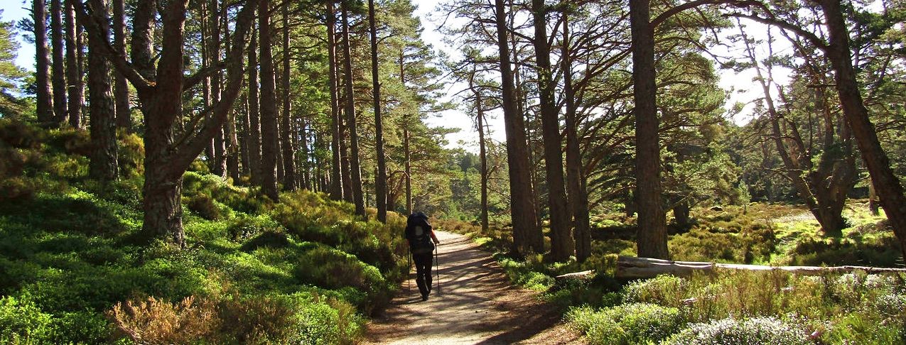
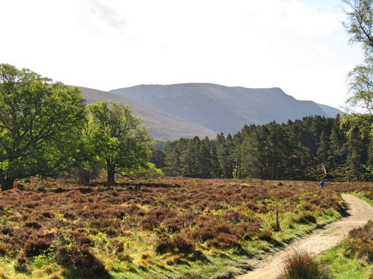
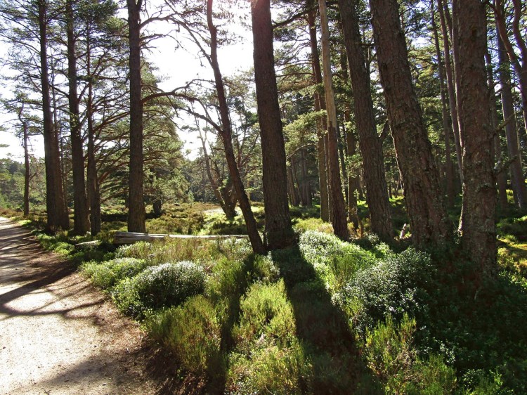
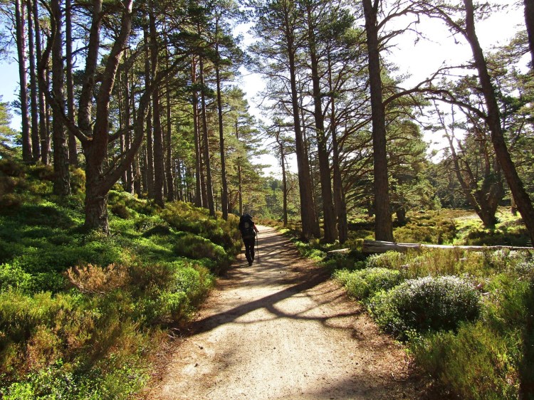
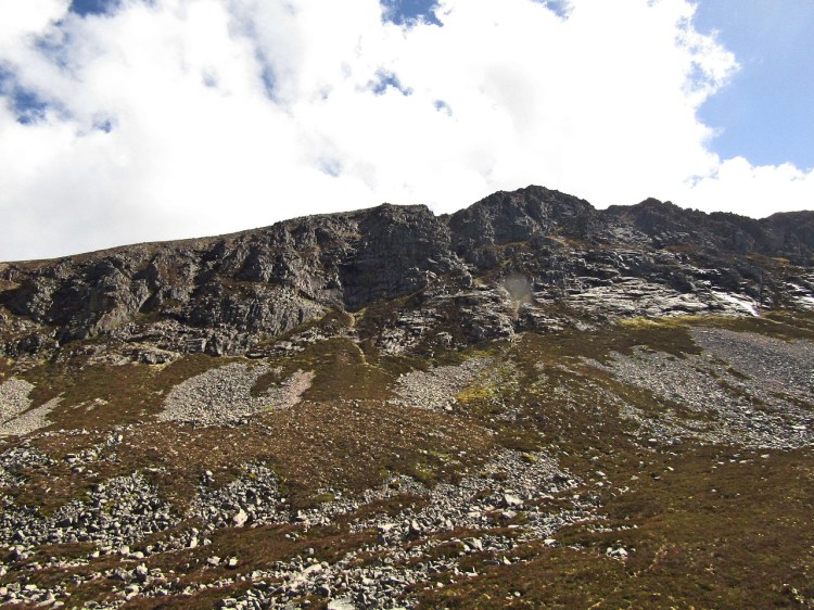
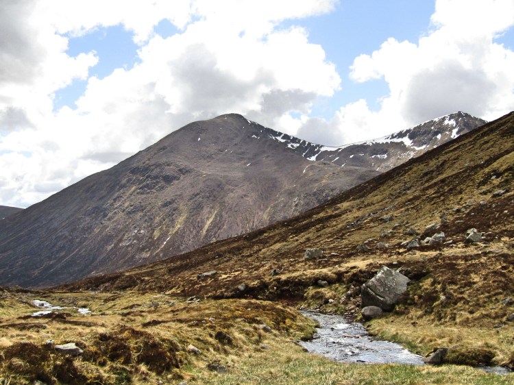
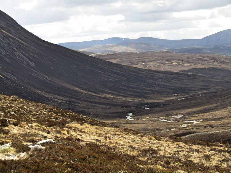
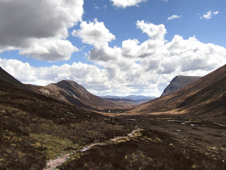
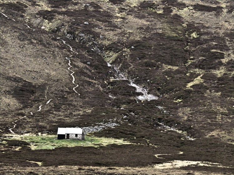
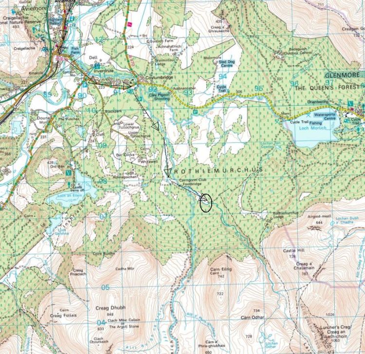
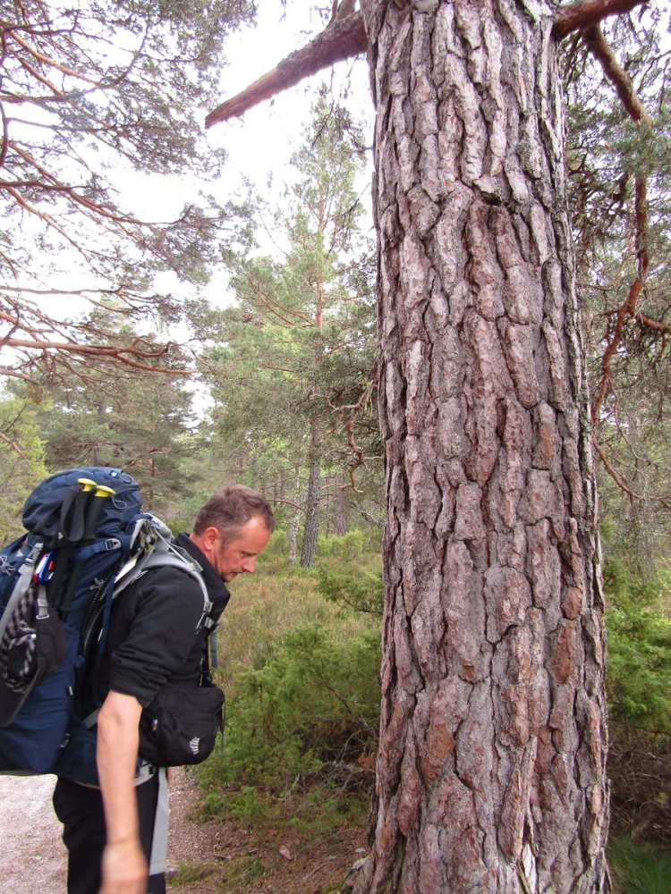
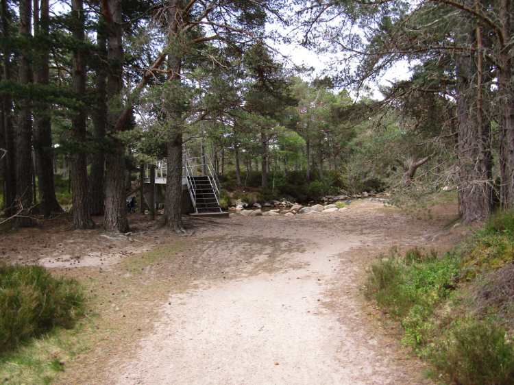
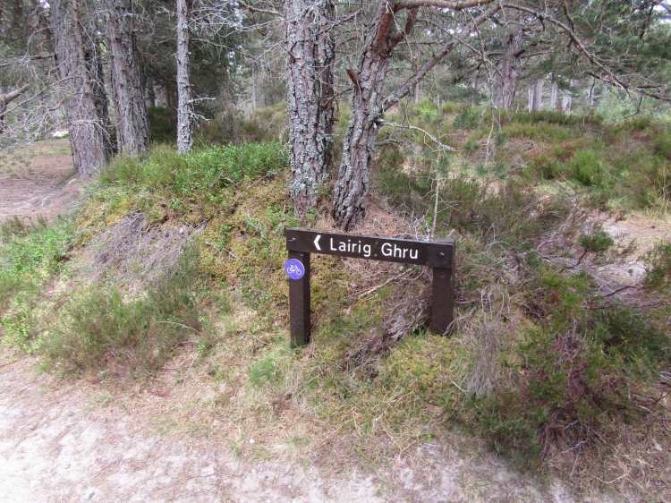
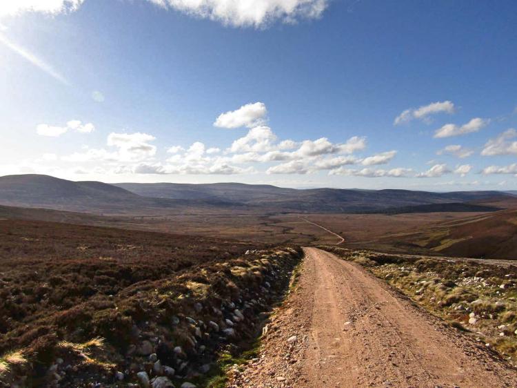
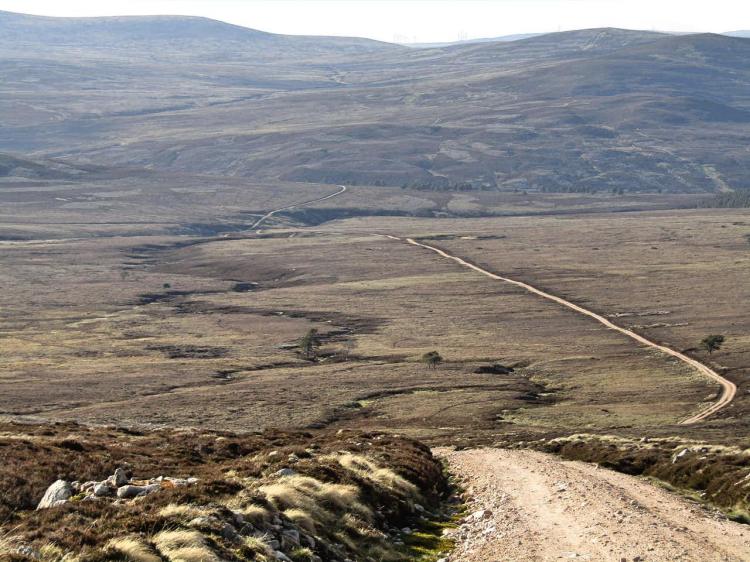
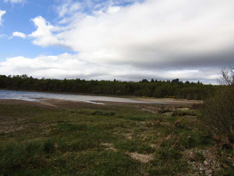
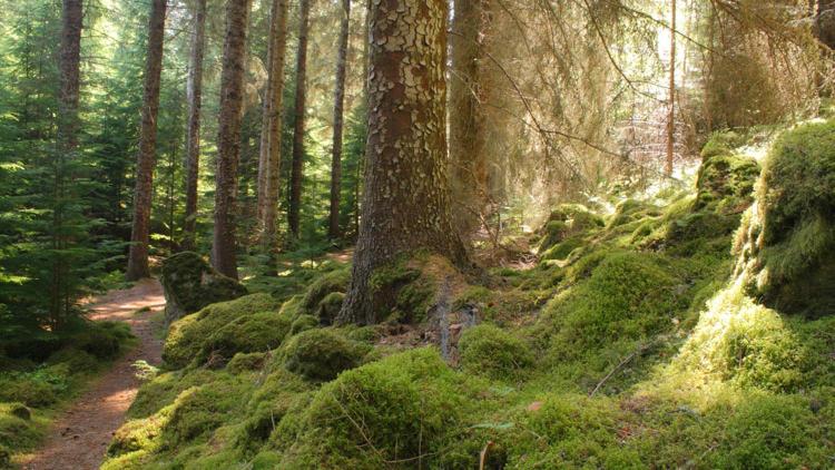
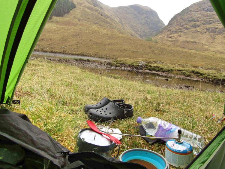
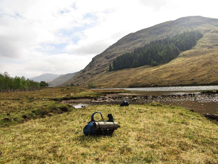
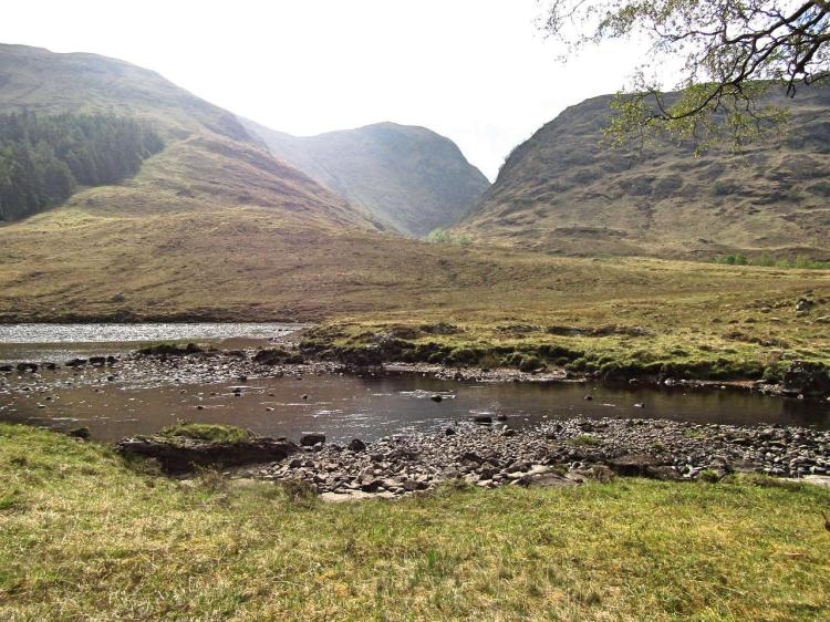
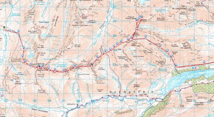
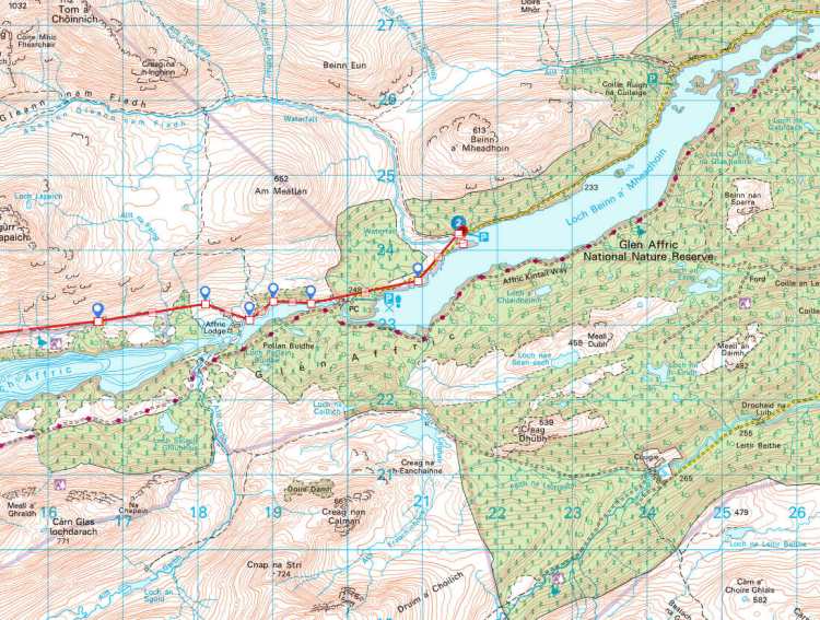
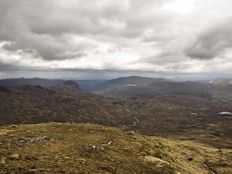
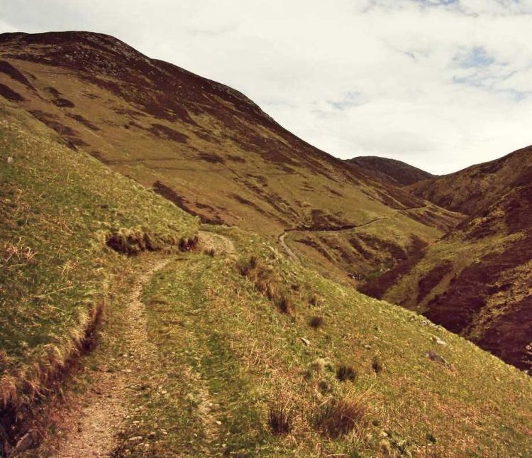
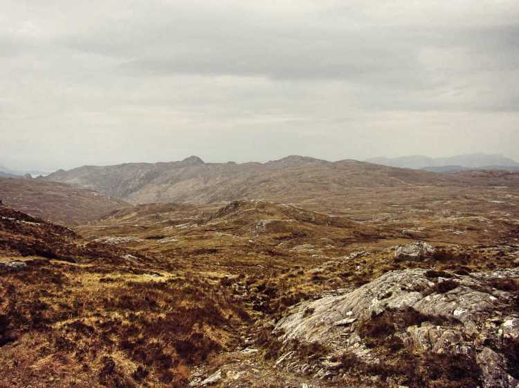
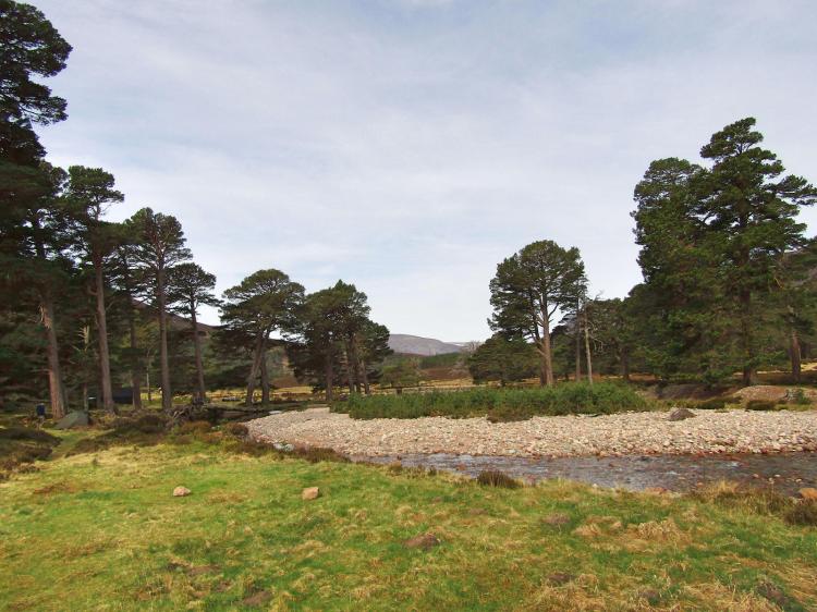
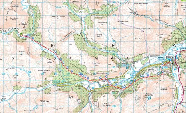
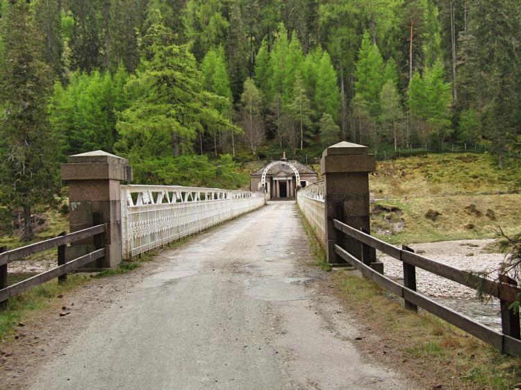
Through all this, the scenery wasn’t half bad even though we were leaving the larger hills behind.  The path to Mar Lodge was enjoyable, if a little dull after our travails of the previous day through the Lairig Ghru, with a different sort of greenery replacing the wind-swept heather and rocky tracks of yesterday. Normally it would have been easy walking, which was lucky as this was about all I could manage – our intended route (involving doubling back for a trio of Corbetts and a look at the Linn of Dee) was quickly shelved for another day without a second thought.

The snow just about still in sight

The Germans caught us up and passed around an hour later, only ambling at a slow pace themselves. The path meandered a little, and lo and behold there was a group of guys stood staring intently at the track ahead of us. I realise Scottish whisky is imbibed throughout the day, and with this being a weekend we couldn’t be sure they weren’t half cut, but from a distance it looked very odd indeed.

Cheerful morning
What a cheerful git.

Arriving closer, this bunch of strange people turned out to be a group of conservationists measuring tadpoles density in puddles. We greeted them pretty cheerfully, unable to muster a single ribbeting joke between us. Things must have been serious. That said, the flat track seemed to have eased my leg a little, as I was now able to speed up to what I would cautiously call a slow walking pace.

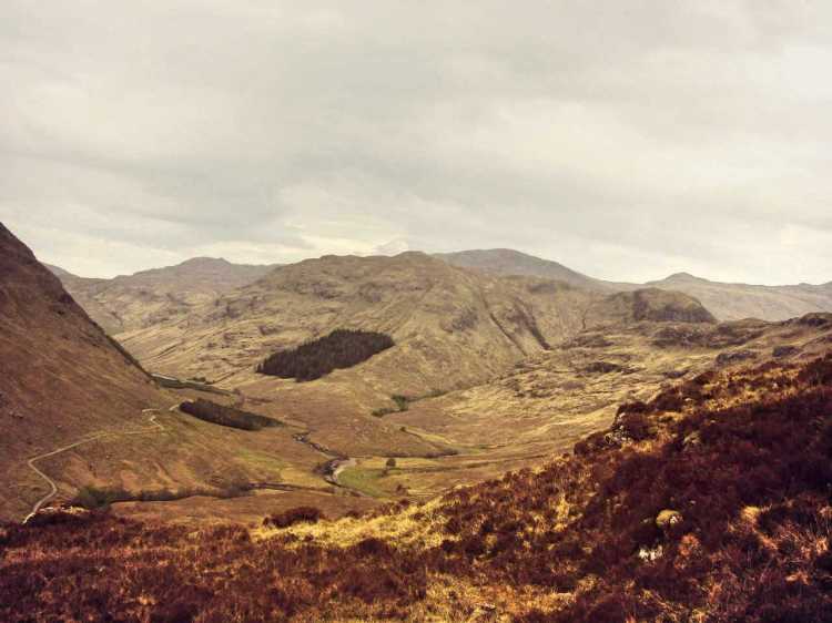
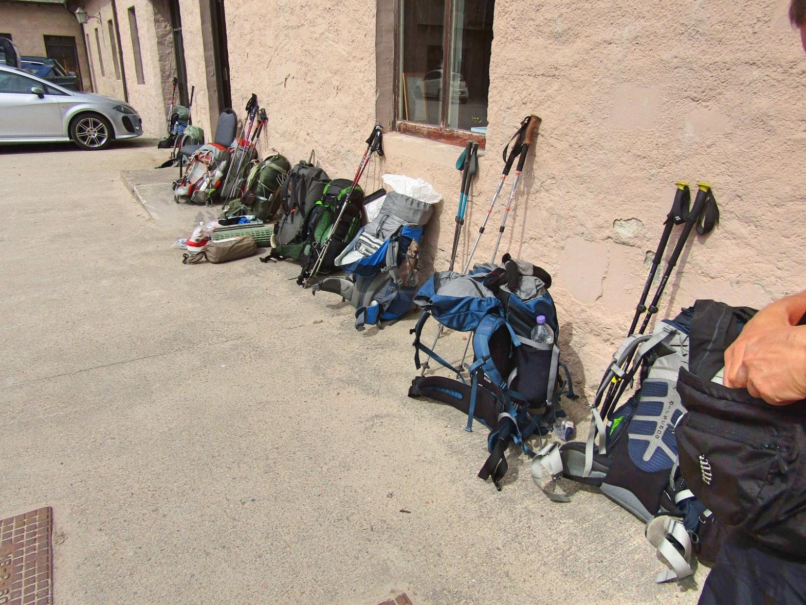
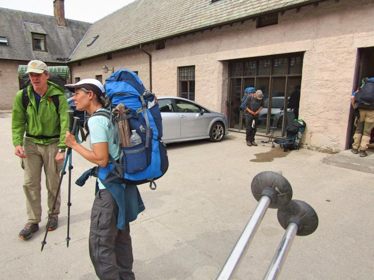
Mar Lodge loomed as we emerged from the wood, quite an impressive looking place yet decidedly quiet and seemingly empty. We assumed the guys had been and gone as we were extremely slow getting here. Round a corner, we were met with a line of backpacks of varying sizes, and out of the woodwork Challengers seemed to appear. Mar Lodge was full of the buggers. Dumping the packs, we walked in to say hi to people and it was the strangest feeling – a bit like a school reunion, but of people you’ve only met last week.

The lost property cupboard about to get overloaded

There were the two guys from Derry Lodge the previous night, the American couple we met leaving the Rothiemurchus forest, in addition to a couple of guys we had met at Drumnadroicht and one chap from Dornie. That seemed like a lifetime back! We got talking and this is when I truly understood what the Challenge is about, when I finally ‘got it’. It isn’t really about crossing Scotland, that is more the social lubricant, the empty canvas still needing an artist and paint. It is about a bunch of people together, passionate about similar things, all discussing their travels so far – their failures & triumphs, and waxing lyrical about just how much they adore the outdoors. Yes, there were a few in a rough state, but everyone was grinning and joking. I left a note on the white-board, found a packet of biscuits and got stuck in. There was no cake, and whether there ever was any cake seemed a bit of a mystery.

2017-05-19-12h17m41_rex_
The lovely American couple, and a rather leaky backpack in the background.

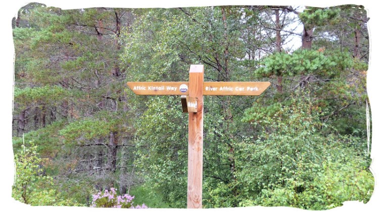
Pretty much all of this motley crew were going to Braemar one way or another, though the vast majority mentioned ditching the Tomintoul viewpoint path (our original route) and instead heading straight towards Braemar. I was taking the road anyway, so figured I’d tag along. Whilst all this was being discussed, Mike Jones walked in, the chap we met in Dornie, our start point. He was in fine spirits yet seemed a wee bit weary, making a beeline for the biscuits almost immediately. That is the sort of thinking which makes you a multiple-time Challenger right there folks.

We drank a load of coffee, finished off plenty of biscuits ourselves and headed off, joining the road for about 5km. I am not sure whether Mar Lodge’s biscuits had magical properties, but somehow I was definitely walking more quickly at this point, despite still having to walk with the ‘crutch’ technique it felt markedly easier than the morning. In our little group we had a Welshman, two Americans, a Pole and several English – all chatting away happily, making time pass quickly.

Derry Lodge bridge
Derry Lodge bridge

One of the guys, Merv, was on his 9th crossing, and it turned he is a Yorkshireman like myself – except unlike me, he actually has a proper Yorkshire accent. We got an excellent run down on a lot of the places to go/not to go were we planning any future crossings, not to mention a not-so-brief explanation of street light engineering, his former profession. Now you may think this may have taken away from my Challenge experience, but after a few km on the roads my leg was starting to ache like hell, and Merv really did me a big favour by distracting me from the pain. During the last kilometre I had to drop back, I was struggling to match the dawdling pace of the group.

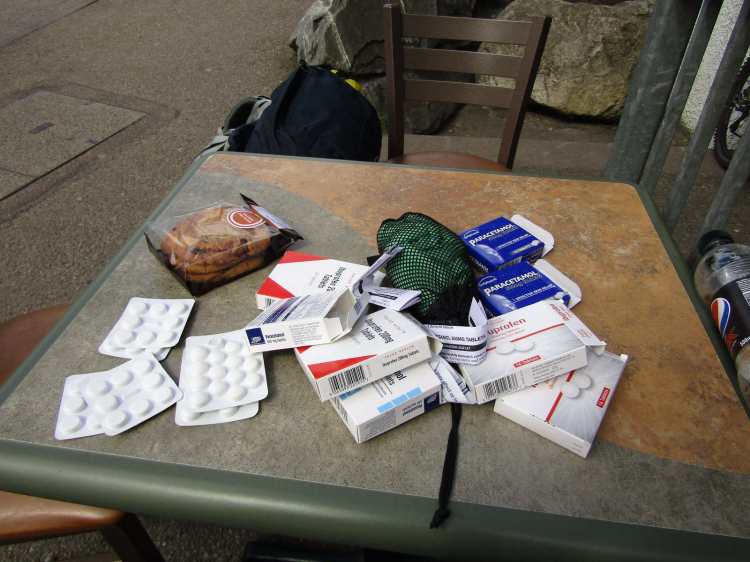
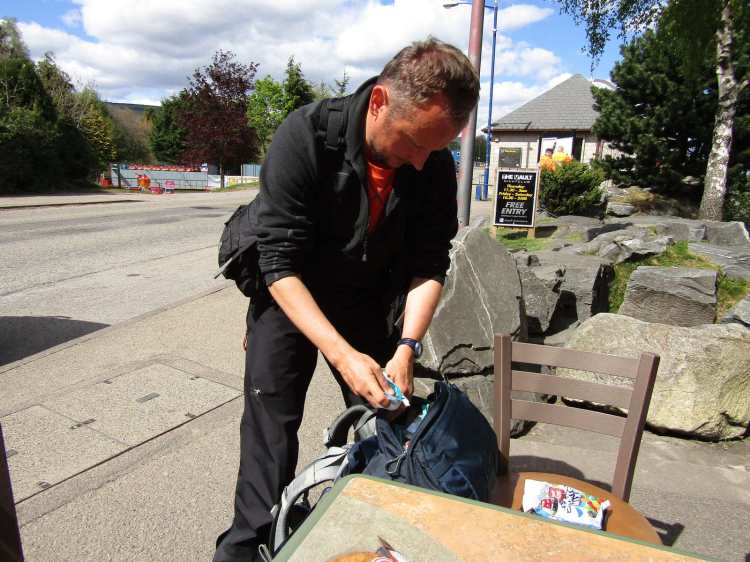
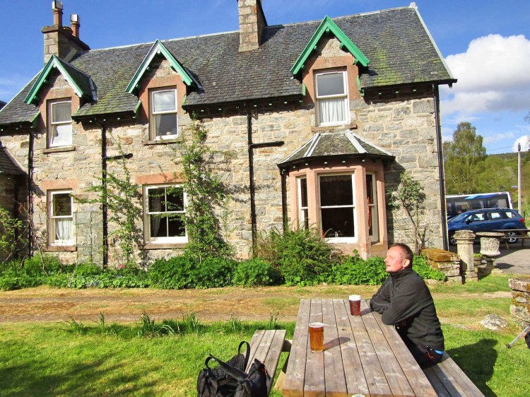
We arrived in Braemar by mid afternoon, both much the wiser about street lighting and yet somehow simultaneously still not knowing very much at all. Braemar was a first visit for me, and what a lovely little place it is.  Little tea-rooms, a cracking gear-shop and a huge pub, the apparant place of some raucous parties over the years – courtesy of the Challenge.   We found the local co-op and I decided to buy some key medical supplies, ending up walking out with a huge bag of crisps, a four pack of lager and some chocolate. In truth there was precious little to buy in there and we were both glad to have resupplied in Aviemore.

2017-05-19-12h24m46_rex_
Beautifully clear

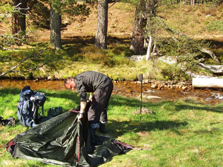
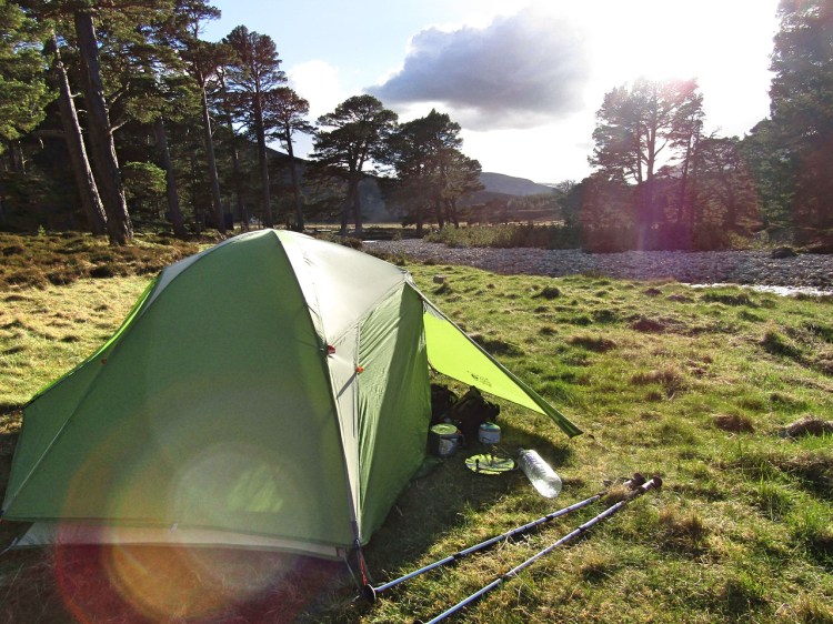
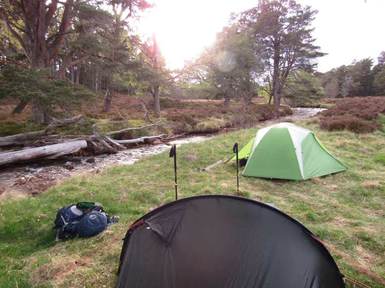
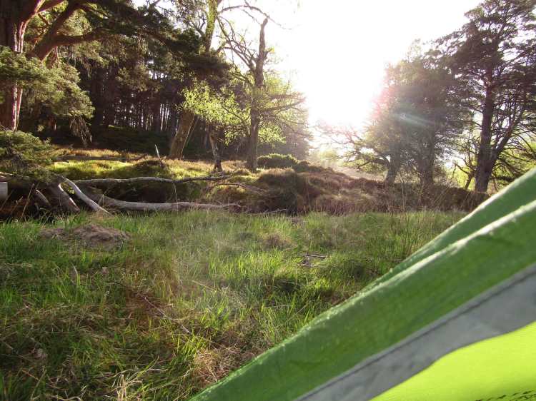
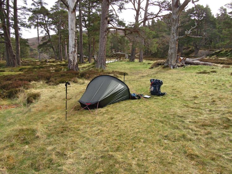
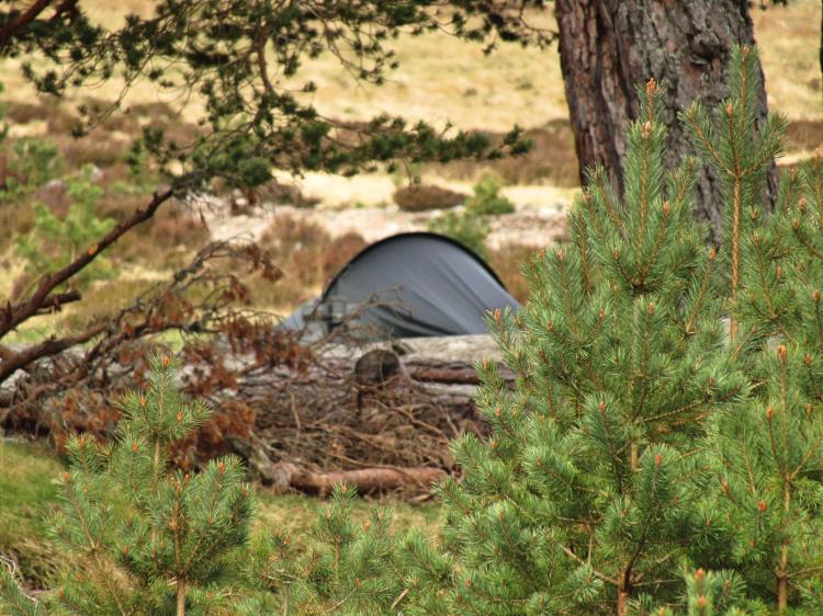
The camp site came next; I had received an email days before telling me there was no issue with space and so didn’t bother booking, but the sheer amount of people descending on the place seemed to surprise everyone, staff included. We ended up getting a plot with a good 15 other people and a tent-forest was soon erected, with everything from Hillebergs to Terra Novas going up whilst the weather was still fine. Now properly set up, some of the lads were starting on the beers early and I felt it would be rude of me to not join in, so I cracked a tin and started having a chat to some of the guys who had arrived earlier, before deciding to head for the showers – which had recently been refurbed. Half an hour later I felt fantastic, with clean(ish) clothes, and I’m sure even the limp had gone a bit.

The original route, doubling back to take on some Corbetts

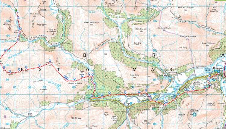
I gathered from the chat that a lot of people were going to take our original intended route to Lochnagar tomorrow, which was meant to be joined with three other Munros – a route which would mark the last of the hill days on our Challenge. We knew it wasn’t happening, and needed to set off to Braemar Sports to buy a map to work out a way to shelve our intended plans for a whole other route. Munching chocolate and mercifully without my pack, I hobbled my way back to the centre of Braemar, passing Peter the German on the way (we waved), where we sat outside a fish and chip shop with our new map and a chinograph pencil.

Ten minutes later we had a plan. The way we saw it, the most direct route would have been going over the tops before taking Glen Cova towards Montrose, but above all else I needed flat terrain. We agreed on a route we had zero enthusiasm for but knew was necessary, and decided on taking the road to Ballater. If the worst came to the worst we could abandon en-route, there would be plenty of people to give us a lift, but it also let us decide to either head for the coast (just keep walking due east), or try to fit in a little more of our original route in if I started to feel up to it. Pleased with ourselves, and having solved the imminent problem, we hit up Gordons Tearoom for some dinner.

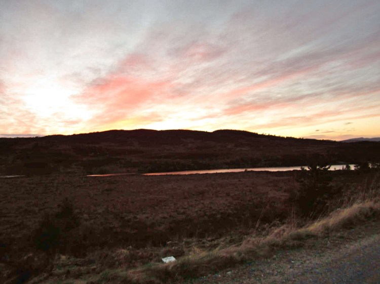
The place was almost full, with us grabbing the last table and ordering a rather hearty meal. I have zero idea what I ordered (I want to say fish and chips), but remember it being tasty, with the staff especially welcoming to a bunch of hikers taking over the joint. Walking back, the leg really started to hurt. Unsure whether the painkillers were wearing off or whether the body was crying out for some rest, I took the hint and retired to my tent as rain started to hit the flysheet.

Still light, I checked the leg, which was pretty swollen. Assuming this was going to be the swansong evening, I thought I’d go out in a bang, quite literally, as I popped open the Doritos bag, opened another beer and decided I’d read my book and relax. I was in actually in strong spirits after the uncertainty of the morning, yet well aware we were nowhere near the east coast yet, with four full days of walking ahead of us at a normal pace, with us currently far from able to do even that.


TGOC2017: Day 7 – Rothiemuchus Forest to Derry Lodge

“Two men and a layby?”

“Hmm, not bad. What about The May Ticks?”

“Oh, definitely a point for that. Maybe Ben-Hurt.”

“All Painful on the Western Front?”

“Rebel without a Tent Floor?”

“These aren’t getting any better”

Morning in the Rothiemurchus

We woke early after a peaceful night of sleep, with yesterday’s extra distance letting us have a leisurely start for the first time in the trip. There was little to do, yet lots to experience – the perfect combination for hikers in the wilds. A leisurely breakfast came next, and as we sipped coffee by the stream we joked about what we would call our adventure thus far, were we Hollywood producers after a catchy parody title. As you’ve realised by now, they were all terrible.

Packing up the Akto
Packing up the Akto

The Rohiemurchus camp proved a magical little spot, still and quiet despite only being a few hours walk from civilization. The bike paths had dropped away and we now had a gentle stroll up towards the Lairig Ghru.  The feet felt surprisingly good this morning, much more alive than either of us expected; and with them now properly dressed we were optimistic for a superb day ahead. All seemed to be going well. Little would we know, that by the end of the day we would struggle to continue, and be faced with a very real question of whether we would have to abandon altogether.

Morning runner
Morning runner in the distance

The sun shined brightly, bathing everything in warmth as we slowly packed up, tents still damp, but ground rapidly drying all around us. A chap on his morning run flew past our campsite, with me shouting a cheerful “morning!” after him. Now almost packed up, a couple of American TGO hikers passed us, briefly stopping for a chat. They were intending Derry Lodge as their destination for the day, and we wished them well as they headed off in to the distance.

Light cast across the forest floor

The start of our day was a lethargic wander through the woods, slowly gaining height to let us look down towards a pretty creek. A couple of mountain bikers flew up behind us and we stepped aside to let them through. I remembered reading an article on just how bad the Lairig Ghru was for mountain bikers barely a couple of months before and hoped they had plenty of patience for a day of rock-hopping!

Gorgeous walking country

Part of Our New Start was changing our socks every hour without fail for a dry pair, to try and remove any chance of sweat causing our feet to soften and break up, in addition to preserving the healing process best we could. With this in mind we sat in amongst the heather, changed them and enjoyed the sun as yet more bikers passed us.

2017-05-18-10h09m38_rex_
Emerging from the trees to the Lairig Ghru

Approaching the Lairig Ghru for the first time in quite a few years, it was a pleasant stroll, with it usually being winter when I find myself up in these parts. The treeline receded behind us as we emerged on to an open path, a mixed party of British and American hikers making ground rapidly on us, all with light packs.

We had a chat as they passed us, although I must admit being none the wiser where they were actually going.  It seems they were exploring the world and this was just one of their destinations to tick off, with something about Iceland mumbled. Some of them were carrying almost nothing, which puzzled us untill they mentioned heading all the way Braemar. Waving them goodbye we wished them a good trip, still wondering how they were going to get to Iceland with barely a wallet in their pocket, and continued heading on our 20km rock-clad path.

Our route to Ben Macdui was still possible of course, we felt up to it and the feet seemed to not be aching too much, but in truth we didn’t much fancy it.  We momentarily entertained the thought of summiting then dropping down the far side to Glen Derry, and whether it would save us time, but felt staying on the easier path made much more sense.

Oh it's Scheduled Sock Time again.
Oh it’s Scheduled Sock Time again.

The Lairig Ghru is a singular place with a gentle path gradually replaced by rising valley walls, as the path gives way to a field of little stones as we gained height.  This was replaced itself by a period of stepping-stones going through a soggy, rather muddy bit just prior to the highest point – eventually ending up at a boulder-field. There were hints of snow at the highest points, not quite yet fallen to the heat from the sun, as we stopped at the Pools of Dee. This area was quite heavy going and we were starting to feel the feet ache once again. Luckily for us, there were only a few km left of the rough stuff, before we could join a more easy-going path with little elevation change.

2017-05-18-11h14m09_rex_
Looming rock

As we descended the south side of the Lairig Ghru opened out and was stunning; the terrain becoming easier and easier with a gentle descent giving one of the most impressive views of the trip. The meandering little stream heading down the mountain side with the peaks behind, still dusted with snow, was mesmerizing – we wanted to sit there all day looking all around us.

2017-05-18-12h32m29_rex_
Hints of snow

This high point gave way to a gentle section of walking on the flat. Despite the earlier rocky parts, it was barely after noon and we were feeling vindicated in our choice of route. It was stunning, with blue sky and sun only adding to the natural design of the place, and as we passed the Devil’s Point, we were already considering winter climbing routes. Corrour bothy (our original idea for a camping spot if the feet were bad) looked particularly bleak mind you, and we were glad to continue onwards.

Pools of Dee
Pools of Dee
2017-05-18-13h08m28_rex_
Another Scheduled Sock Change

An hour onwards, the best of the weather seemingly was behind us, with clouds and gentle rain falling as we turned east towards the Allt Preas nam Meirleach, and then on to Derry Lodge. It was thankfully only intermittent, though our spirits were high and it hardly mattered, it was only around 4pm and so another early camp was possible. We knew we had a short day to Braemar tomorrow, so our rest day had actually turned in to two and half. Rather pleased with ourselves, we descended towards the fords.

2017-05-18-13h42m12_rex_
Gurgling stream and snow kissed peaks in the background. Not bad at all.

At this point it all started going wrong. Whilst descending, I caught a stone on a steep bit, tripped, tried to put my foot out to balance myself, and fell over to one side. Picking myself up, I thought nothing of it, I didn’t have more than a few scuffs on my hands. We were about 1km away from Derry Lodge, so as far as I was concerned it was the last little run in, I’d put some anti-septic on them later.

2017-05-18-13h57m25_rex_
The expanse of the south side of the Ghru

I decided I might as well carry on due to the camp being so close and got up. Immediately upon putting my foot down, I felt pain shooting through my left leg. It didn’t feel right at all. I took my rucksack off and walked around a bit, trying to understand what happened. It was intensely painful, and having looked at the area which hurt, there was nothing superficially wrong with it. It didn’t feel like a break, it didn’t seem like a tendon problem, and it was possible to walk, albeit extremely painfully – so I reasoned I’d rather get to Derry Lodge and set camp.

2017-05-18-14h14m38_rex_

That 1km to Derry Lodge was agony, I used both my walking poles like crutches, putting my weight on my right leg as I stabilized my left with both poles at once, trying to remove as much weight as possible.  I remember grunting with the pain as we passed the Americans we had waved at that morning, who were busy making camp at a pretty spot where the burns joined. I threw them a wave, gritted my teeth and cracked on. This 1km took over an hour, and as we arrived over the foot bridge at Derry Lodge I was already making plans for Gabe to continue without me. I could not see how I could make any sort of distance at this speed.

2017-05-18-14h20m31_rex_
Path to somewhere

Arriving at Derry Lodge, there were a couple of guys already there with tents just going up, as we searched around for a good spot. We ended up with what we thought was one of the best sites in the area, close to the burn, protected by the trees yet open enough not to be concerned with anything dropping on our tents.

Corrour Bothy - not especially inviting
Corrour Bothy – not especially inviting

Once the tents were up, Gabe fancied a rest, and it was about time to figure out whether it was a show stopper or not.  I attempted to wander around a bit on the leg, still using poles as crutches. I went to see the guys who were sat on a fallen tree trunk enjoying the early evening light, with the leg feeling substantially better without a pack, yet still aching with every step. It turns out they were both German, one living in Aberdeen (Peter) and another from Berlin who was visiting his friend for a few days in the hills. I tried out a little German, but it has been years since I used much of it, and discussing their evening food and saying ‘mein Bein wehr sehr‘ was about as far as I got. I got that look I recognized from the early days of living in Norway, the raised eyebrows combined with the creeping smile, which told me they were trying hard not to burst out laughing at my rusty pronunciation.

2017-05-18-15h46m29_rex_
The Devil’s Point – for another day

Their hill day had been Macdui, with their goal to get to Braemar where the Berlin friend would depart, with Peter staying in the area for a few days. They had no idea about the TGO, so I explained our route thus far, and our fairly epic series of days, with eyebrows raising a little as I retold our gradually more intense trip. I wished them a good trip and left them to cook, returning to cook a little food, wash our socks and relax.

2017-05-18-16h09m36_rex_
Valley in the distance

I probed the leg a little, gently checking first my foot, then all the way up the leg. It appeared to be a fibula injury, I decided not to worry too much at this point, I didn’t have anything in the first aid kit which could handle an internal leg injury, I was taking anti-inflammatories anyway for the feet, so why not enjoy the evening.  It was a beautiful one after all – and we were warm, fed and were looking forward to our rest. We heard voices and two Challengers arrived over the foot bridge, with me hobbling over to them both to say hi. Both were pretty exhausted by this point with them finding the Lairig Ghru heavy going, though they were hiking on their own.

2017-05-18-19h03m05_rex_
Evening camp in stunning weather

It was nice to camp with some other Challengers for the first time since Dornie, and we let them get on with getting set up while we returned to our camp for a relax. As dusk was falling it started getting cold, and the down jacket went on before retiring to bed to read. The leg was swollen but not unduly painful now that I got my weight off it, yet I was concerned with the very real risk I would not be able to end the Challenge due to how slow I was moving, with abandonment an imminent possibility.

2017-05-18-19h03m10_rex_

TGOC2017: Day 6 – Aviemore to the Allt Druidh

Aviemore Abundance

Looking out from our hotel’s dining room, we could see the fells in the distance through the French Windows – illuminated as they were in the glaringly bright morning sun. The Scottish breakfasts (don’t call it English, you’ll get looked at funny) were ordered and we wondered what the day would have in store for us. Whilst we were waiting for our greasy fry-up to arrive, we dug in to the breakfast buffet like starved savages: toast, cereals, yoghurt and fruit all vanishing with gusto.

Our breakfast conversation sounded like any other morning, requests to pass the toast or pour some extra orange juice, even how beautiful the weather was.  We both wanted to preserve a precious few more minutes of normality, to keep the illusion of it being a relaxing morning – but behind the veneer of calmness, we were certainly a little worried.

We needed to switch our monochrome vision of the past few days back to colour, to reboot ourselves, to realise the simple truth that despite the massive effort we have put in so far – we were only really about half way with a good few Munros still to climb. The literally painful truth was that the feet weren’t going to get any better and we were going to have to make some changes, as we wouldn’t be able to bail ourselves with endurance and stamina as we had done thus far.

Cluttering Aviemore as we pack

After breakfast, I brought my copy of the Route Sheet (a master list of all our upcoming days) out of my pocket, printed on waterproof paper and now flecked with dried mud from our adventures so far. At least for our Challenge, pulling out the Route Sheet is a serious declaration to make, with it only being done in the direst of situations.  Essentially it’s like saying you are absolutely knackered and are trying to reduce distance, and most likely on the verge of keeling over. Today, we were looking at the ascent and distance numbers for the next few days and wondering what would be best to cut.

Rationing the Route

Editing the route is difficult on the fly due to each individual day being part of a sequence – if you move one part of that sequence, the rest of it stops forming a functional route – not to mention ‘shortcuts’ conceived in haste are rarely easier than the route you carefully planned months ago on 25k scale maps.  Luckily, during the planning process I spent a long while looking in to potential routes through the Cairngorms, with a good five potentials still in my mind (amongst them were Gleann Eanaich, the Lairig Ghru, the Fords of Avon, Glen Avon and Glen Loin).  With the water levels so low the Fords of Avon was a tempting place to go, even if our general excitement towards it didn’t much get beyond lukewarm – mainly due to how much distance that would involve for us to get towards Tarfside – where we intended to be in 2 days.

Frankly, most of the foul-weather alternatives (FWA) involved ascents over rough ground or they were much flatter yet included a significant increase in distance, becoming unattractive because of it. One of our most ‘severe’ FWAs was essentially a Challenge ‘abort’ (still finishing), where we would proceed almost directly east, shadow the River Gairn and get to Ballater in three days (two at a push). The hill days would be banished to mere unrealised potential, and we would settle in for the long slog to the coast.

Aviemore
Day 7 – to camp

Neither of us wanted that, we discussed at breakfast that we probably needed two days of reduced mileage more than anything else –  this would let us get ourselves in better shape before we returned to our intended route. Often the simplest possible solutions make the most sense and we agreed the Lairig Ghru was probably our best bet – it was only a small change of plan from our Ben Macdui route too, so depending how we felt tomorrow the Ben could still be on. The Lairig Ghru is a stony route we knew would aggravate the feet, yes, but it is a well-marked direct path which would make for fast travel.

To give us an extra advantage, we decided to set off this afternoon rather than in the morning – with an aim to clear most of the Rothiemurchus Forest to reduce our day tomorrow. We knew the key was dropping the number of hours we were walking each day significantly and giving the feet time to recover in camp, rather than purely altering the difficulty.

Going Postal

The next port of call was Aviemore Post Office to pick up my resupply box, with Gabe having already picked his up from the hotel last night. Arriving at the post office, only a minute down the road, I asked for my parcel –  the cashier disappearing in to the back area to rummage, returning shortly asking after to confirm my name. After a further search, I was told there was no parcel here by that name; and my morning, which held so much promise only moments ago – had rapidly taken a turn for the worse.

Painkillers
Late morning was spent restocking the pain meds

I couldn’t understand why it wasn’t there.  It had been sent early enough to have have been there by Saturday/Monday, at least two days prior to our arrival in Aviemore.  I received a text confirming it was sent on the correct day, so the expectation was that I’d walk in, pick it up and get on with it.  Everything had been so well organised.

The parcel was my resupply box, which contained all the food required for the rest of the Challenge – in addition to camera charger, medical supplies and crampons for our next section. It wouldn’t be impossible to replace, though this would mean a supermarket sweep I didn’t want to have to make. There was always the option of ‘outdoors’ meals from Aviemore’s numerous sports shops of course, but that would put me back close to a cool £100 for three meals a day.

A little investigation had to follow, with it unfortunately not aided by a postmaster who had got out of bed on the wrong side that morning.  Armed with an identification code, I contacted the post office at which it was sent to confirm what was going on. The (sending) post office confirmed it had indeed been posted and that it should have been there two days ago. I was left with one hope – that it would arrive today, or we were going to need to cut our plans down and leave tomorrow (assuming it arrives), or spend the money, leave today and abandon it.

2017-05-17-14h46m00_rex_
Repacking the food. Jelly babies at the top of course.

Rucksack Reduction

With nothing further I could do until the 11 o-clock delivery, I headed back to the hotel to see Gabe, who had bought a box to send back his excessive kit – of which he had plenty. Because of both of us are Mountain Rescue team members we packed conservatively – mindful of not wanting to be caught out by anything, but especially the weather and the distance. We both have a decent amount of medical training, so our first aid kits were extensive, certainly not as minimal as I had seen other Challengers carry.  In addition, we carried a fairly broad selection of clothing and emergency kit (bothy bag, mylar bivvy etc) to handle benightment in the mountains, even if it became seriously cold.

All that said, Gabe was now being ruthless.  His pack weight had been a cause of much teasing from me for days – him taking it mostly well – but he knew he had over cooked it. Aviemore was just as much his salvation as mine, and the room rapidly filled with different piles of his kit – the ‘keeps’, and the ‘nopes’. Lets just say there were a lot of ‘nopes’. We packed up and checked out by 10am, hobbling outside to sit in the sun whilst I recharged my camera batteries, soaking up the beautiful morning as Gabe headed to the post office to send his now full parcel home.

The rather snazzy Cairngorms Mountain Rescue base
The rather characterful Cairngorms Mountain Rescue base

Boxing Day

Some time later I saw Gabe wandering back still holding a parcel and assumed he had forgotten something, though as he got closer I noticed it was covered in grey duct-tape, the same colour I had used on mine.  Flap over, it seemed our luck had turned – the postal delivery had arrived early and I now had my supplies.

What followed was a careful repacking of the contents of the box, with the crampons, crocs and wind-shirt going back (the wind-shirt was hardly being used and there was no snow whatsoever for crampons). The food bag was refilled and went from wonderfully light to heaving-full, due to the full week of food, with the excess portions returned alongside the rest of the equipment I didn’t want.  An hour later, camera fully charged, I put the charger in, sealed the parcel, and wandered to the post office to mail it.

Since we’re talking about food, the dehydrated food we had chosen to pack was going down well, even though I was heartily sick of vegetable curry by this point in the trip – which in truth was bloody strong.   We had started a little trading of meals between ourselves like prisoners with cigarettes – “dehydrated mixed bean chilli? That’s worth at least a dehydrated cabbage and sweet potato stew, plus a small packet of jelly beans”.

2017-05-17-18h30m49_rex (1)_
Now in the Rothiemurchus Forest

Starting on the wrong foot

We had the entire afternoon ahead of us and decided to address the feet next. I am conscious that I haven’t described the actual state of the feet so far, with the assumption that some of the gory details could be spared until we were able to do something about it.

The simple fact of the matter was that they Were Not Good.  I spent the next hour with Gabe, draining my blisters from the majority of my toes and making sure they were as clean as possible before taping them up.  Now sat in the sunshine, we debated how to triage them for the next week of walking.

2017-05-17-18h31m05_rex_
Admiring the bark pattern rather intensely.

There are differing schools of thought when it comes to blisters, but by far the most successful is prevention – don’t get them in the first place! This involves sage advice like keep your feet dry, keep the distances down, avoid road walking, etc etc.  Being past this point (with most not all), a lot of this advice didn’t apply, nor was not walking anywhere much of a possibility – we still had half of Scotland to cross!  Once they are already in-situ, it becomes a whole other ball game.  As they get worse and the skin disintegrates past a certain point, you’re pulling the skin off as well as the tape – it becomes a strategy of containment, reducing direct friction and pressure to the area, and above all keeping it clean.

2017-05-17-19h17m54_rex_
The Cairngorms Club bridge – with an attractive camping site right next to it

We carried two types of zinc tape with us for such purposes, the stronger was incredible stuff and physically impossible to remove without pulling the skin away underneath – beyond this, if things got really bad we had duct tape – intended for fixing broken hiking poles or the tent, which we would use as a last resort patch for our feet. Applying dressings to both feet after the blisters were drained, we carefully taped and ‘sealed’ with the stronger tape, prioritizing protection over actually being able to access and maintain them.

The Lairig Ghru

Departure

Now patched up, we wandered off to grab some lunch and restock painkillers. We knew we’d need to take an alternating course every couple of hours, and have enough to be able to maintain this until we hit the east coast if necessary. I must add this isn’t an advisable way to travel, however the pain was present enough the previous day for us to be concerned with making sure we had enough, if required, to reach our goal.

Lunch meant us heading for a little cafe with a first-floor balcony with a splendid view over the fells, a place recommended by the hotelier as a solid lunch stop as we left a few hours ago. We ambled in, and to our surprise they wouldn’t let us go out on to the balcony, citing ‘high wind’, with every other table inside full. It was barely more than the most leisurely of breezes, so we said we’d be happy sitting outside with the doors shut, as we just wanted a place to relax for an hour and have food before leaving. This was promptly refused. I remember deeply sighing, I didn’t much feel like an argument and decided we’d take our business elsewhere.

Pitched in a beautiful spot

We found a place to eat, with it now mid afternoon, and we began to head out of the town and start heading back in to the wilds again.   The next part of our journey was towards Coylumbridge where we would begin to head south to the forest, before heading through the Cairngorms with the eventual goal Braemar. Passing a fish and chip shop, Gabe couldn’t resist ordering a portion, and we ambled at the most leisurely pace of the Challenge so far, sunkissed and enjoying walking in t-shirts again after the previous few days of mixed weather, both glad to be underway.  The path wound its way through little wooded areas and over bridges, just far enough from the road to feel we were beginning to return to the great open spaces of the first few days.

Water on the fly and evening light
Just after the shower – evening light

We were enjoying the sunshine so much we nearly walked past the campsite we were turning south at, and quickly found our track to the forest proper.  The walk through the Rothiemurchus forest on one of the many snaking biking tracks was a superbly peaceful part of our trip, and was right up there with our best memories of the Challenge. Often when you are in the outdoors with someone you know well you’re able to be silent and enjoy the fresh air in your lungs, and this was one of those moments.  We spent a good half hour listening to the streams gurgle, enjoying the smell of the forest and listening to the chorus of birds throughout the trees as they started their evening songs. It really was magical. The route shadowed the Am Beanaidh, the flowing water in the background adding to the ambience as we approached and passed a group of tents, likely Challengers – we didn’t see any faces, everyone seemed to be relaxing in their tents, but we’d no doubt see some of them tomorrow. About 3km later we found a perfect pitch, a nice little spot by a stream with easy access to the water, stunning views, natural wind cover and absolutely flat, all the ingredients for a good camp.

Time for some tea
Time to get a brew on

Pitching the tents was quick with us deciding to pitch snug to the lee side of a downed tree, with the last pegs going in just as a few drops of rain started to sput against the flysheet. I got the kindle out (something I hardly had time for so far) and read for a few minutes, totally relaxed as the shower passed overhead. Preparing the food, we watched the sun drop slowly and talked until we were ready to retire to bed – I even remembered to text people to let them know we were in good spirits.  Settling in for the night and now looking forward to tomorrow, one of the signature days of our route, it started to rain again.  With me now properly snug in my sleeping bag, I read until darkness and slowly drifted off.

2017-05-17-19h50m52_rex_
One of my favourite photographs of the trip

TGOC 2017: Day 5 – A resurgence. (Upper Findhorn to Aviemore)

Coignafearn
The route to Coignafearn

A mirage

I woke in the middle of a dream to birds gliding gently across the sky, wings glimmering in the sun. There was some sort of figure, though I could only see their legs, with their feet nestling within flowing, fresh water. Bright sunshine seemed to caress them and warmed their shoulders. There was absolutely, utterly no rush. I remember dreaming that sensation the most vividly.

I blinked, felt the warmth against my face, and broke in to a broad smile. Like missionaries who had had their beliefs tested in unfamiliar lands, our faith had returned to sustain us. It was a moment of being at one with the outdoors and luxuriating in that, letting us remember what the Challenge was meant to be all about.

Gabe and I looked at each other, nodding in a way which communicated more than any number of words could have. Breakfast would come eventually, but for the moment, watching the stream gurgle its way down the hillside was enough sustenance for anyone.

What a difference a full night of sleep makes.

Day 5
Day 5

We weren’t really expecting it would go all our own way today, with 35 km still to travel, normally nowhere near problematic for us – but with the feet having taken a sustained battering over the last two days, we knew by the time we arrived in Aviemore we’d be relishing getting a proper rest.

River Findhorn
River Findhorn

This was the first day we shuffled our maps to pull out the FWA (foul-weather alternative) and decided to change from our intended route, which would have involved striking out over a succession of hills, culminating in the 878m Carn an Fhreiceadain, before dropping down and continuing east. No, we’ll be having none of that thank you.  Instead a morning amble through the Strathdearn would have to do.

Strathdearn and Coignafearn

The morning began with a couple of sumptuous hours of walking by a beck, our path punctuated with fords as it snaked towards the bottom of the valley. The Monadhliath has a mixed reputation amongst some, and on the evidence of today, it had been unfairly maligned. In our (admittedly narrow) experience it seemed a tale of two halves, with parts of the western section seemingly developed in to clusters of wind farms – or are in the process of being constructed in to one – with vast swathes of land cleared and turned in to access tracks to get the heavy machinery in. I don’t want to ramble too much about wind farms (spoilers: I probably will), but let’s just say we were glad to get back to enjoying the scenery.

As we approached the valley floor we both agreed it was the right choice to stop ‘early’ last night, with the extra two hours likely to have finished us off. Now fresh, we cheerily greeted a bird-watcher who was out early, and continued on to Coignafearn Old Lodge. We now were walking on the flat, choosing a wide expanse of grass which ran parallel to the ‘proper’ track, being buffeted by a fair amount of wind – handily giving us a push. Ahead, there were three pairs of walkers making their way in different directions – we assumed they were Challengers, as this seemed the middle of nowhere for anyone else to be wandering about.

The Burma Road
The Burma Road

We thought back to our fellow Challengers on the boat yesterday afternoon.  It was likely that one pair may have been the Americans from the boat yesterday, who despite being fit, must have made brilliant progress. They said they were headed to Coignafearn ‘the long way’, sticking to the tracks, although it seemed unlikely they overhauled us being as we went straight over the tops. As we approached, looking forward to catching up with them, it seems we were wrong – it was a mix of day hikers and those who had parked a couple of km further on to get some fresh air.

A good Samaritan

Not long after overhauling this motley crew we took a break to replenish our water, it was around 11am and our now-ritual changing-of-the-socks had to be done, too. Sitting there, re-taping some of more dubious-looking parts of our feet, a motor home passed us, stopped and then started backing up into the little area we were occupying. It was a small space, barely enough for a car, and with the motor home getting closer and closer a thought flashed through my mind – that I would have to explain to Challenge Control  I will have to abandon due to being run over. Pushing myself to my knees with zinc tape still stuck to my fingers, in readiness for some sort of sockless leap out-of-the-way, I mercifully heard the engine cut out a generous couple of metres from us, and the handbrake go on.

The long road back
The long road back

A gentleman got out of the driver’s door and I had half a mind to tell him about the near miss, but instead he immediately greeted us warmly and asked us in a broad Scottish accent whether we were on the TGO – as he had seen our backpacks and thought it likely. We were to find out this chap was Ian Shiel, unofficial TGO support crew, his brusque bearing and motorhome adorned with a well-placed saltire and SNP sticker revealed a proud Scotsman.  He was very surprised to see us, mentioning he hadn’t seen anyone this early and that he wasn’t expecting any TGO-ers until the afternoon – commenting that we must be flying to be here by this time of day. Taking a look at my exposed still-sockless feet covered in tape, I had to agree.

We were just finishing our break and were actually just about to leave, but company was nice to have, and on top of that, most importantly, Ian offered us something to eat.  He vanished in to his motorhome and returned shortly afterwards with steaming bowls of soup and a hunk of Scottish bread. I thought it looked a bit like a French baguette myself, but I glanced at the saltire and decided not to mention it. Discussing the rest of our route came next and we found Ian had a strong knowledge of the area, and with our change of route we were welcoming any local advice we could solicit. Our adjusted route was rated favourably; mainly due to it was the most direct (rather than our original jaunt over the tops), with us heading across a bridge 2km from us and then making towards the Burma Road. Soup now finished, we thanked him and headed off, with Aviemore now only 20km as the crow flies.

Saddle sore

Leaving the glorious River Findhorn behind with its’ water still low we crossed and headed south-east to cross the Allt a’Mhuilinn, done with a stylish leap, now joining the path which wound its way alongside the allt. The wind had dropped, the shades were back on (gold aviators, in case anybody had any doubts how cool we looked) and this unexpectedly became one of the most enjoyable sections of our Challenge. The secluded valley meandered and the stream trickling was a lovely soundtrack in the sunshine as we slowly ascended, before getting ready to strike-out over the Carn Caol saddle.

Heading off the path and over the rough ground we set off on a bearing, determined to get ourselves up and over, intending to use a lochan on the saddle for navigation.  Proving rather heavy going  we chose to not follow the en-entrant as we had planned and instead took to the ridge, hoping to get some traction on the harder ground and power up in one go – at the cost of being more exposed to the more turbulent weather of the afternoon. The area was covered in peat bogs, miles of them, and winding our way through these bogs turned a relatively simple section ‘on the map’ to a terribly slow crawl in reality.

Once we reached the ridge the wind caught us in full, catching Gabe’s rain cover like a sail, and we decided to switch to making progress towards the northeast with the wind to our backs, not least to get away from the energy-sapping boggy ground, with us trying to seek out rough heather wherever we could. It may have something to do with the cumulative fatigue from the days before or the state of the feet, but this was the single hardest section of our Challenge in terms of terrain, with 5 km across country taking us a long while.

Road trippin’

Over the crest we saw the beginning of a track, disconcertingly heading in the wrong direction to the south-west. As often happens the maps had seemingly not yet caught up to the reality of what was there and we reasoned we’d take it, walking a good half kilometre in the wrong direction (never a good feeling) before the track meandered around towards the north-east and made sense for Aviemore.

We were a little concerned with how long it took us to head over the tops, with it now almost 5pm but still having 18km still to go to Aviemore, much of it hilly.  The good news was that we knew we had a rest day tomorrow, favourable terrain ahead  (dry tracks), and perfect weather – with the added bonus of wind to keep us cool – but it would still need a big effort to get there in the light.

This part of the River Dulnain certainly had character, with the Cnoc Fraing imposing to the south-east and plenty of streams and features within the valley we were walking through. It was clear we were getting close to civilization as the odd mountain bike was whizzing around in the distance and eventually a whole group of them rode up to ask for directions to Aviemore as they had no maps between them. I’d love to say our navigation skills got these guys out of a potential bind, but it was as simple as pointing out the massive dirt track heading up in to the hills and saying “follow that and you’ll get there”. Seemingly happy they pedalled off, with both of us agreeing we’d have to sort some bikes for the next Challenge, maybe a tandem.

First view of the Cairngorms

By 6pm we had arrived at the bridge before Caggan bothy and looked to start the Burma road, which should take us most of the way back. It was clear we had to pull something special out of the bag if we were going to avoid another late night. We had a serious distance to cover, yet we had to slowly ascend to 700m before descending back down again, something neither of us relished

This section holds some mixed memories for me because we felt we had come so far, challenged ourselves and managed to not only beat illness, injury and sleep-deprivation on the way – but we had done it whilst helping each other, keeping each other motivated and digging deep. We resolved ourselves to make it to Aviemore in the light tonight even though the feet were in agony, but we were certain nothing was going to stop us now.

An hour later, we had covered 6km, predominantly uphill – mostly powered through sheer determination. It was a storming pace and Gabe, now free from his illness, was now leading the way; with my feet, much in the worse condition, were slowly making me drop behind. We maintained a 5km/hr pace for 3 hours, including stops – a monster pace with a heavy pack – and by the time we were descending to Aviemore my feet were in seriously bad shape because of it. Our thinking was it was better to push it tonight and let us recuperate all day tomorrow, than camp, lose our reservation and have to get back on the Burma road in the morning anyway.

Cairngorms

As we arrived in to Aviemore proper civilisation began to spring up around us, road signs gave way to underpasses, which themselves gave way to high street brands as we walked the last couple of kms to our hotel – grabbing some beers and food on the way. Checking in, it was still light (we made it) and we went about unpacking our kit, showering and then washing all the clothes. The room turned in to an explosion of drying tents, socks and trousers – hanging off literally every available corner.

Gear explosion
Gear explosion

By 11pm I was finishing off a portion of chilli as Gabe relaxed on his bed, a forest of beer cans open and tired smiles on our faces. We felt our TGO was back on.  We would resupply tomorrow and have all day to recover, with Ben Macdui and the Cairngorms lined up for two days time..

TGOC 2017: Day 4 – Drumnadroicht, Loch Ness and the Monadhliath

Urquhart Castle
Urquhart Castle
Day 5 Route
Day 5 Intended route

Marching to the Drum

Our 5:30 am alarm had been (rightly) ignored, turning it off immediately and catching a few more precious minutes – but by 6 am we knew we should be moving. Why bother doing 95% of the effort on Day 3, if we were not going to bother with the end of it? Packing up, breakfast was eschewed in favour of using the time to close some distance.

With the state of our feet hitting a fast walking/slow jogging pace was unlikely, to say the least – but we had become friends with the intense ache whenever we put our feet down and willed them to propel us forwards. Beginning at a rather optimistic, rapid pace, we covered ground quickly -passing Lochletter without so much as a pause. By 7 am things weren’t looking promising, with it now blindly obvious that unless we suddenly broke in to a Usain-Bolt-esque sprint, there was zero chance of us making the planned ferry.

Tired and resting
Tired and resting – gazing out over the loch

This started a lively debate, eventually adjourned as we settled on the more immediate concern of finding the nearest water source, both to rehydrate from our night-time travels and to cook breakfast (a different sort of porridge this time).  Whilst eating, we discussed whether we would be able to catch the ferry once it had returned to the jetty on the western bank, and whether we would be able to charter it ourselves for an additional trip.  Paying over the odds to get to the east of Loch Ness did seem our only option, though we agreed it did seem unlikely to happen.  We could do worse than float the idea, excuse the pun, given that we were aiming to make it to Aviemore by Tuesday (tomorrow) night.

Strolling on the quiet Affric Kintail Way was a welcome change of pace, with Scotland’s newest national trail obviously having been developed with a clear direction in mind. The paths were in good shape, well maintained and hopefully the local tourist board was reaping the fruits of their labours.  We passed loads of walkers going east to west over the two days on it, so our experience was positive, and that “if you build it they will come”.  Calling Gordon to pitch our plan came next, with him demurring, instead asking that we talked to him when we arrived in person at Drum, though we did hear we were not the only Challengers to miss the morning ferry slot.

Eventually arriving in Drum at 10 am, the first port of call was the tourist information office where we asked about alternative ferry services. It seems Gordon runs the only option (I think we knew this before, but we were too tired to remember and anything was worth an ask), so it was going to be 5 pm or nothing. After seeking out and talking with the man himself, he told us our one option was to round-up the other Challengers who were likely to arrive in Drum over the next few hours, probably including the ones we passed the previous evening. If we could get him a full(ish) boat, he’d run an additional crossing. We talked amongst ourselves and decided to give it a try – we had little to do in Drum at it was, still having plenty of food in our massive food bags, so looking for people with backpacks seemed as good a task as any.

Loch Ness Ferry

Proceeding to the jetty some hour and thirty minutes later, that slim chance had suddenly become a substantial one. Challengers had started to arrive en-masse; with Americans, French, Italians and plenty of Brits shambling their way through the place – some limping, others still seemingly untouched by the ardour of their travels. We had lunch and relished relaxing for a couple of hours at jetty, content this was the best option we could get.

Loch Ness - disembarking the ferry
Loch Ness – disembarking the ferry

The boat itself was a pleasant surprise and sparked in to life the famous sense of Challenge camaraderie, with Challengers quickly forming a team to pass backpacks on board, stacked up in a medley of colours near the helm. I was reassured to see many similar heaving backpacks, with a clear dichotomy between those who preferred ultralight gear and those who were inclined to bring extra kit. It was interesting that the Americans preferred lighter, smaller packs, something I’ve seem to be common when browsing online “thru-hiking” (long distance hiking) communities – with the British generally preferring a “just in case” approach, likely due to how changeable the weather can be in Britain, as well as a lack of ‘on trail’ huts and layovers which tend to populate the popular Appalachian Trail. They were both surprised by how wet it had been and were tired from bush-whacking, with one suffering with his feet, and started to patch them on the jetty a few moments later.  Once we departed (on our fifth mode of transport of the Challenge so far) we took some video of the Urquhart castle, a 13th-century castle which has seen better days, but still stood sentinel at the side of the loch. We would have liked to have a closer look were we in the area for longer, and made a note to return.

The eastern side of Ness

Arriving at Inverfarigaig it was surprising how a “jetty” can differ from your expectations, being that it was a precarious clamber from the boat to what looked like a grass-topped bit of scaffolding.  Once most had departed, we formed a human chain to pass the heavy bags up. Talking with the others, a few were staying at a hotel on this side of the loch, whilst most, including ourselves, were looking to make distance and to slowly approach the Monadhliath mountains. By this time, it was mid afternoon, and we felt we had given ourselves a chance to get to our intended campsite, though with 28km still to go, we knew we’d have to dig in.

Loch Mhor
Loch Mhor

Continuing on to Errogie, a tiny village at which we would turn south, was done with a short road section, there being little alternative if you wanted to make inroads into the Monadhliath. We strode past most of the other Challengers despite our feet, I was even lucid enough to try a little French with our Gallic contingent.  We overhauled everyone apart than an incredibly speedy chap in his 60s with a tiny pack who seemed some relation to Road-runner, and certainly appeared to have had his Weetabix that morning. It was now around 4pm, and we were intending to get to Coignafearn Lodge by night fall, a tough ask.

The section after Errogie involved a little road walking alongside Loch Mhor, where we stopped for a while to relax by the shore.  It seemed a good time to change clothes and stop for some food to fuel us for the evening ahead, and the energy bars were quaffed greedily. Departing the loch we proceeded through Farraline, a farm accessible by private road, with fells to its rear and the loch in front – a beautiful setting for an outdoor aficionado. We walked through, only stopping to cheekily refill our water-bottles from the farmer’s outside tap, before striking out on rough ground, aiming for the path over the bealach which would take us towards Dunmaglass Lodge. This proved very heavy going, with the path quickly becoming indistinct until it eventually reappeared as we crested the far side of the bealach, now approaching the wood surrounding the lodge itself.

More Loch Mhor
More Loch Mh.. oh you get the idea

Dunmaglass lodge is a strange place. It is almost as if an oil baron with infinite money decided to build a woodland retreat, including a grand tower with a conical minaret, yet neglected to ever live there. As we approached from the heathery slopes to the west, slowly dropping down into the grounds of the estate, it struck us as odd just how new everything was, yet how little character it had. It seemed newly painted with just-laid gravel along the drive and fresh wood chippings covering the paths gently winding through its gardens. There wasn’t a single soul in sight, yet room for over a hundred. We continued through the entrance paths which didn’t seem to reflect our 50k maps, and took the wind-farm access track to Beinn Mheadhoin, now walking in wind and rain.

Dunmaglass Lodge
Dunmaglass Lodge

Perhaps surprisingly we were in high spirits at this point, even though it was approaching late afternoon and pretty dreich, we were finally “catching up” with where we were supposed to be for the night. With a line of construction traffic snaking its way down the access path, finishing their work day, we continued in the opposite direction with vigour, pushing a strong pace. G’s illness, something I know I haven’t mentioned for a while, was on the cusp of being banished, yet still present, but he was struggling massively with the pace being set, going so far as to talk about abandoning due to being in so much pain with his back.  I, being a good friend, told him he was just being soft, and he should eat some jelly babies and get himself up the hill.  In truth, I was concerned by the receding light and wanted to get over the tops before we got caught by darkness,  but having done many hikes and carried many heavy stretchers together in the past I knew he wouldn’t threaten to quit lightly.  We had already exchanged some of the heavy kit and reduced the more indulgent heavy foods, but I was concerned due to how little I felt I could do.  In the end I walked slightly behind, keeping him motivated with talk of going out for dinner in Aviemore the next day as we proceeded up the access track in the grim weather, hoods up and pulled tight as we walked against the wind.

Stock photo of Carn Odhar
Stock photo of Carn Odhar. It was too wet for us to take any.

Now gaining height, the weather was becoming increasingly dull and damp, with darkness approaching as we made the 7km up the road.  We left the track and struck out up the reentrant, which would take us all the way up towards Carn Odhar, a Corbett sized, fairly nondescript hill.  I have a quite vague recollection of this hill, but it was soggy and required a big effort, with peak bogs everywhere, making any kind of travel inefficient, tiring and slow.   Cresting the saddle and coming out from the protection of the hill,  we were caught by the wind, now in full force, and we began our descent down to the far side to the nearest access track. That 2 km over the tops was very slow going indeed, but we kept ourselves moving through the now deteriorating weather, battered by wind-driven rain and navigating through hill fog. This was one of the more bleak sections of our challenge, with the intense effort needed to cross the peat bogs and navigate at the same time occupying all of our attention, with neither of us having any appetite to need to relocate ourselves in such poor terrain.   The bothy bag got some solid use during this section, an item of kit I used to consider a luxury, but proved invaluable for this sort of thing – giving us a chance to change clothes, eat, read maps and patch our feet out of the gale force wind without losing warmth, or being rained on.

We navigated by compass until we hit the much smaller gamekeeper’s track, contrasting markedly with the wide access ones on the other side of the fell, used to bring wind turbines to the summit on articulated lorries. There was a real sense of isolation up there, with nobody sighted for many hours, and bleak featureless hills behind us.  With it approaching 11pm we decided rather than pulling another late night, we’d camp at 550m by a ford, perhaps two hours behind where we intended to camp on the route sheet. By 11 itself we were erecting tents, away from the worst of the wind behind a good 5m bluff, before retiring to our tents to make food, aware of the need to keep up our strength. The pitch wasn’t great, uneven with tufts everywhere, but with the feet were in a bit of a state, it was clear what over 90km in the last 2 days was costing us.  The possibility of a a full night of sleep was calling us like a Siren, and in a secluded site, we felt finally back on track.  Looking looked forward to an easy morning of walking through the valley as we approached Coignafearn Lodge, I think I fell asleep as soon as my head hit the deck.

TGOC 2017: Day 3 – The epic (Carn Eige to Drumnadroicht)

Day 3 route
Day 3 route

When planning our route we were not only seeking to complete the coast-to-coast, but we were seeking a challenge which would test us physically and mentally – and it seemed things were coming to a head to offer us exactly that. For Day 3, already our expected longest day in distance at nearly 40km, we knew we would need a huge effort to stay on schedule, but little did we realise how deep we would have to dig to do that.

Camping high the previous day wasn’t our preferred choice, but with Gabe struggling and the weather deteriorating we were forced to take what we could get.  Pitching early to get some rest was an imperative with both of us short on sleep; not to mention letting Gabe’s illness fade – however it seemed the weather had other ideas and we weren’t going to be resting much, if at all.

Glen Affric Oak
Glen Affric – Forest

Tent Trepidation

As darkness fell the occasional gusts of the early evening, when we had set up, gathered force and became high winds, something we had known was likely to occur camping high and had pitched to avoid the worst of it. The gusts began picking up further with the high valley walls acting like an inconvenient funnel, focusing the speed and the energy towards our little camp. The tents were taking a battering, with my Skyledge shaking with the heavier gusts despite having the better pitch of the two.

Storm flaps were flicking around on both tents as rain noisily pounding the fly, with only our position behind a large rock helping us avoid taking off entirely. The overall experience was incredibly loud, and even the earplugs I brought specifically for bad weather camps only blocked out some of it.  Normally I love storms, provided I’m snug in a sleeping bag or waterproof jacket of course, but that night we really needed some rest; and this crescendo of noise made drifting-off difficult even despite the big hill day.   As the late evening turned in to the small hours I was still awake to the noise of the storm, confident in the tent but concerned the heavy gusts would pull a tent peg loose in the now rather damp earth.

Tiredness claimed me eventually and I must have slept at some point, waking at 4:30am to find my tent still standing (though it was still raining).  We proceeded to make some breakfast – a porridge, nut and milky bar buttons concoction which sounded great when I packed it (complex carbs and sugars to give me a kick), but was rather sickly upon first waking up.  More and more I’m leaning towards camping trips with a ‘dry’ breakfast, like energy bars, and just brew up some coffee – instead, focus on making a warm lunch and/or dinner when I’m better able to keep the rich food down.  Something to plan for future trips.

Hearing G’s squeaky air mat move, I shouted to ask how he was; with a rather tired-sounding groan the only reply.  Getting up, I ambled about to find clean, running water to boil and popped my head in to his tent on my way back.  He was looking in rough shape, with bloodshot eyes and a weary look on his face, and said he hadn’t managed a wink of sleep, something which worried me due to the distance to cover today.  It wasn’t altogether surprising mind-you, his 4-season tent had taken an absolute battering in the more exposed pitch and was undoubtedly much louder to be inside because of that. There wasn’t absolutely nothing we could do to fix this right now though, so we both packed up (in a merciful period of light drizzle), aware of the necessity of getting moving.

We had little in the way of decisions to make with today’s route, as it would be predominantly focused on gaining plenty of distance in order for us to make the Loch Ness ferry the next morning at 8am – and then subsequently on to our hotel, booked in Aviemore for two days later after that – where we would also have our rest day and collect resupply boxes.  If we got too far behind schedule we knew we could expect to miss the boat, quite literally!

The Beautiful Glen Affric nature reserve

Now fully packed up we cracked on immediately, contouring ourselves to the ridge and then putting in a big effort, climbing steeply with hands and knees in order to re-summit, peaks again clad in low cloud (as they were yesterday), then descended alongside the Allt Coire Leachavie – a gurgling stream – before we joined the path which would take us all the way to Loch Affric.

As we dropped to the side of Loch Affric we felt the hot sun on our faces, finally letting us put the rain jackets away and dry off for the first time since our first Munro yesterday.  The views of the area slowly opened up as we descended, teasing us with a glimpse of the still water of the loch, then the forest itself with multiple streams winding their way towards lower ground.  Affric itself is gorgeous, with both of us disappointed we didn’t quite make the distance yesterday to our loch-side campsite which looked stunning in the sunshine as we arrived at the little peninsula on Loch Beinn a’ Mheadhoin we had intended to pitch at.

For those who know the area, I’m sure you are scratching your head at this point. Glen Affric to Drumnadrochit? That’s bloody miles! We were expecting an already challenging 40km day on the flat from our intended Day 2 campsite we had just walked past, with the goal Drumnadroicht’s campsite; however, with our unplanned high camp, it was going to push our distance to almost 60km to make it to the same spot. In short, it was going to be a monster day.

Affric Kintail Way
Affric Kintail Way

Glen Affric Nature Reserve

We crossed to the south side of the loch as we didn’t fancy the road, yet the compacted rubble access tracks weren’t doing our feet any favours either, covered as they were in jagged aggregate.  The time we spent in the clouds yesterday and today with constant rain had made it difficult to change socks as often as we would have liked, our feet moist and gradually softening because of it, making us vulnerable to blisters – and as we approached 15km done before 10am our feet were really hurting.  Now in the warm sun we stopped to slow their decline, patching up the problem areas with zinc tape, aware that running repairs would be necessary.

Loch Beinn a’ Mheadhoin is a good 8km long and set amongst fine countryside, with the trees in the nature reserve often covered in lichen in intricate patterns (usually the sign of exceptionally clean air) – something which would have made a good painting if we had a lazy day to spend there.  There were birds hovering overhead, frogs hopping out of our way on the path and a general sense of wilderness in what is a pretty isolated part of Scotland. Affric itself was expected to be the highlight of our trip alongside the route through the Cairngorms, and as the scenery unfurled itself it was doing its best to make up for the previous day’s downpour claiming all our Munro views. Eventually we ambled our way away from the loch, taking the easterly path instead of the more meandering one towards Dog Falls (though we did pass some Challengers who said they were heading there).  It was at this point after another ten km on hard track that the feet really started deteriorating rapidly – the ascents and descents having left their mark, sure, but the compacted access tracks were far more problematic, as multiple parts of my feet were blistering at once.

Ouch - the feet were hurting
“Just stick it back on!”

Approaching Tomich we were torn with whether we should decide to simply carry on, aware of the need to make up time lost yesterday, or stop and try to see whether some food was available.  In the end, we saw the pub and our decision was almost immediate.  By this point, now mid-afternoon, we had been walking since 5am pretty much non-stop – other than refilling water bottles and patching up our feet – it was high time we took a proper break. Tomich was a good 28km from our start point that day, so we figured we’d drop in for a pint, as this represented a little bit more than half way and we’d need energy for the rest. We had been warned about the place from a local on the road through the nature reserve, who warned us to to expect eye-watering tourist prices for bog standard quality – but it was, quite literally, the only pub for miles, and beggars can’t be choosers.

Refilling water bottles in Glen Affric

Whilst sitting in the sun we met two Challengers (I want to say Mike and Christine, but I was quite sleep deprived by this point) leaving the pub, having done their stint for the day, and we briefly discussed routes. They asked us about our evening campsite and we replied that we were carrying on until Drumnadrochit, to which they seemed a little stunned. This got us in to a spirited discussion about our travails so far, and they seemed interested, saying they “never usually meet the mad ones”, and that they were glad they ran in to us. They were striking camp on what was to be our route out of Tomich, and promised to keep a pitch for us if we reconsidered our impending night route.

Pub and a beer
A cold pint in the sun. Things are looking up.

The weather caught up to us at this point, having had intermittent showers but plenty of sun since we dropped down from the mountains.  With us dragging our kit (and ourselves) inside the pub for shelter, Mike and Christine headed off with us wishing each other a good crossing. We found a table by the bar and took our shoes off.  We both badly needed a rest; I was tired from little sleep, and the feet were starting to ache unrelentingly.  G was putting in a superhuman effort, with his cold not as bad as yesterday, but he was still running a temperature and had still walked almost 30km with a 24kg backpack – on zero sleep.  And to top it off, this was only half way.

Our food arrived, and never had a burger and fries tasted so good. Now on to our second pint we took a look at the maps, and decided that unless we wanted to lose our ferry crossing, and probably our Aviemore reservation as well (and most of our rest day) – we were going to have to do this.

We headed east, immediately walking quicker, with one purpose in our mind. The area around Tomich is quite pretty with only a few power lines to blight the lovely views, as we pushed up the hill to Loch na Beinne Moire – meeting our fellow Challengers from the pub, now pitched facing the sunset and lounging outside their tent.  At this stage of the day as we entered the rather waterlogged forest, we both knew it was unlikely we would find the rest of the day easy and would certainly end feeling dog tired, but we figured we could do the distance by the early hours, perhaps 4am, and catch up some sleep on the eastern side of Loch Ness the next day. So we hoped, at least.

Emerging from the forest we encountered another compacted earth track for heavy machinery (something I was finding difficult due to the feet), a handful of wind turbines and plenty of tents.  A good five or six of varieties were pitched by a ford a couple of hours from Corrimony, presumably the quicker challengers who were looking to get to Drum for tomorrow’s evening ferry. Stopping to check our equipment as night approached, we checked our head torches, put on an extra layer and enjoyed the sunset as we approached the woods of Corrimony – with it pitch black once we arrived.

Corrimony Sunset
Corrimony Sunset

Pushing on, now map reading by torchlight, we became pretty knackered from walking kilometre after kilometre of unforgiving construction roads. The dense woodland was robbing us of most of the moonlight, and it was unremittingly dark because of it. Keeping moving was all we were focusing on in order to get to Drum, but we were strong in spirit, even briefly entertaining the thought of whether we’d have time to shower at the campsite before getting on the ferry.

The previous days were catching up to us by now, however, and a huge day 2, on top of the lack of sleep for two consecutive nights was adding up.  To mitigate this I focused on keeping adding fuel to the fire, eating most of our heavier food (G had been handing his out since day 1 to reduce weight) in order to keep me going. The feet ached constantly and we were forced to re-apply blister tape every couple of hours, with more and more areas damaged, but we were relentless.

Night navigation
Night navigation

G had a far away look in his eye of someone so determined he was refusing to fail.  We both seemed to have resolved ourselves that we had gone this far, it was just a couple of hours more, surely? But it was not to be.  We were getting slower and slower, and we knew it.  Night navigation, never foolproof even when you are fresh, was proving more and more difficult as we were getting close to running on empty.  Every stop, I would put my pack down, lay down on it and try anything to get weight off my feet to reduce the pain.  By 3am, with 8km to go and 51km walked for the day, I sat down in a grassy field somewhere near Loch Meikle, feeling absolutely dreadful, and said “thats it for me, let’s camp here”.

What followed was probably the laziest site selection I have ever managed, pitching the tent exactly where I left my pack. I pushed in the pegs, getting thistled in the process. I didn’t care –  I just needed sleep. G put his tent up quickly and we were both zipped inside the shelters within mere minutes. I assume we both fell asleep instantly, I certainly did.  An alarm for 5:30am was set so we could finish the distance, and finally get back on track for our morning ferry.

TGOC 2017: Day 4 – Drumnadroicht, Loch Ness and the Monadhliath

TGOC 2017: Day 2 – A ridge too far. (Falls of Glomach to Carn Eige)

Morning campsite
A room with a view

We woke during the night due to wind battering the tents at 1am, with G’s Akto taking the brunt of it as he was pitched closest to the head of the loch. The pleasant & still weather in which we retired to our tents had developed in to substantial gusts; catching our exposed tents at our formerly tranquil campsite.

I’m unashamed to admit I did that thing I’m sure most hikers do, everywhere, and lay in the sleeping bag nice and warm, wondering “do I really need to get up for this..”. The tent only began shaking more, and being aware we needed to avoid any issues with the kit I felt the decision had been made for me. I got dressed, barely having slept a few hours, put on my head torch and got out of my snug little home to check the guy lines and drop the height of the flysheet as the wind swirled.

Loch Na Leitreach camp
All packed up, enjoying the views.

Gabe, bless him, shouted out of his tent that he had hardly slept anyway, with the combination of his aching calf, his fearsome cold and having the worst of the wind whistling past his Akto. After a little adjustment to the guylines, I checked G’s tent before retiring to the Skyledge, put in my ear-plugs to block out the wind and gently drifted off to sleep in the early hours.

We stirred from slumber relatively late, at a luxurious 8am to a rather still morning, the gusts having seemingly blown themselves out.  Tents were intact, with G unfortunately absolutely knackered due to coughing and spluttering for most of the night, in turn getting practically zero sleep (again). The original route for our day 2 intended us to be up by 7 am and gone by 8 at the latest, however, we’d have to adapt, with the extra couple of hours necessary to recuperate a little – especially for Gabe who looked pretty exhausted.

Towards the Falls of Glomach

Over a warm bowl of breakfast porridge we discussed how we would tackle the day, and the Carn Eige in particular, the last fell of the day.  We debated whether it would be better to stay low, give time to recover from illness (not to forget the still-aching calf), or should we trek on, stick to the original plan and keep to the ridge route.  After much deliberation, it was agreed our route had included Carn Eige for a reason and we wanted to commit to that plan, even if it was going to be bloody heavy going and a long day.  The beautiful morning weather only cemented this decision further, with us both keen to get up there and make the most of it – hopefully getting some great views in the process.

Day 2 Part 1
Day 2 Part 1 (intended)
Day 2 Part B
Day 2 Part 2 (intended)

I packed up quickly as Gabe was getting himself sorted, I didn’t want to hurry him so spent a moment letting the views sink in, appreciating just how beautiful Loch na Leitreach is, hills on all sides shining in the morning sunlight as the stream glimmered. Despite the setbacks, in that moment I felt glad to be on the Challenge, and this was what it was all about – wild places and exploring (this little corner of the world wasn’t even on our route, remember).  Two solo (assumed) Challengers passed us at the limit of waving distance, taking the same track towards the Falls of Glomach before 9 am – we exchanged waves before setting off ourselves a good half hour later to travel through the falls ourselves – an area not on our original route, with us curious about what to expect.

Sometimes you've gotta go
Sometimes you’ve gotta go

To get to the falls proper we needed to negotiate a fairly steep and precarious approach, turning in to an exposed route through the lower falls until we met the more established path slowly winding itself upwards. The Falls themselves were stunning in parts, but we were negotiating a mountain goat track at best, needing both hands for stability, thus not many photos were taken. There were streams running ‘through’ the path, even after few weeks of dry weather, and in heavy rain some parts would have been difficult to cross without incident if carrying a full pack.

Heading off
Heading off

We made hard work of this, pushing ourselves to gain time due to being aware we had the ridge coming up; catching the hikers who had left before us.  We quickly flew past a couple of hikers on the trail who commented they didn’t envy the pace we were setting, but we were aware of the risk of getting caught out later in the day and measured it worth it.   Whilst climbed through the falls we both agreed we’d like to go back, set camp nearby and explore the local trails without our packs – it seemed an almost condensed version of wild Scotland with features, hills and beauty at every turn of the path.  It seemed such a remote area with no roads and precious few formal tracks; thankfully still untouched as many others were slowly losing their battle with construction companies.  Getting through the falls certainly provided a difficult start to the day, and we both knew it would likely be challenging throughout on our expected hardest day.

Head of the Falls of Glomach

We cracked on until we crested the Falls, arriving rough ground similar to the Coire yesterday as we started to ascend Creag nan Clachan Geala, a gentle pleasant climb which ended in a brutally steep ascent over scree.  We were now climbing with the hot sun on our backs, marvelling at the views in between working hard to shift the seven days of food we had on our backs. As we approached the summit to the first Munro, the weather which had staying at a distance for most of the morning was rapidly moving closer, the dark clouds eventually arriving and enveloping the summit in cloud and rain.

G was struggling from the climb, and in truth I was pretty tired due to the steepness of it, in places essentially scrambling – so it was more than welcome to crest the summit and begin walking the much more reasonable slope of the ridge itself.

Still a little snow lingering

Ironically, despite all the deliberation as to getting up there primarily to enjoy the views, we had little visibility once up there and now were hiking through clouds and getting drenched in the process. Through all this, there was a definite time pressure knawing at the back of our minds, needing to make good time over the ridge and on to Mam Sodhail and Carn Eige itself, which would involve a brutal sequence of descents and ascents, with that whole route now entirely obscured by cloud.

Turbulent clouds not spoiling the views
Turbulent clouds not spoiling the superb views

At this point we had done much of the hard part getting up there and agreed to push on despite the weather, predominantly due to how steep any descent would have to be were we to drop down from the exposed ridge to a path to the south. Because of this, we knew once we started the ridge we’d have to commit to it.  Thus began a succession of undulating hills with the rain physically running down our waterproofs for much of it, with us making decent progress but handicapped by perhaps 20m of visibility, forcing navigation by compass through low clouds as we ascended and descended along the ridgeline with everything rather wet.  Heading over the summits one by one was a little bittersweet, being as we didn’t get to linger and enjoy it as much as we had hoped due to the weather, and the need to keep moving to be able to complete the ridge.

As we approached late afternoon, the original plan to camp at the eastern side of Loch Affric was looking unlikely, extremely so in fact. On our approach tothe Carn Eige, we didn’t feel up to the 8-9km of descent to arrive by the loch, Gabe was absolutely running on empty due to two successive nights of poor sleep and on top of that the steep climbs had aggravated his calf.  We knew this would mean descending in the dark, which considering our heavy packs and the wet ground seems altogether A Bad Idea.

Instead of committing to a poor plan or getting benighted, we decided to get on the front foot and choose our plan instead of having is forced upon us.  We decided to camp high at the nearby lochan and prioritise getting the tents up early without needing to strike camp in the dark – not to mention giving G another night to recover from illness and rest his injury.  We reasoned this should let us double back on day 3 as we originally intended, dropping down by the Loch and getting out of the bad weather which had been pretty relentless for much of the afternoon. We descended from the summit, which was intended as an absolutely gorgeous viewpoint yet seemed relegated to an afterthought once we were there as we were focused on finding a campsite.  Now in heavy rain (again) we began looking for some cover from the wind; eventually striking camp at 850m by a large boulder to try and shield us from the wind – which we expected would be pretty intense late at night.

Heading towards the ridge

At this point it was already windy, still lashing it down with poor visibility – and both of us in sore need of a rest, but the site seemed promising (probably the only option, in retrospect). The tents went up in the rain, my Skyledge’s inner-first pitch making it rather soggy and damp inside by the time I got the fly attached. We assumed the Akto would have more staying power due to it being a proper winter tent, so I pitched as close to the boulder as I could, dropped the flysheet to the ground and let Gabe’s tent shield my larger dome tent, with our assumption that it was going to get pretty rough up there providing more right by the minute as the wind continued to swirl. Now set up for the night and tents dry(ish) on the inside, we ate before heading to bed early as the gales started blowing up the valley with gradual greater force – all the while knowing we’d need to be up and packed by 5am for us to do the necessary distance tomorrow, to get to Drumnadroicht by day 4, for our pre-booked ferry crossing..

TGOC 2017: Day 3 – The epic (Carn Eige to Drumnadroicht)

TGOC 2017: Day 1 – Dornie Daundering (Dornie to Falls of Glomach)

Departure
Time to dip our feet in the water, the next time we do this it will be on the east coast…

Day 1:

Day 1 Route
Day 1 (intended) Route.  We ended up adding a couple of fells.

The TGO had long loomed for the previous few weeks prior to departure, and after days of frantically dehydrating various meals for the road, we were finally here, at the morning of departure.

We woke early, eager to fly out of the blocks and get on our way to the east coast … before remembering we couldn’t actually ‘sign out’ until 9 am, the competition rules precluding early starters who bugger off at the crack of dawn instead of respecting a more civilised schedule.. . Instead, we decided we’d much rather spend a leisurely couple of hours taking photos and giving ourselves plenty of time to have breakfast at a gentle pace.

After the cooked Scottish breakfast (it looks remarkably like an English breakfast, but got to get the branding right), and much extra toast from the Dornie Hotel, we wished the other Challengers well – meeting an American family, the Jacksons, with the youngest member of the Challenge amongst them, and signed out. In the process, we spotted two cheaters who had deemed the 9am start far too late for them, before we too penned our signatures and headed off. G was struggling with his cold, apparently also having little-to-no sleep the previous night, forcing us to take it carefully. This was likely not helped by the colossal pack (23kg of kit, 51lbs in old money), which he had bravely, or more likely fatally, refused to cut down the day before when we passed Dornie Post Office.

The road out
The road out of Dornie, with the hills teasing in the background.

In a previous post on the trials of actually getting to Dornie, I mentioned there were a few calamities involved in actually getting here – but do not fear, there was to be yet more (unwelcome) excitement on the way! During our first climb out of Dornie – a relatively casual gradient considering what we were to face later – we were both contemplating the large distance of hills and valleys ahead of us.  Barely a couple of kilometres from Dornie, Gabe winced and pulled up, turned his head and said: “I think I’ve pulled my calf”. I remember a brief pause, swearing a little, before asking if he’s joking.  It turns out he was quite serious; I helped him get his pack off whilst he concentrated on massaging the offending leg – we were certainly off to an eventful start.

At this point, there was something ridiculous about it – thirteen hours of travel to get to Dornie, planning every Challenge day impeccably down to multiple choices for campsites, even potential places to stop for lunch (with cracking views of course); on top of bothering to do training weekends with full kit ..  and yet still managing to put the whole thing at risk before seeing the first proper peak.

Loch Duich
Loch Duich

G had admittedly been struggling throughout the night with a fierce cold, but for that to be compounded so quickly on the morning of our first day had a Murphy’s law feel to it: what could go wrong, was going wrong. That said, in the moment I stand by finding it rather hilarious and had to take the piss a little.  After I had finished laughing, I decided to leave G massaging his leg (it wasn’t going to get magically better anytime soon), drop my kit with him and blitz the 2k back to Dornie proper and tag us on Social Hiking, a social route planning tool with interactive maps which would let friends and family follow our progress, something I had neglected to do whilst using the Dornie Hotel’s Wi-Fi (and Dornie, like most of Scotland, has atrocious mobile phone coverage).  Satisfied with our first geo-tag, I left to rejoin him in the hope it would ease a little for him after a short rest.

On my way back up the hill, I was acutely aware that muscle pulls don’t heal properly for a few days and considering we were going to be on our feet the majority of the time this was going to be a tough situation, especially as calf muscles are absolutely key for hiking.   I wondered whether Gabe would need to abandon or delay if he was in bad shape, or whether we would instead alter the route for our subsequent days to hit lowlands only and protect him.

2017-05-12-11h37m45_rex_x.jpg
Our path up through the coire

Arriving back, Gabe seemed much more relaxed, having apparently non-stop massaged the muscle aggressively.  He knew how important it was he was back moving properly, and seemed confident to continue provided we took it steadily.  We eventually left at around 10:30am at a (much) slower pace, making doubly sure to not aggravate it further.

2017-05-12-18h56m19_rex_x.jpg
Path to somewhere

Leaving behind the tarmac road, arriving at the entrance to the Coire was a welcome step in to the wild.  We ascended through the steep sided valley with the sun shining, feeling like this was a proper beginning. The river was extremely low, more a large stream due to a lack of recent rainfall, making the jagged rock cut away slowly by millions of years of water and ice even more prominent. The sun-tan lotion made an appearance, despite being ridiculed by friends for even considering bringing it to Scotland, and we slowly made our way through the valley and marvelled as the hills unfolded before us.

Waterfalls
One of the many waterfalls on the way

This particular route out of Dornie was discouraged by our route vetter, preferring we took the River Glennan route (where 80% of Dornie Challengers appeared to be going), and having now been there I can understand why – the terrain is extremely rugged once you exit the relative easy walking of the Coire path.  ‘Rugged’ has different connotations for different people, but rest assured this is very wild country indeed with undulating terrain which will make you work for the views.  Even despite this rough ground, it was truly an excellent route with an immediate sense of scale and over all else, space – with this part of our route originally conceived after reading Alan Sloman‘s blog about a Challenge of his which started with the wander through the Coire, and how struck he was by its’ natural beauty.

Feet
Gabe resting his feet in a natural pool

We were both enjoying ourselves, Gabe more comfortable yet still taking it steadily, both making time to take photos and basking in the sun. We had stepped barely a few kilometres from the road out of Dornie, yet it felt we were in another world. Nobody in sight, no paths, no roads nor vehicles, just glistening waterfalls, trickling water, hills in every direction and a spring in our step. We were making progress towards Beinn Bhuide, something not on our original route, but with such a beautiful day we wanted to add a high point to truly appreciate the panorama – and this would handily give us a viewpoint towards Gleann Gniomhadih and trace the beginning of our ridge walk planned for Day 2, intended as the highlight of our route.

2017-05-12-16h06m47_rex_x
Beautiful sense of space

Heading over the saddle towards Beinn Bhreac, there was a definite shortage of water due to all the sources we passed having dried up, and the remaining little pools which were still somewhat present were fetid. We dropped down a little early to Loch na Leitreach to the north of the Falls of Glomach, originally intending to camp above it – it’s worth mentioning this is a steep descent on precarious ground, so give yourself plenty of time and/or light if you want to take it.  We followed the river for a little at the bottom of the valley before crossing it to join the much quicker track on the north bank – letting us make quick progress in hunting for a campsite at the head of the Loch.  It was almost a perfect campsite,  a flat area with room to two convenient trees to hang a clothes line from, and even a ring of stones and few scattered logs if we wanted to get a fire going. There was even a small stack of logs left conveniently by a tree, something we felt was a sign, and after setting up camp we started collecting some kindling.

There was plenty of long grass in the area and ticks were a concern of ours, so I rolled my trousers up and kept an eye for little black specks crawling around – it was approaching dusk and I’d rather not be taking extra critters to bed for the evening!

2017-05-12-21h00m38_rex_x
If in doubt, wash it

By the time we got the fire going to the point of a decent blaze, it was quite late in the evening and getting dark. Firing up both of our stoves, I rehydrating my pasta and drank a cup of coffee – enjoying the peaceful spot by the river as the fire crackled, sun gradually falling until it disappeared behind the fells, leaving us with a superb feeling that we had made it to (roughly) our intended campsite and just had to fall gracefully in to our sleeping bags later.  The clear sky and the rich smell of wood smoke drifting over us made it a fine end to the evening. Resting muscles and deciding how best to tackle our substantial day 2 would come as we approached the Falls of Glomach tomorrow, and our principal hill day with 6 Munros looming.

TGOC 2017: Day 2 – A ridge too far. (Falls of Glomach to Carn Eige)

1561145470654737775_567074312
Proper campsite