
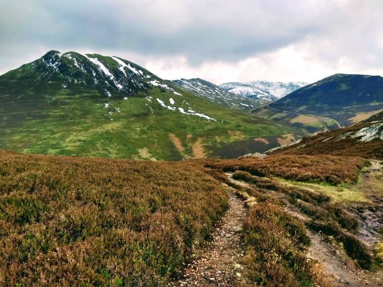
Wainwright wrote that many of the hills on a Coledale Horseshoe were much quieter than their high profile northern fells counterparts such as Skiddaw and Blencathra. Much of the second part of this route definitely had that quieter feel with little paths meandering gently through the heather, not quite busy enough to bring the attention of the Lakeland authorities wanting to shore them up with scree (just yet at least). Being as it was the end of the winter season it was possible to get many fells entirely to yourself, too, encouraging you to linger and enjoy the views as they gently unfurl the higher you climb, accompanied by just the gentle sound of the wind and crunch of snow underfoot.
It’s been quite a while since I’ve posted a trip report and I’m sure some of you who followed me when I was writing my TGO Challenge Diary will wonder who on earth this is again and why you’re getting an update in your inbox! (yes, that was back in 2017!).
I’ve been walking fairly consistently since, of course – but in general found doing the trips a lot more fun than writing about them. That being said, this trip was a particularly amazing route which rekindled that love of waxing lyrical about the great outdoors, so I hope I’m not too rusty to make it a compelling read…
Now, for those who haven’t read any of my trip reports, they’re typically pretty long – I write primarily as a trip diary to remember all the little bits I loved about day out, and unapologetically included plenty of photos this time to break it all up, especially due to some of them being absolutely stunning – so if you like that sort of thing, grab a beverage of choice and scroll on…
The Coledale Round (a ’round’ or ‘horse shoe’ is a route which starts and finishes at the same place without retracing its own route) has been on my list for a while now, though Grisedale Pike in particular for some reason has kept eluding me. We’ve had non-stop gale force winds for weeks (months?) with three ‘named storms’ coming in and dumping a massive amount of water, so this was the first forecast for months with clear sky and almost no wind – so I decided I’d get out there, put the boots on and see what the Coledale valley was all about.
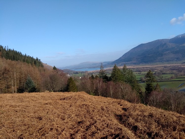
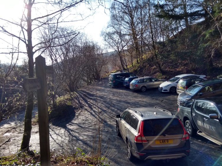
Parking at Braithwaite it was a stunningly beautiful blue-sky morning, I thought I’d be one of the first on the fells but the car park was already near full with those who had thought the same about making the most of the break in the weather. Ascending steps from the car park immediately starts the climb through woodland towards Kinn, the first mini hill of the day. That morning I was lucky enough to be serenaded by birds enthusiastically chirping away their morning song as my legs were warming up for the day. It was that kind of bright, still-winter morning where you’re looking everywhere and enjoying how the world looks with those long, luxurious morning shadows and I mercifully had this section all to myself with nobody even in sight. It felt incredibly fresh, every breath making you glad to be outdoors.
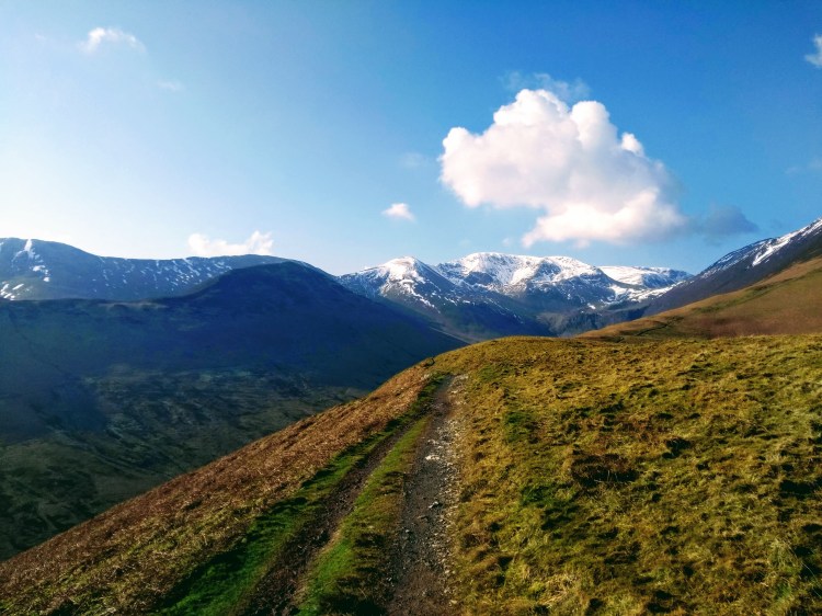
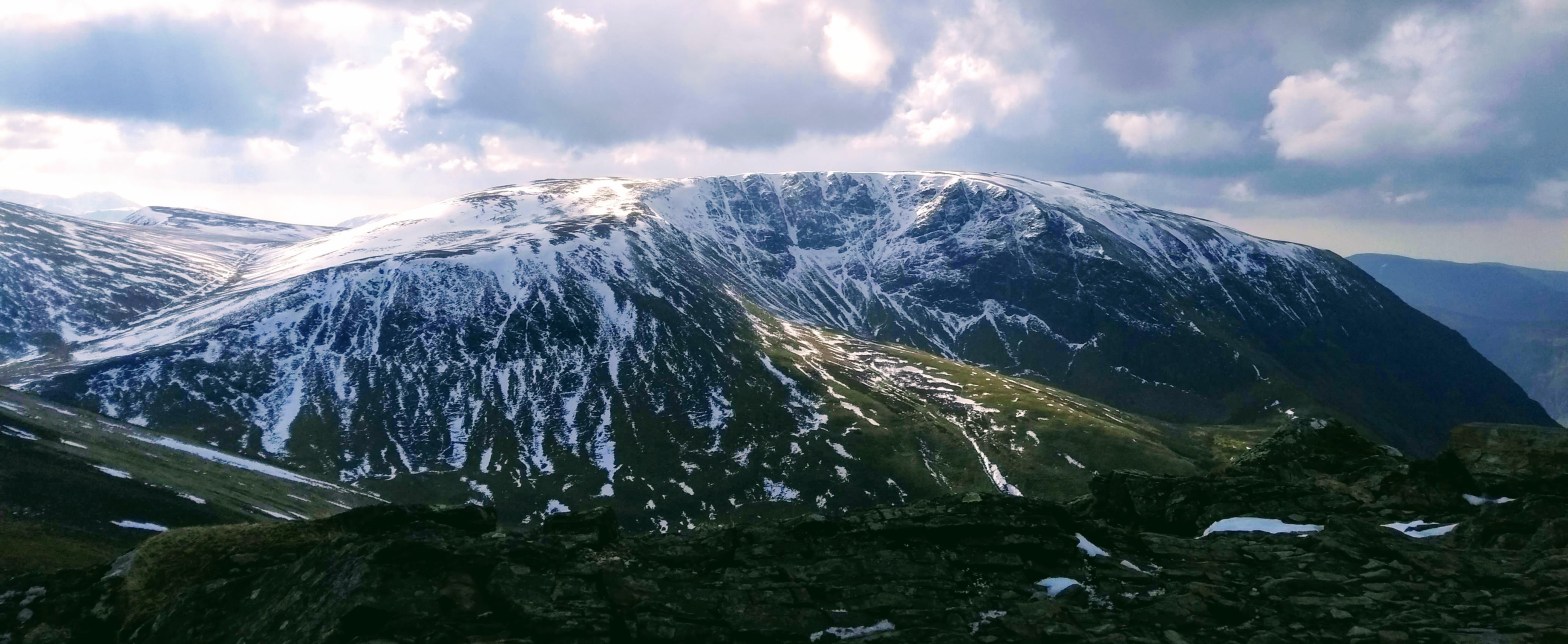
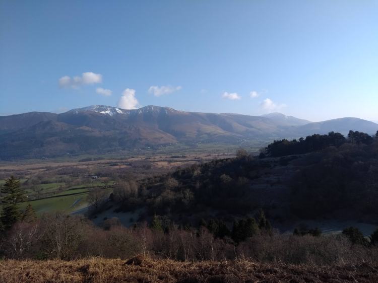
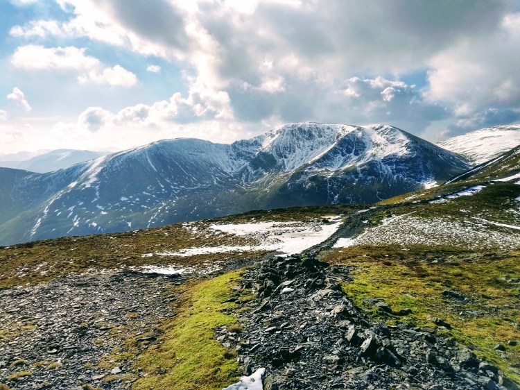
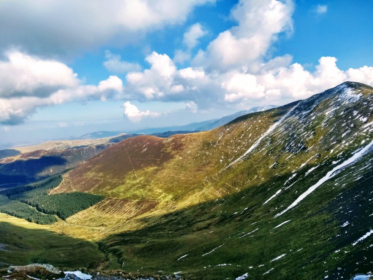
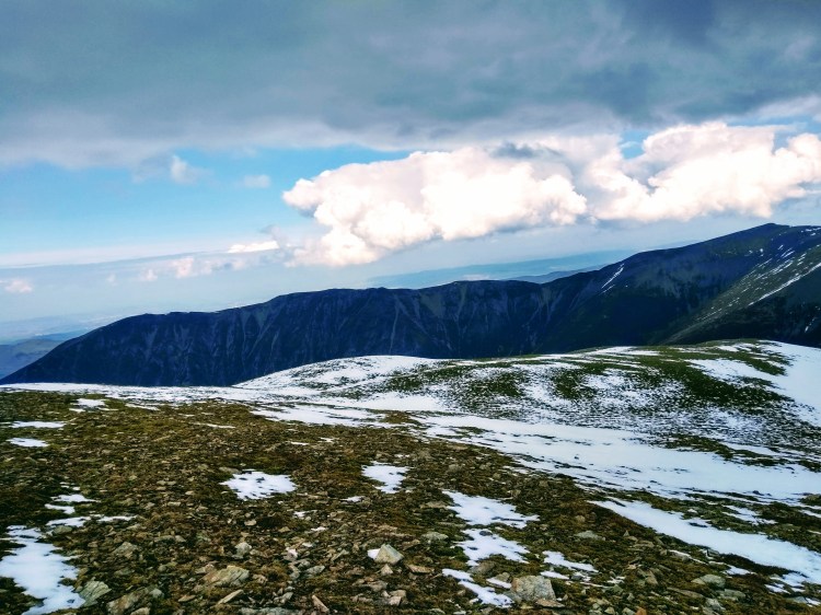
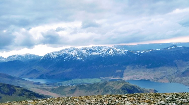
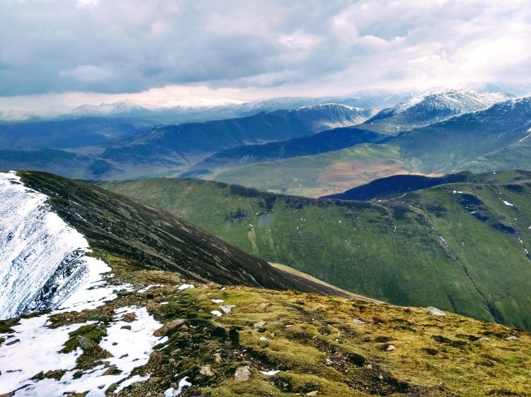
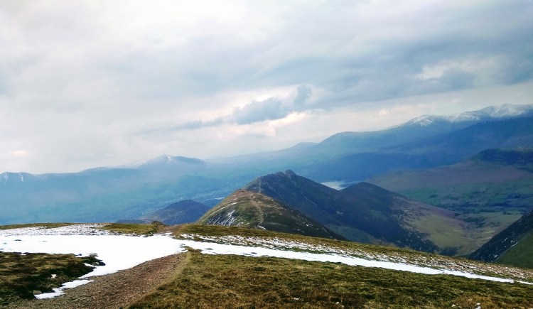
The route slowly curves around and then levels out to this little alpine-style section with grand views of the Crag Hill at the head of the Coledale Valley, still coated in sun-kissed snow – all the while admiring the beck running along the valley floor below. I’m not sure if it was due to knowing I’d be climbing them later in the day, but the hills did look particularly stunning – with clear views to Skiddaw to the north, Blencathra to the north east and across the Whinlatter Forest to the north east once I gained enough height to see it bathed in full sun.
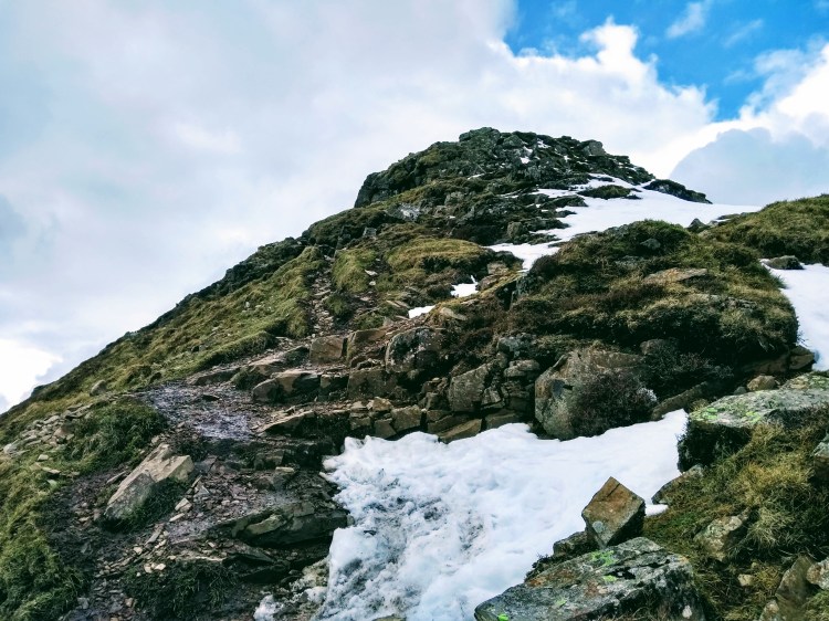
Sleet How came next, the scrambly section which was fortunately in full sun and so only still held a few slippery sections of consolidated snow from walkers boots. It was a fairly steep sustained section and I caught and passed a walker at this point, stopping for a chat (truth be told we both didn’t object to a breather). Apparently he was also trying a Coledale round but was ready to cut it down if he ran out of steam later. We wished each other a good day out and I cracked on with the ascent.
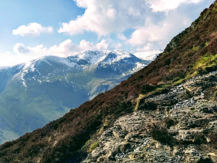
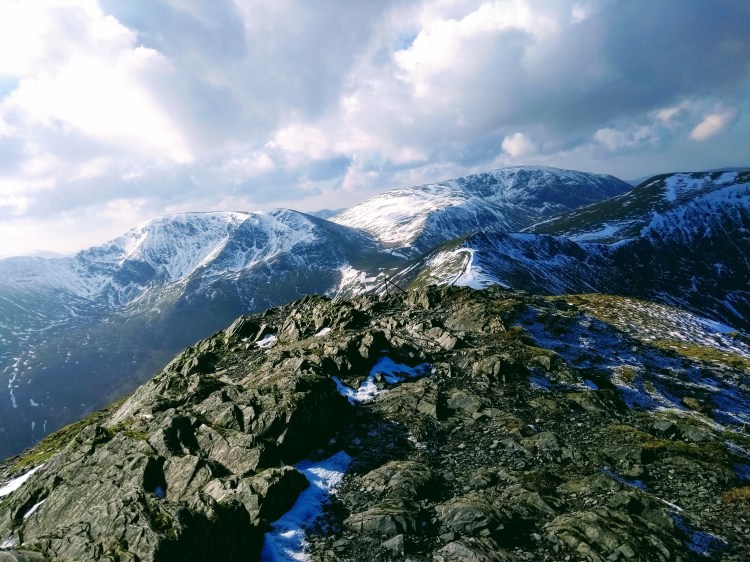
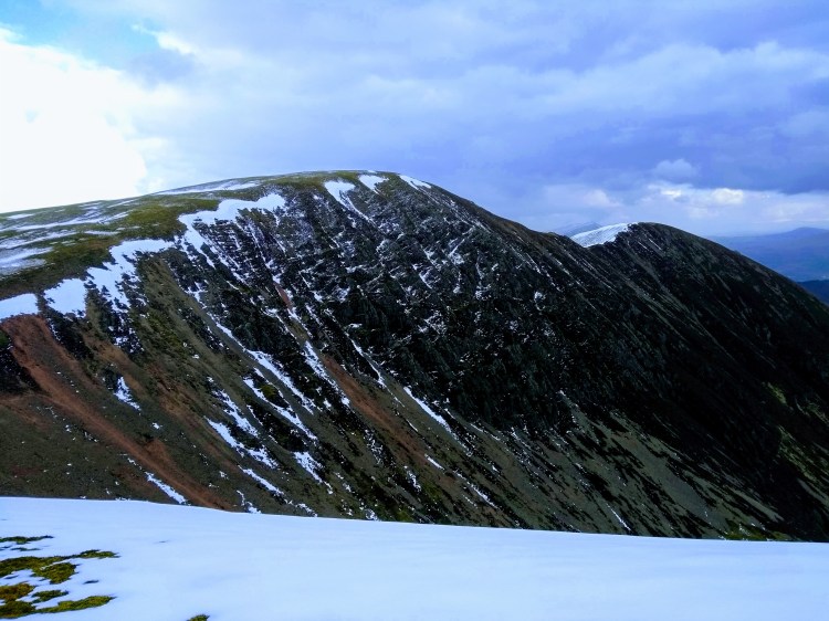
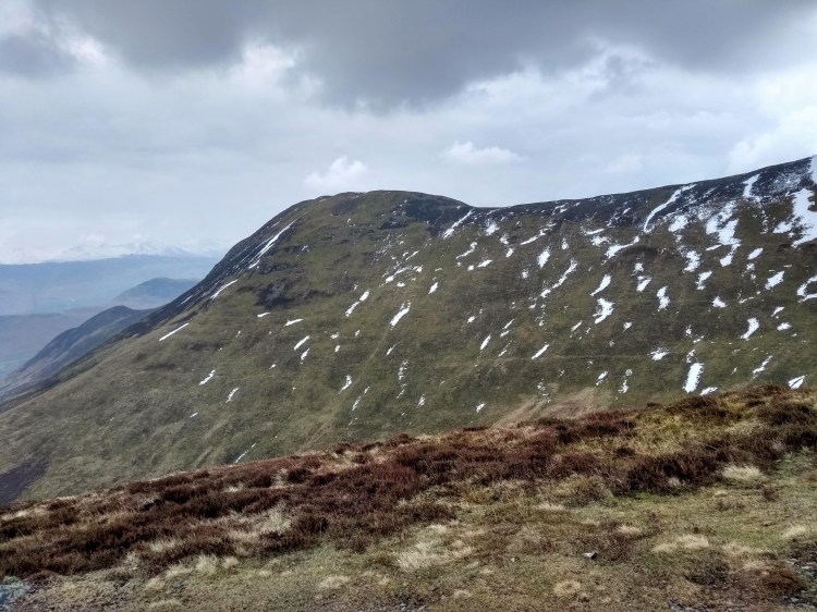
This section was particularly beautiful when it came to views once above the snowline, the views towards Ladyside Pike and Swinside to the north west were framed majestically, the blues of the sky mixing and reflecting from the snow and ice, giving so much more character to the fells than you’d usually see with the mix of browns and greens you’d see on a normal summer day.
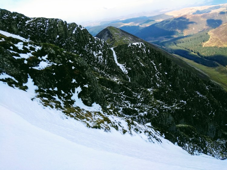
Contuining onwards there was one of the absolute views of the day, the rocky contrast with what was underfoot and the soft snow in the distance. This was a truly beautiful section which made this walk one of my absolute favourite days out in the Lake District so far.
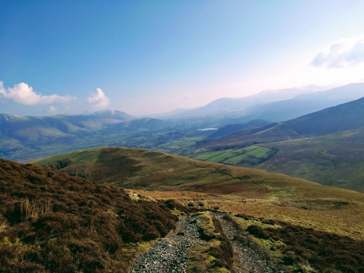
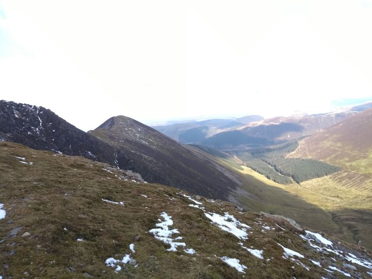
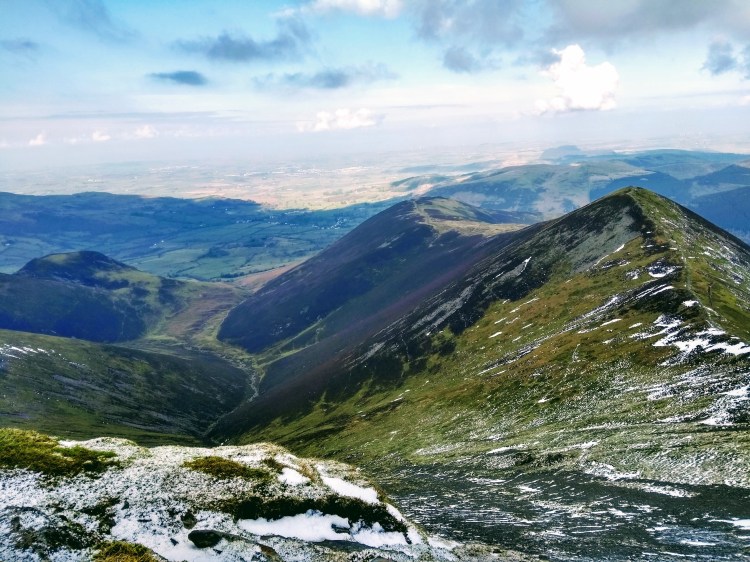
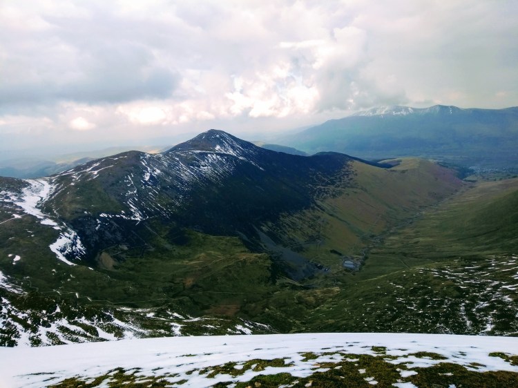
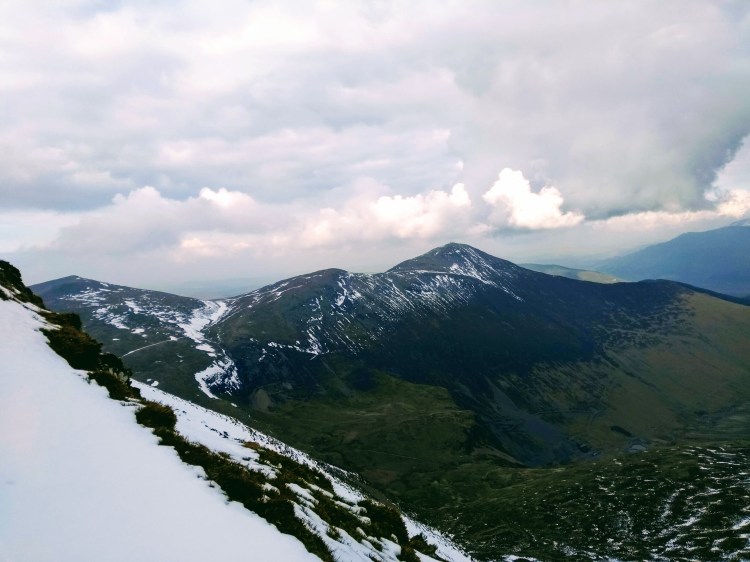
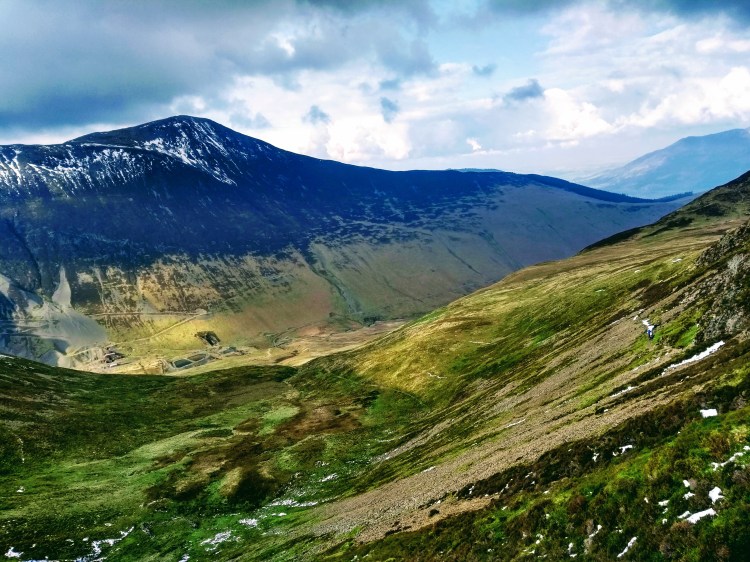
Proceeding from Grisedale Pike itself, I was uncertain whether I’d include Hopegill Head when planning the walk – it would add a little distance and I conscious of the strong winds we’ve been contending with for weeks. Originally I thought I’d save it for another day and tie it in with another walk from Crummock water… but with the views on offer I kept going with a spring in my step, enjoying the slow, easy downhill with Hobcarton Crag to the north, spoiled by views of the Whinlatter Pass and its’ surrounding forest.
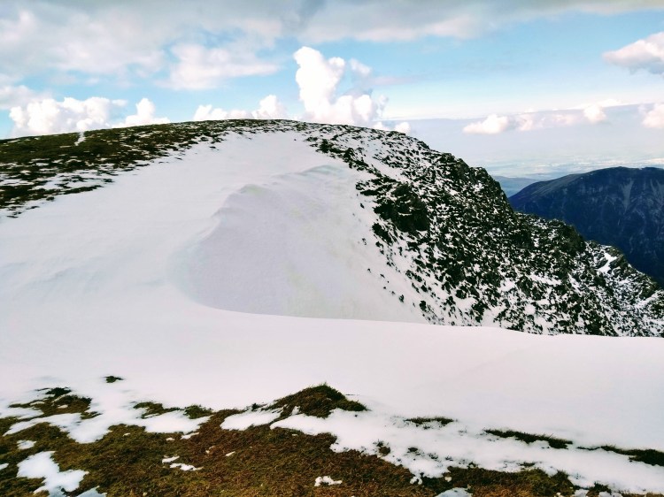
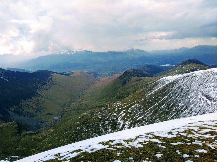
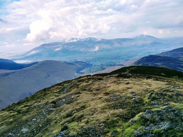
The route has a lovely gentle downhill which curves around to the north west, allowing you to see up to Hopegill Head and the lovely craggy aspect to the side of it – where a single figure was standing and looking down at me making my ascent. By the time I was at the top they were nowhere in sight, but this particular hill has a lovely aspect of an area I’ve not normally had much experience of – the pics are included below, I couldn’t leave them out!
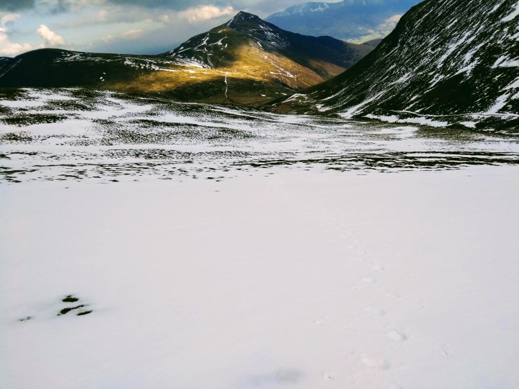
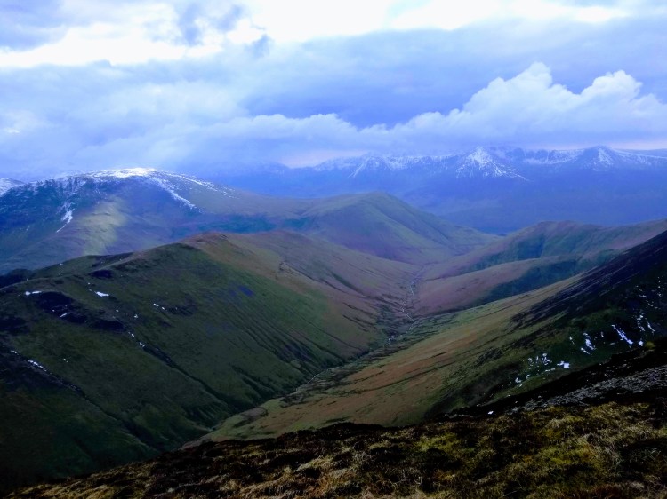
I grabbed a few bites of food in preperation for the drop down to the Coledale Hause and the climb back up again at the south side of the Coledale valley, the Hause being a saddle (natural low point) between two sets of hills and especially well protected from the wind were you looking for a camp spot. On such a still day this made little difference of course, however Grasmoor (which I wasn’t going to do on this walk) looked incredible and I just had to add it to the route..

The route down was covered in scree, which made for a bit of a jarring descent and I kept to patches of snow where possible, glad to have my hiking poles to help the knees a little. The stream (which becomes Liza Beck) was in full spate with the snow melt running off the tops and I took a moment here to refill water bottle and stripped down to just a base layer in preparation for a sustained climb from the bottom of the Hause all the way to Grasmoor’s cairn.
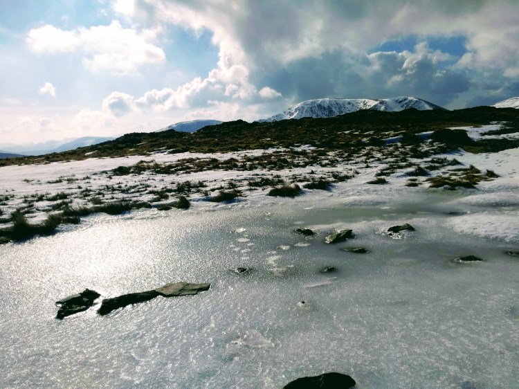
At this point there was a veritable explosion of walkers arriving from other directions, with a series of people appearing from the route to Wandope Moss to the south in the opposite direction. I had been enjoying the solitude so far and decided to keep it by hurdling the stream and taking the north-east aspect up to Grasmoor which still held plenty of snow. This made for heavy going but gave an opportunity to practice some boot techniques as well as that lovely feeling of walking over untouched snow with no boot prints whatsoever. At 750m the crispy snow turned to hard neve as it had refrozen – making kicking steps a necessity all the way up and needing steadily increasing effort. I made the decision to not carry an ice axe on this trip as the snow melt had been rapid so normally I’d not want to ‘practice’ on hard snow without, but the run out was gentle and decided to use the opportunity to get the microspikes out to make progress over this short section and keep climbing towards the Grasmoor’s cairn.
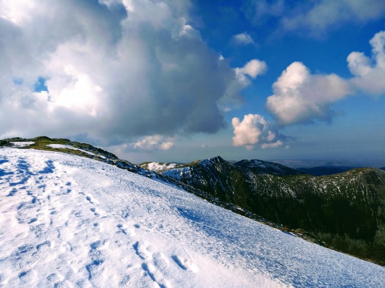
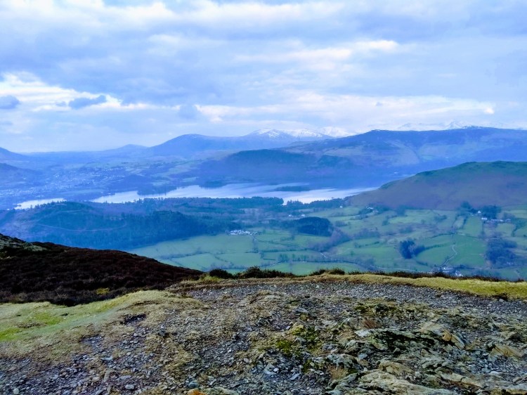
After reaching the top of Grasmoor the expansive view to the south of the Buttermere fells cleared and I could see Great Gable with Scafell Pike in the distance. For a March day the views were brilliant. I took loads of pics, a selection of which are below:
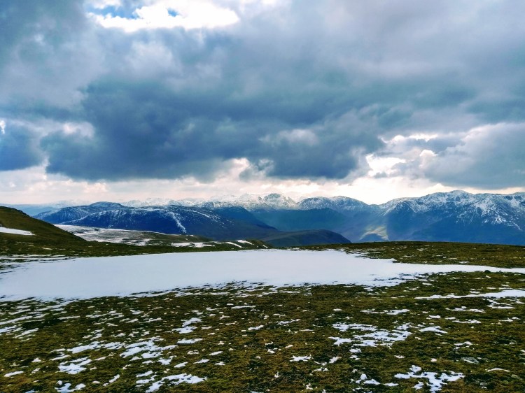
Perched looking over both Buttermere and Crummock this seemed an ideal time for a long leisurely lunch stop, though I began to chill and noticed a cold front had moved in, likely dropping the air temperature to around -1/-2C that high up. I had been moving rapidly all walk so far and only needed a Power Grid base layer, adding my fleece and windproof for the stop.
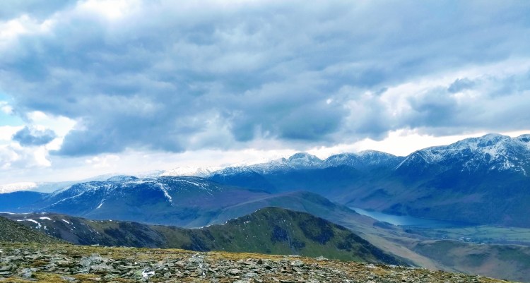
The best way to warm up is always to move of course and as I turned around to hea dback I made a mental note to get myself back to Buttermere soon (..seem to do this every time I’m near Buttermere, it’s a lovely place) and decided to head towards Wandope, first descending Grasmoor’s eastern aspect via a snowy downhill with deep plunging steps before continuing a slow plod in the slippery footsteps of walkers on the way up to Wandope itself.
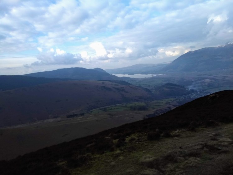
This part of the fells, now around lunch time, was the busiest I’d see the route all day – Coledale Hause acting like a hub for walkers coming from the Derwent side to the east, Buttermere to the south, Crummock via Gasgale Gill and the few walking up the Coledale valley route. I wanted to get moving and find some space to myself, so engaged the afterburners and flew up Crag Hill and enjoyed a quiet summit away from the cairn – contemplating just how lovely the route had been so far and relishing the undulating aspect of the second half of it to come.
Crag Hill marked most of the hardest walking of the day done, however a series of wainwrights still were tempting me – my thinking when planning had been that I’d see how fresh I felt and add or remove them if I felt any significant fatigue. It hadn’t been that long since my calf injury which had me on crutches for a while so I wasn’t wanting to persist with pushing it if anything felt ‘wrong’.
Scrambling down The Scar wasn’t too tough with a couple of slightly icy areas of compacted snow, however the walking poles made for quick progress and I was soon negotiating this lovely little saddle before Sail itself, itself covered in snow with the valleys beginning to open up their views on both sides.
Finishing the snowy little ridge after Sail I took a minute to strip a layer off and climbed Scar Crags quickly. Even though it was holding more water than the rest of the route so far, this hadn’t registered much due to enjoying the solitude in an area which seemed much quieter than the busy ‘walking hub’ I had come from. Presumably most walkers had taken the Coledale beck route back.
I had been intending to just walk straight north west from Scar Crags to rejoin the path, but took a look at ground conditions with a steep icy run off on boggy, slippery ground and thought the better of it. In many ways often these ‘short cuts’ on the map are often worth resisting, by the time you’re checking your foot placements to avoid a slip you’re committed to a lot more than you needed to be – far better to keep a little safer, pick the slightly longer but faster route without any dramas!
This proved a wise decision as the route to the north of Scar Crags was holding a fair amount of snow and the descent had become a slip-and-slide experience where you try to avoid the icy patches which had been compacted by other walkers. I was passing several groups of slower walkers who didn’t have poles and couldn’t seem to stay upright for very long!
Still feeling fresh I crossed over towards Outerside to tick off another Wainwright – though the High Moss area (the clue was in the name!) was a fairly extensive bog which took some careful stepping around to avoid going ankle deep. I hadn’t brought the gaiters this time so I was being extra careful. There’s nothing which makes an otherwise brilliant day go sour than immersing your whole boot and finishing the day with cold, stinking feet.
The round was coming towards a close but not until I had included Barrow – a hill I’ve not visited before. I was considering cutting the day short here and coming back to do Barrow later if there was much more snow and going had been slower – but I felt fresh, still had some food left in the pack and so set off for Barrow without a second thought, passing a couple of surly fell runners on the way.
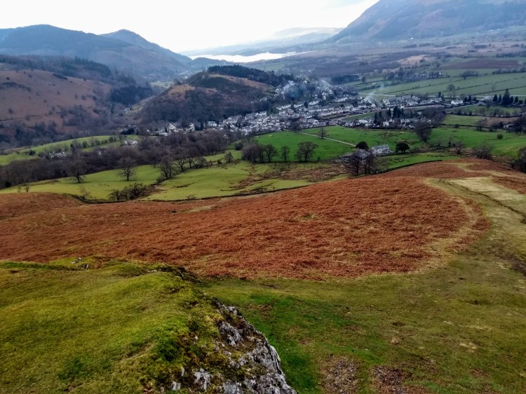
Upon topping out there was a short intake of breath, as for quite a little hill there was a lot to enjoy about it. The aspect across Derwentwater, the general panorama allowing you to stare at Bassenthwaite, the Whinlatter tops and generally spend a moment contemplating in any direction you choose. I’ll definitely be back – though probably with more company since it is fairly easy to get to from Derwentwater’s shore on a sunny day.
After a proper break here (the last one had been on Grasmoor) I packed up and meandered slowly behind another set of walkers back into Braithwaite. I’ve hardly explored here much in the past, usually just passing through – but there seems quite a lot there for a small place. Obviously very dominant with holiday cottages, but two pubs, a village shop and a village restaurant isn’t a bad haul for what is a little place!
Overall a superb day out, loved the route and well worth the my delay in getting to actually do the walk. If anything the thawing snow gave it a lot more character and colour than the summer would have done, not to mention having many of the hills almost to myself. This walk also saw me pass the ‘half way point’ of a Wainwright round of 214 fells and I seem to be enjoying them more and more lately, especially with many of the far western fells remaining which are typically a bit quieter.
I’ve decided to include much less text in these trip reports and a lot more photos – I take loads of them, so why not! Let me know if that’s something you appreciate. Occassionally I’m very tempted to go off on a tangent about gear choices, navigation and so on, but at the end of the day that’s pretty niche stuff and only really relevant during the truly bad weather days out (type 2 fun – isn’t much fun at the time but makes for a good story later!).
There are stacks of photos to get through from trips during the last year so hopefully this is a start of a resurgence of interesting trip reports, after all it’s now the beginning of the proper spring season and a perfect time to lace up your boots and get out in the fells.
For those interested in my TGO write-up (be warned, you’ll need several cups of coffee to get through it, it was an epic) there is a link at the top of the page which takes you back to the index page and can go from there (or click >here<)

Great photos! and beautifully written – almost felt like I was there too! 🙂
LikeLiked by 1 person