
Every film series has that inevitable part which gets – for want of a better phrase, A Bit Rubbish. It’s inevitable, really, you just can’t keep up that non-stop action without the plot not making sense, and you end up watching the glittering, stupendously expensive CGI effects and not caring one jot about the protagonists. This is the movies, see, and the good guys have to win – even if it ends up as a horrific convoluted mess in the process. For every The Matrix there is a head-scratchingly-odd Matrix Revolutions; for every Terminator, there will forever be the mash-up mess of Terminator: Genesys sharing the moniker. Gabe and I had already got our rather crap sequel out-of-the-way, and were now stocking up on the popcorn for a Return-of-The-King-level finale to our crossing. It was time to dim the lights and get stuck in to finish it how we intended to in the very beginning…

In yet another change to our original itinerary, today was not actually intended as our last day. ‘Cheyene Hill’ (835874 for those with a map handy) was about the only little hill on the map which could make a scenic campsite with a coastal view, and if the weather kept kind we were aiming to get there by the evening after a day of forest walking, ending in us enjoying the sunset with spectacular views of the sea – before ambling in to Stonehaven the morning after, with barely 6km left from our proposed camp. That was the plan, anyway, and our plans have proved pretty flexible this trip.

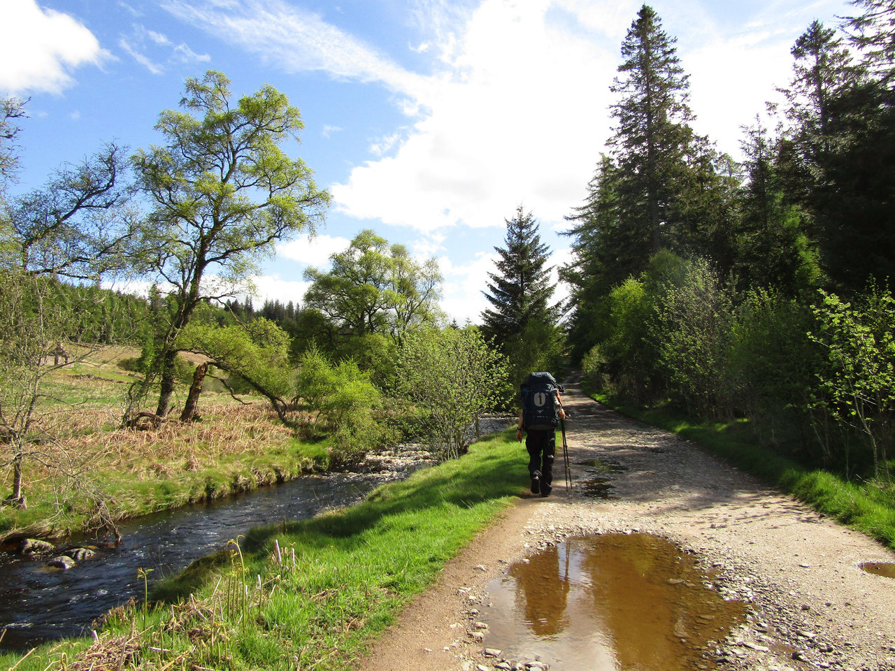
Charr Bothy was a fine place to start the day. Waking early and looking outside, a clear blue sky was tempting us to make good time and hit the coast later in the day. Breakfast in the sunshine followed, with us anticipating a pretty easy day of walking through the forest in the sunshine. We restocked all our water to maximum, aware we were entering farming land and would need it if it turned in to a scorching day, signed the visitor’s book and headed off. A couple of leisurely hours of strolling down a track until we reached a bridge to take us across the Water of Dye, allowing us entry to the Fetteresso, a 20km-wide forest, as the countryside changed from barren hills to woodland.

The Fetteresso itself began with much promise, with us winding along the deserted Old Military Road and cutting in to the forest on a logging track. The outskirts were certainly beautiful, with it warm enough to need sun-lotion, but this gradually changed from untouched forest to include a smattering of abandoned heavy machinery, oil drums and a general sense of lots of work having been done to the place. There were signs warning not to drink the water (something we were aware of) and even though we had stocked up, we knew it was unlikely to last us all day, especially in the heat, with our filters little help due to being designed for removing micro-organisms, not chemicals.


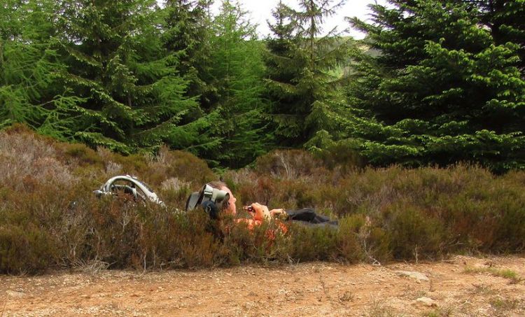
As we meandered through the forest in the blazing sunshine, covered in suntan cream, we were trying to get a bead on the place. Many Challengers have said they loved it, yet some absolutely hated the place, calling it sullied and a sad reminder of the work eking away Scotland’s wild spaces. The wonderfully little green access pathways seemed glorious and the machinery wasn’t that excessive -surely they must have just been there on a particularly dreary day?

We continued until we excited the woods, emerging into the wind-farm proper, or at least the edge of it since it’s a colossal site, with an estimated 40 units whirling away across the best part of 4km. The lush forest’s deciduous shrubs and trees simply disappeared, changed instead to a barren open area with drainage channels, compacted access tracks and debris strewn all over the place. It’s an absolute mess, frankly, and a couple of hours walking through the wind-farm was more than enough for us. We were approaching mid-afternoon by this point, and we had plenty of forest to walk through on winding tracks before our camp.
Gabe and I were to have other ideas, however, as we didn’t feel there was enough untainted water in the forest on a piping hot day to make a forest camp feasible. We were expecting to walk miles of compacted tracks, too, and felt rather than getting ourselves in a situation of camping later with no water, we’d make a push for the coast today and make it all the way. We headed to the south-east of the wind farm, past a whole host of additional machinery, generators and metal fences – then decided we’d pick the most direct route, head over Leachie Hill (a 400m trig point) and pass through farming land to the quiet B-road. This did involved jumping over a double barbed wire fence (when does it not?), but we were convinced it was the right choice, and our hiking gear survived intact, despite a precarious wobble at one point and a bit of swearing. Level land, faster route and guaranteed water provided we made it to Stonehaven seemed quite obvious pros, despite the fact it was road walking a rather major negative. The feet weren’t that bad after our half day yesterday and diligent treatment, but we were certain what 15km of road walking would do to them.


We decided Stonehaven was worth pushing to tonight, despite it approaching late afternoon, and cracked on with us expected to arrive in Stonehaven by 9pm. A camp on the way would have been a solid backup plan, but most of these fields contained beasts and it wasn’t worth risking and agreed we’d find a wood if we had to. There is little worth writing about road walking, and we spent the afternoon going through periods of downpours intermingled with blazing sun. After a few stops to take the waterproof on and off again, I decided to just keep wearing my merino base layer and get soaked during the next one and live with it, as my grandmother would have said, ‘skin’s waterproof anyway lad’. We probably spent four hours to reach the outskirts of Stonehaven itself and were going a fair pace. Even so, it seemed quite a long walk to the coast at the time, but by this point we knew we had made it – despite the feet screaming for a respite, our only question was where we camped for the evening and when.

Stonehaven began with an industrial estate and few shops open on the way in due to it getting pretty late. A fuel station seemed to be the best bet, and so we ended up doing a surreal supermarket sweep, with some easy food for dinner, a celebratory bottle of wine, and something for breakfast the next morning. I was struggling with the feet/leg at this point and so sat outside, causing a few drivers to cautiously do a double-take to be sure we weren’t planning on robbing them as they went back to their cars from paying for fuel. Backpacks were loaded and our spirits definitely improved after a proper stop, before we cracked on to the coast with the intention of getting our feet in the sea.

Stonehaven isn’t the best place for ‘easy access’ to the water, however, and we ended up walking in the rain as dusk approached, taking the coastal path to Dunnottar Castle, our stated ‘end-point’. There were a few evening runners about and the odd couple having a leisurely walk with their waterproofs on, but we were determined to make it, still in the base layer with water running down our faces. The feet were burning from so much walking on hard tracks and roads (about 38km today), we were likely a little sunburned, but this close to the finish we were prepared to set up in the dark if necessary.
Arriving at Dunnottar Castle itself, a cliff camp seemed a good shout despite the chance of strong coastal winds during the night. Camping on the beach or further back would have worked, but we really wanted to A) camp right now without moving any more and B) a good vantage for sunset and sunrise the next morning. Camp was made rapidly with all the guylines setup in prep for a rough night and food soon followed, made separately in our tents as it was raining pretty heavily.

Afterwards, we shouted to each other to get the jackets on and both sat on a grassy knoll facing the castle and the water. It was quite an emotional moment in many ways. Perhaps it is that I figured I’d be unable to continue sometime during the next five days after injury, or perhaps that it necessitated being so focused on the moment, on the next goal, that I was caught out by that feeling when I realised we had nowhere left to walk tomorrow. Sitting down, sharing some food, we felt the wind blowing in our faces as the rain started to intensify. We sat there with our waterproofs on, hoods up, drinking red wine and grinning. We had done it.
The rest of the evening was fairly short due to arriving so late, having walked for probably 12 hours that day. The bottle of wine was finished pretty quickly, enjoyed what was left of the sunset (although it was an overcast evening and there wasn’t much of one). Retiring to the tent, I checked the guylines were prepped for a heavy night and set an alarm for 5am. We were damned well getting up for sunrise no matter how tired we felt right now.

Hallo Wonderful article! We are linking to this great content on our website. Keep up the good writing. grazie
LikeLike