

Day 9 : Braemar to Ballater (32km)
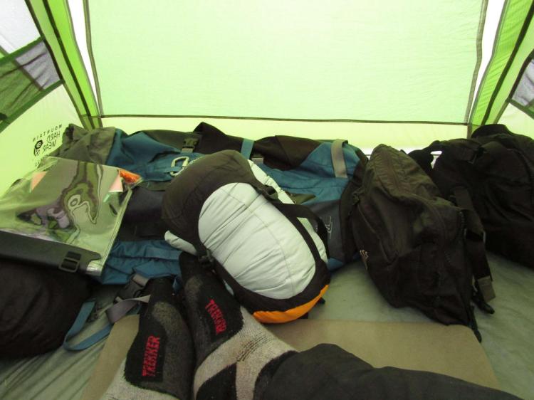
Waking early, I crawled out of the tent and made an urgent beeline for the facilities, after the previous night’s beers – it was probably the fastest I’d moved for a few days. The night had been blustery and wet but the well-protected campsite allowed us wake rested. Gabe seemed to be stirring early today and a trip to Gordon’s Tearooms beckoned, the mercurial little place which opens especially early during the Challenge and was rumoured to do good breakfasts. With a kick-start needed, we left the tents and headed off.
Braemar was enjoying a sleepy Sunday morning with nobody about, the breeze gently blowing our faces as we saw hints of the morning sun coming out. Arriving at Gordon’s, there were already had a few early starters occupying tables, including a chap from Minnesota I had met the day before who taught bushcraft for a living. The others were a mystery despite being clad in outdoors-gear, I know there is a bunk house in Braemar so perhaps they were from there.
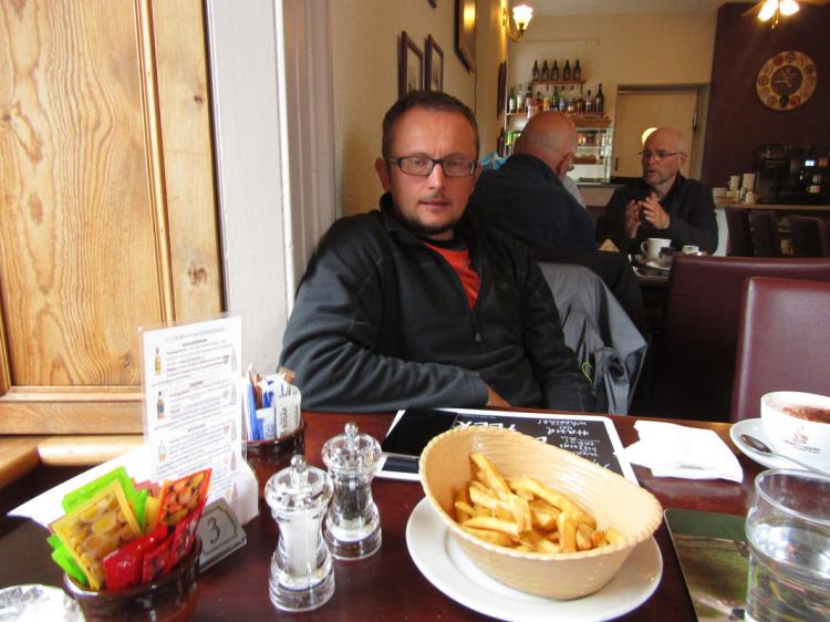
Two proper Scottish breakfasts were ordered and the coffee was a god-send. I had pocketed the new map from yesterday and pulled it out to trace some routes, with us now fresh it seemed a better time to judge what I could manage. Gabe, usually a vegeterian-of-convenience, went off the deep end and ordered a bowl of chips alongside his full breakfast; confused, the waitress asked whether he was sure, leaving me to explain he is foreign, and thus unused to civilized breakfasts. Tucking in, we joked a little and greeted the procession of Challengers entering the place like a reverse-clown-car, until almost every seat was taken – presumably roused from their slumber by the smell of crispy bacon wafting across to the campsite.
Everyone seemed in the mood for a leisurely breakfast, it seemed as if we had decided, en-masse, that we weren’t actually that bothered about finishing the Challenge and instead felt like a time-out. A second coffee was poured as we greeted the arriving French contingent, who we first saw at Drumnadroicht pier, seemingly all in fine form yet looking sleepy. Our route had been roughly fleshed out yesterday, but we had agreed to call it provisional in lieu of me feeling useless this morning. As it happened the swelling had reduced a fair bit, and whilst nowhere near back to normal, I felt I could manage the day, which was just as well as it would turn out to be an absolute bastard.
Leaving Gordon’s Tearoom we ambled back to the campsite where we packed up and wished everyone well, it now looking a thoroughly overcast day. I handed Mike my spare beer as I didn’t feel like carrying it, and we set off. This would be the last time I’d see Mike during the Challenge, as he was running a day ahead of his schedule and intended to stay around Braemar for the day, in order that he might finish on the Thursday. Ballater had been mentioned before in our conversation together at Dornie back when we intended to be nowhere near the place. Now, it was going to be central to getting back on track.
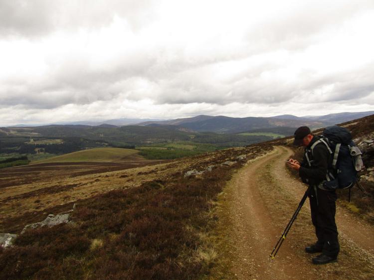
I didn’t think I could afford walking a scenic route consisting of back roads and little woodland ascents, instead I wanted to make as much distance as possible; and so we began the most boring and bloody painful day. I won’t bore anyone reading this with a full account, I’ll keep it mercifully short. Suffice to say we walked 32km on the road to Ballater, mostly in the rain, which took us a good 10 hours of walking – I simply was not able to push any faster.
The rain was a blessing in some ways, we were glad not to have bothered with Lochnagar as seeing anything would have been nigh on impossible, which made losing one of our hill days less of a blow. There were hundreds if not thousands of cars which passed us during the day, and I’ll freely admit that by the 25th kilometre I was seriously considering bumming a lift; but we persisted. Arriving in the town as the daylight started to drop, the feet were aching like a bastard from the hard road surface with much of the previous few days of careful recovery/use undone. The slow lengthy downhill section felt a long way as we finally arrived in the centre.
We discussed earlier in the day that we’d camp as far to the south of Braemar as possible, and failing that at the campsite, purely so we could get an easy and quick pitch with a minimum of hassle. Looking at the map that morning there wasn’t much to be said for simply heading east with miles of road walking ahead – even despite injury we felt this would be beyond what we were willing to endure to finish. Instead, we wanted to link up with Tarfside by tomorrow night using the Glen Mark route. This would let us walk on softer ground in addition to staying in roughly the ‘pocket’ of being able to enter the Fetteresso Forest, with the added bonus of having an opportunity to drop in to Tarfside and enjoy the hospitality.
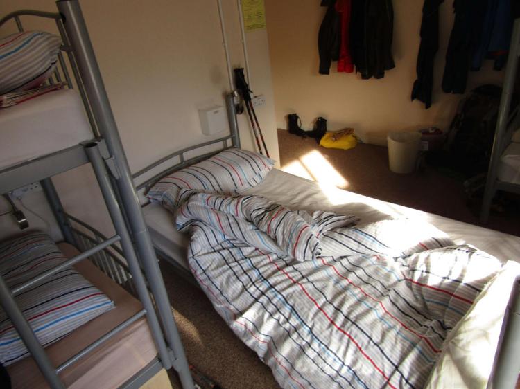
By this point it was around 8pm, later than we would have liked, but early enough for places still to be open. We stopped for dinner, our first stop for more than ten minutes all day, and it was almost a strange experience to be still. I was in quite a bit of pain by this point and didn’t think I could do the extra 3km to a forward wild camp for tomorrow. Wandering around Ballater, completely by chance we found Habitat, which has since changed its name to Ballater Hostel. The opportunity to rest in a proper bed was overwhelming and barely ten minutes later we had our packs on the floor in one of the hostel’s rooms, enjoyed a proper shower and met (yet another) motley crew of hikers.
After repairing the feet and getting the socks back on, I went to the lounge area where some sort of local hiking coach-tour was congregated. Many of them were leaving on a hike tomorrow, with a few routes offered, but the net result was a very full hostel. You might think we wanted a quiet evening, but this bustle was pleasant, with the snug lounge area filled with people discussing their latest hiking projects and eating food picked up from the local Chinese takeaway. Gabe decided to have a nap whilst I hobbled about socialising. This was the point where, lo-and-behold, Peter the German arrived (!), the guy we seemed to run in to wherever we went, culminating in him giving me some of his food as we talked about the past few days and how he was enjoying life in the Scotland.
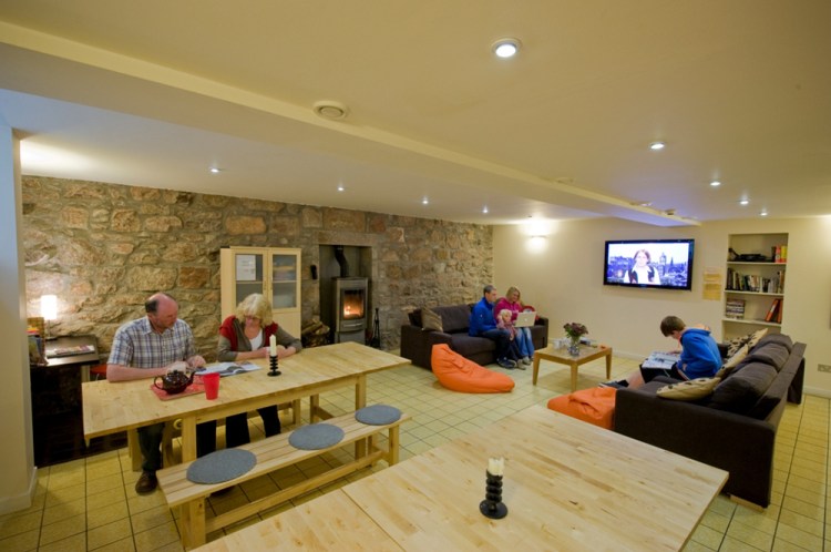
The owners are a couple, Dominique and Dan (an ex army guy), and were good company after what was a pretty boring day of road walking. There were plenty of jokes going around and clearly had strong knowledge of the area, even though they had only taken the hostel over in August 2016. They were glad to see such a busy hostel, they had had a difficult winter due to the lack of snow in the area not attracting the usual winter aficionados.
Clean bedclothes, a proper shower and the drying room were all fantastic, and after greeting the other Challengers in the hostel we crashed for the night with an early start needed tomorrow.
Day 10 : Ballater to Tarfside (26km)
I sleepily heard the electronic beep of my alarm, rolled over and nearly fell out of the bed. I had ended up with the top bunk, so this wouldn’t have been a good start to my morning.
We quickly got ready, there wasn’t much interest in wandering around Ballater for breakfast, instead we found some rice crispies and bread surplus to requirements, which were quickly reappropriated along with some marmalade.
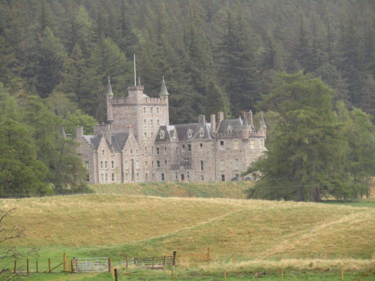
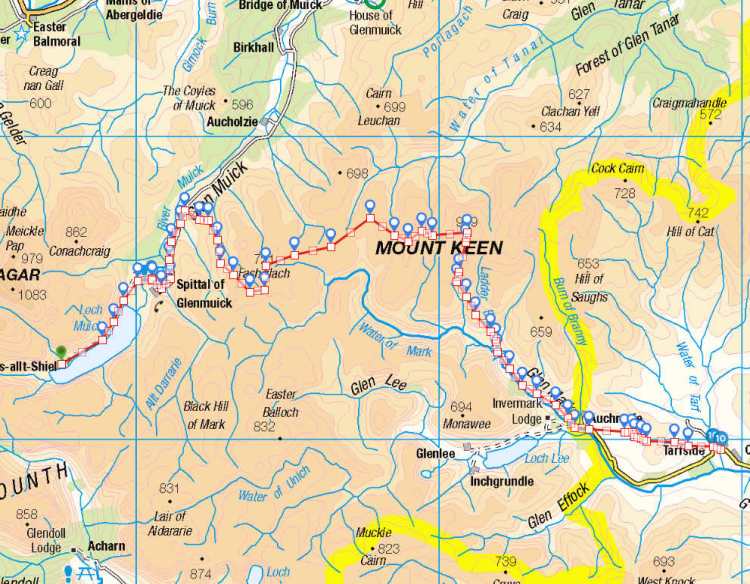
Today’s route involved a slow walk to the south of Ballater and overall would be a test of my fitness, with a fair bit of moving over rough ground. We slowly crossed the bridge in the morning sun, taking the B976 south for a mile until we hit our turn for Glenmuick House, which appears to be a private house. We took note of the Private notices and decided they wouldn’t be too bothered about two backpackers walking through at 9am, continuing through in order to gain access to the track behind the estate which headed up the hillside to the south-east.
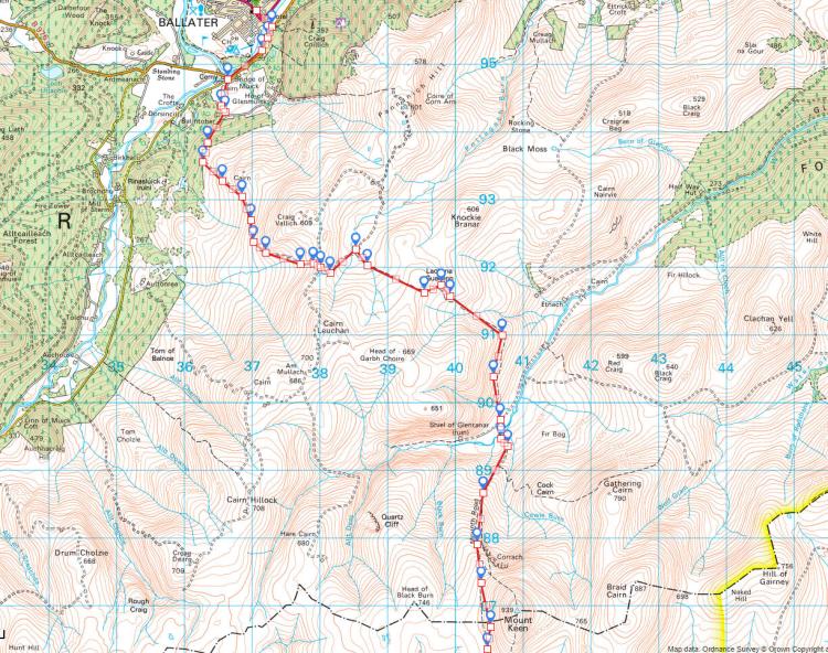
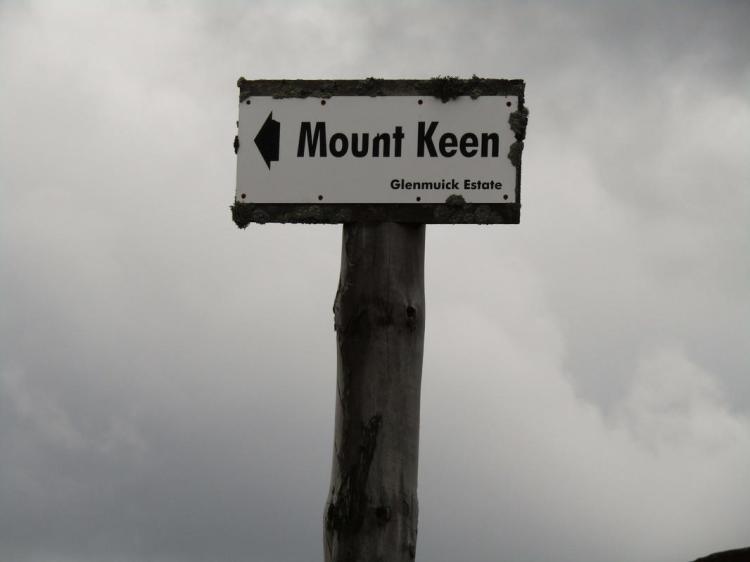
We were slowly making our way towards Mount Keen, itself a Munro, something we had expected to have seen the last of on our Challenge. Looking at the topo maps, we wanted as much time on proper tracks as we could to minimize heather-hopping, and this route would let us cut back down to an easy glen whilst forcing us to gain a little height to do so.
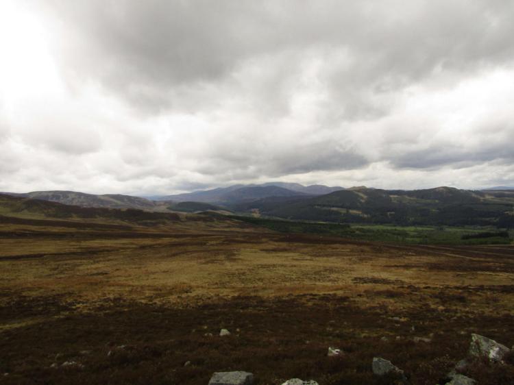
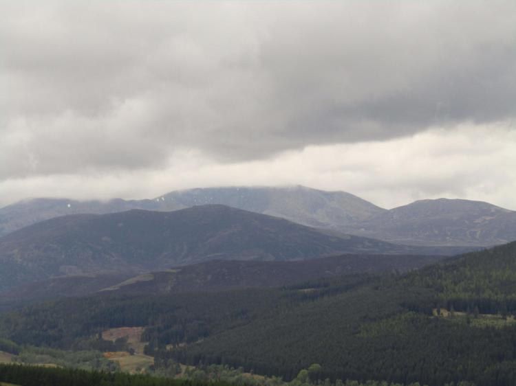
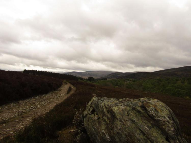
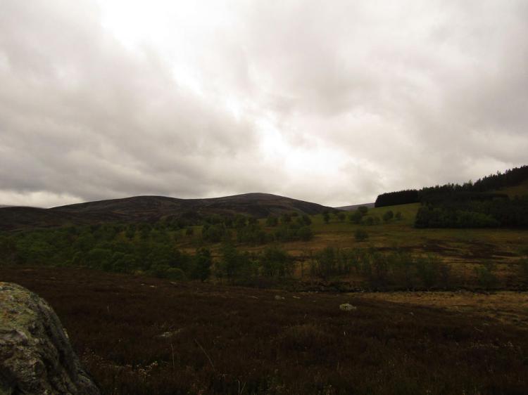
Continuing uphill we passed a couple of trail runners putting in the early morning miles, both of them looking a great deal fresher than we were, but we were making distance slowly and surely all the same The gentle slope becoming steeper as we rounded Craig Vallich – with the view superb, despite the cloud looking turbulent. The path was a compacted earth path, considerably easier to walk than the ones covered in rocks that we experienced during the early days of our Challenge in the west.
The signage is actually surprisingly good in this area to the point where only the poorest navigators can expect to get lost, with Mount Keen actually signposted a good half dozen times(!), though there are still multiple ways to get there. We had decided on the path which struck out to the south-east over Lach na Gualainn, which provided to be little more than a sheep track through the heather. There was little choice in the matter, so off we went.
The track ambled indirectly towards the Water of Tanar, and on the way it seemed that everyone was on their holidays nearby. We had mountain bikers pass us, a few hikers, and one Challenger kept appearing in the distance, his white backpack acting like a beacon as we repeatedly closed the distance on each other before our alternate breaks widened the gap again. Approaching the bridge over the river, we took a look down in to the valley and wondered what was going on. Otherwise in the middle of nowhere, a line of mountain bikes had been left whilst their owners presumably climbed Mt Keen, with hikers converging from every angle. It was beginning to take a turn for the worse weather-wise, with dark clouds starting to move from the horizon and approach. Undeterred, with half of it now done, we started with the ascent up Mt Keen on the Mounth Road.
Lets just say I didn’t appreciate the several hundred tonnes of rock they must have used to build the path, with it starting with a steep section of loose stone which often slipped beneath our feet. With the weather worsening we threw the waterproofs on and cracked on, with the steeper section evening out to a gradual ascent where we could use the earth to push ourselves up instead. I had been looking forward to putting in the last push to summit Keen for a decent view, but by the time we were 700m up it was clear it was not to be, with the peak clad in low cloud with rain pouring down, making it effectively pointless to do so – just as well, as I was struggling with the leg. Gabe seemed to realise this, reassuring me we had done the hard bit, with us now slowly descending in to the next glen.
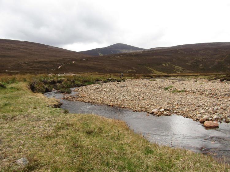
What followed was several miles of loose-rock descending, which was agony, plain and simple. I groaned under my breath like a wounded animal as I descended the steep area of Couternach as we approached the Ladder Burn, it was really starting to give me a lot of grief, and I was questioning the wisdom of ‘just heading over the top’, even though we had specifically pinpointed this area as a potential problem from our topo map earlier.
It was at this point we were greeted by about 12 girls returning from Mt Keen, most of them without anything more than a light daypack, minimal waterproofs and perhaps a bit of food. Obviously I perked up a bit. We were caught relatively quickly during this difficult section, ending up chatting as we approached Glenmark and the Queen’s Well.
It turns out they were researchers from Aberdeen from a NFP on a team building exercise, with some optimistic soul having suggested Mt Keen as something worth doing. Talking with the senior researcher/analyst, Rachel, who seemed to be chaperoning the rest – it seemed they were conservationists. We spent the next hour and a half discussing analytics, conservation areas and the beautiful outdoors. She even started handing out pieces of Toblerone to fuel our spirits. This was an absolutely perfect time to get a distraction and I was thankful to talk constantly until we stopped for a break. We wished them well and they went off on their way.
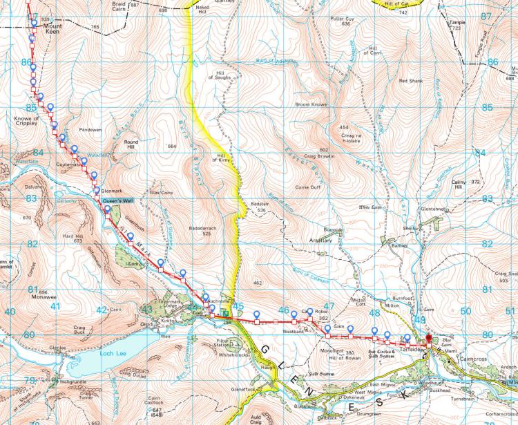
By late afternoon we were left with roughly 6km to cover to Tarfside, distance we wanted to make sooner rather than later. We heard that there was cake and proper food on offer there, so understandably had little interest in camping barely a few km short. That said, this was extremely heavy going, with a few hikers with multi coloured backpack covers in front of us disappearing and re-appearing over the next few hours. I actually think this would have been enjoyable on a sunnier day, it is nice rolling countryside all the same, but at that point of day, feeling fatigued it was heavy going. Finally arriving at Tarfside at almost dusk, with a dark sky raining on us most of the way, we turned a corner and found St Drostans.
Everything hurt, but just taking the backpack off and leaving the poles made me feel much better. We knew we had got ourselves back ‘on route’, and had nothing to do for the evening eat food and rest. Walking in to St Drostans we met the helpers who were all wearing a Challenge T-shirt, and were faced with a wall of noise and questions. After several hours of walking with grim determination, it all seemed a little surreal. Heading to the toilets to splashing some water on my face in the toilets, I took a moment to take a look at myself in the mirror – I looked dreadful. Fatigued eyes from the pain, blood in my beard from a finger injury and generally in need of a rest. But first it was time to greet everyone, order some food and catch up – I washed my face and decided I might as well be sociable.
There was a fair few people there, probably sixteen Challengers plus about six or seven ‘helpers’ who were doing the cooking/baking and generally helping with the morale of tired walkers. We retold our tale a couple of times and were left with open mouths, it certainly was taking a lot out of us. I could be wrong, but I got the impression the Tarfside helpers are all former Challengers who have completed a number of crossings, including a couple who act as vetters for the routes. We were glad to meet people who not only knew where we were talking about having climbed, but had likely been up there themselves not too long ago.
It seems by arriving late we had missed the ‘first’ sitting in the dining hall, and so sat in the anteroom, everyone in their socks having some back and forth banter. There were people we had met as far back as the Americans from the Rothiemurchus who were still looking out for us, laughing and joking that effectively the Challenge was over, we just had to avoid any slips and we’d make it to the east coast. The last of the hills were behind us and it was only a matter of choosing which direction to take.
Food came next, mercifully, with it being piping hot and very welcome indeed. There was a full table even for the second sitting, with many talkative people. Usually a talkative guy, I mostly listened, realising with surprise that two of the lads there had been bombing along, arriving at Tarfside yet having started only the previous Monday, and were averaging 40km a day. They mentioned their route being rather similar to ours, but it seemed unlikely we could match that pace, nor did we want to at this point in the Challenge, with it being Sunday and our finish planned for Wednesday night.
Eating the last of our dinner, some fantastic home made cake, we were offered a room for the night but declined. I was so tired I’d happily throw the tent up and sleep pretty much instantly. Walking over to the campsite, just over the road, it seemed there were a good few making that same decision with a forest of tents of various colours either erected or in the process of. We set up, Gabe relaxed for a nap as I went around meeting people I hadn’t managed to talk to in St Drostans. By half nine I was knackered, having been up since something like 6am. I read my book, thankful for the perfectly flat ground, and slowly drifted off, excited to be one step closer to finishing the Challenge, with all the big hills now behind us.
