
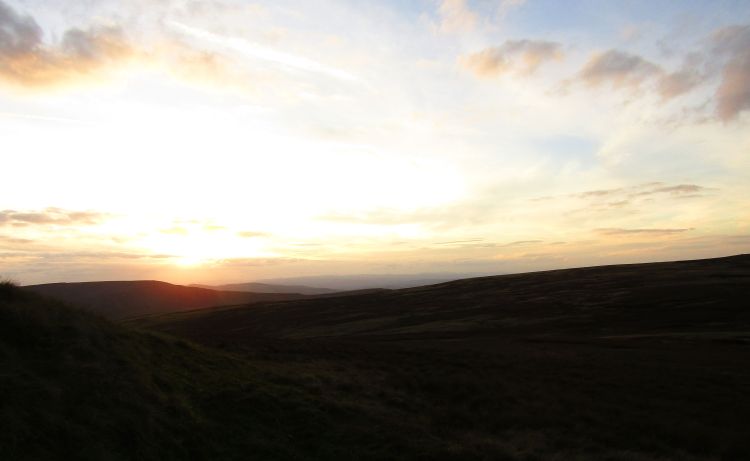
Summer, it seems, is staying late this year. It is sunny, a beautiful clear sky, and despite being late September. Time to get some new fells beneath my boots.
The plan was to be the northern Yorkshire Dales, an area I have yet to set foot in properly other than the odd day trip. Having driven from Kirkby Stephen to the Yorkshire Dales often, I’ve admired the beautiful hills, but so far have never actually went up them. There were a few good days in the forecast, and decided it was time to get some use out of the gear.
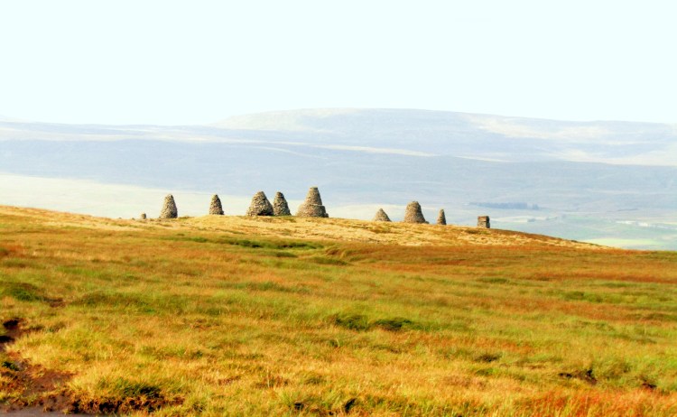
One hill I keep being drawn to whenever I look at a map of the area is Nine Standards Rigg. The gentle ascent doesn’t grab my hiking passion as much as the Lake District or a holiday to Scotland, though that said, Nine Standards does have many compelling reason to visit. Famous for having the nine stone cairns at its summit, the history of these stone towers is fairly patchy, yet fascinating. There are rumours they were markers as part of a route system for tea traders in the area hundreds of years gone by; where other sources claim they were boundary stones between Westmorland and Swaledale.
Looking into this a little further, there is clearly plenty of history in this area. The Romans retreated here to form a beachhead after losing Hadrian’s Wall, in order to use the natural boundaries of the Pennines and Howgills to protect their southern territories. Later, the last Viking King of York, Eric Bloodaxe, died on a local plain, Stainmore Common, an area linking Nine Standards Rigg itself with the backbone of the North Pennines – it is said he was cut down “by an agent on the orders of Earl Oswulf of Bamburgh, supported by the King of Wessex”. Later still, in medieval times, the rampaging Scots attacked the area too.
The ‘Standards’ themselves were mentioned in 16th-century land registries of the area, and have stood in wind, rain and snow for centuries. It was about time I added my muddy footprints and explored that great sense of history.
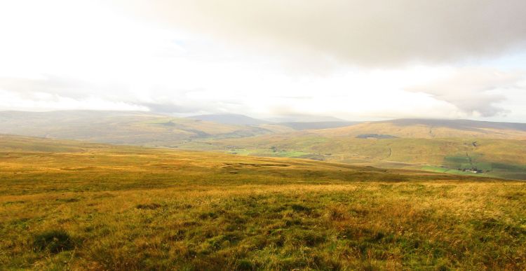
On the Ordnance Survey map, Nine Standards is marked as a ‘viewpoint’, for those not familiar with OS maps, this indicates it having a superb all around view of the area, with an especially pleasant view to the west towards the edges of the Howgill Fells and the Northern Fells of the Lake District. With that in mind, I took a look at the local list of Nuttalls (something I should probably write a separate post about entirely). There are a series of four Nuttalls to the south of Nine Standards, over a distance of a good 10-12km of mostly high ground, alongside two Nutalls on the opposite side of the valley. A plan was formed, bags were packed, and it was time to head off into the hills.
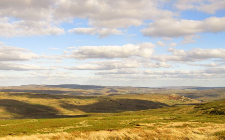
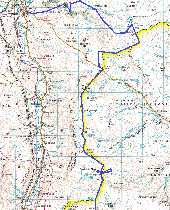
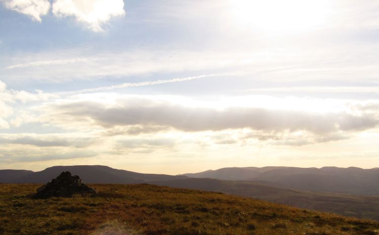
As much as I like a slow ramble, with the hills as unwalked (for me) as they were, and the weather brilliant, I wanted to see as much as I could. The route started at Nabeby, then a succession of – Nine Standards Rigg – High Pike – High Seat – Archy Styrigg (otherwise known as Gregory’s Chapel, due to a pretty extensive chapel ruin close to the summit, and still very much evident). Before proceeding to Hugh Seat and Ure Head where I hoped to find a spot out of the wind for the evening. As it turned out, the view from Nine Standards was superb and I rested for a few minutes taking in the views. As a hiker, supposedly a ‘leisure’ pastime, I am definitely guilty of hiking just to reach the top, and often neglect those moments where the clouds part, a shaft of sunlight grazes the surrounding area and you can’t help but smile.
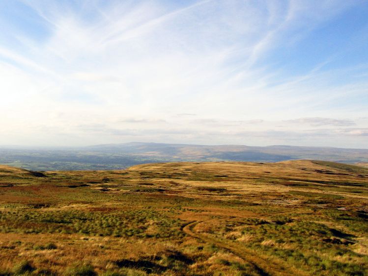
Continuing from Nine Standards, which was exposed in high wind, I carried on southwards to Lamps Moss, passing a laden hiker on the way. Proceeding up Mallerstang Edge was a joy, with beautiful views, and finally some decent protection from the brunt of the wind. I kept on the edge itself towards the south for most of the afternoon. The the first couple of kilometres were rough ground towards High Seat, a place I would like to revisit on a calmer day, as it had gorgeous views to three sides.
Upon arriving at Archy Styrigg I was most surprised to see Gregory’s Chapel, which after walking for several kilometres with little around, seemed a more ‘intact’ ruin that I was expecting. There is definitely an eerieness about the place with the high wind whistling past the fallen walls, thinking of those who resided here during winter days, heavy rain and freezing snows. Certainly pretty bleak. By this time, it was approaching late afternoon, and on the final km to Hugh Seat I knew I was starting to lose the light.
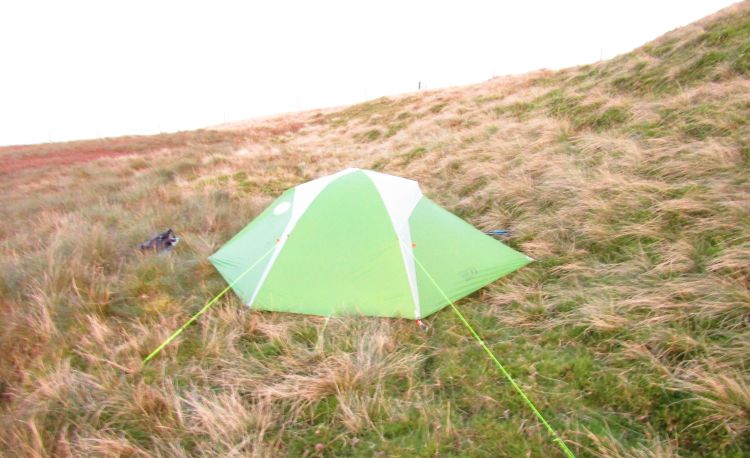
The original plan was to go further to the south east, away from my day 2 start, to find a stream I could draw water from and camp – however with the winds high, the only available water source was boggy and in exposed wind. My back up plan was to try east of Hugh Seat, still high enough to be protected – but hopefully having flowing water.
Unfortunately by 7 pm, now in fading light, my search for water was looking unlikely, with the best I found being a bog with the sound of trickling beneath. With the option either walk another 2km for a chance of a better site, or go back to the sheltered summit, I decided I’d stay high and enjoy the views.
I was a little concerned with the wind direction changing overnight, and so pitched tight to the hill, put a few extra guy-lines up and rested my feet. Incidentally this was my first use of Line-Lok guyline adjusters, which seemed to do a great job, a lot simpler than the usual metal things.
I am definitely no camping gourmet when it comes to preparing decent meals, and the evening meal was a work in progress, to be kind. A large amount of decaff coffee with me was welcome due to being pretty tired, but the spicy noodles/cous cous/spiced beef concoction with extra spices really won’t be seeing another outing.
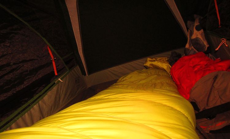
The camp itself was pleasant, if a little uneven, but was warm throughout and happily listened to my iPod. Unfortunately my CREE head torch was flat, I assume the power button was knocked whilst in the rucksack. Not sure how to fix this, many of the CREE models have ‘easy access’ power buttons which tend to be susceptible to this. In almost all situations, my Petzl Tikkina seems the better choice. Lighter, smaller, harder to turn on by accident, and runs on AAA batteries instead of the large CREE ones.
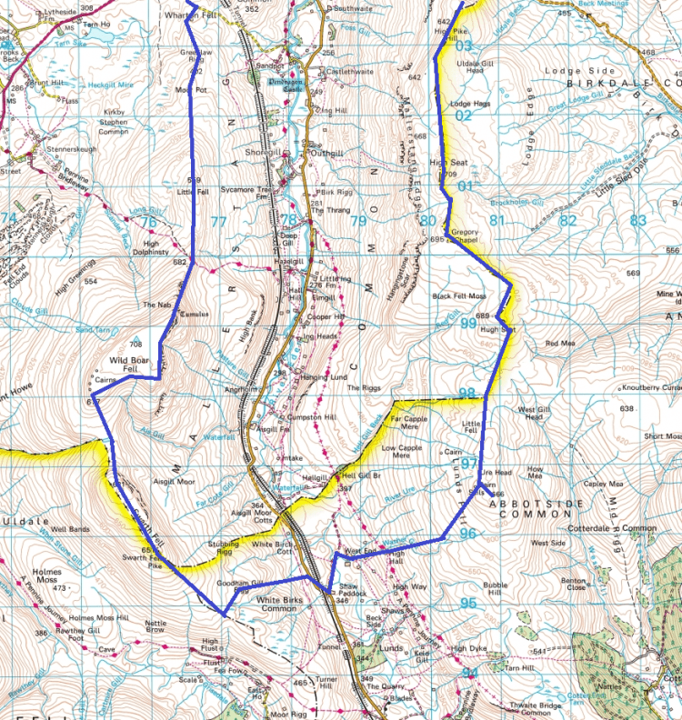
Plan for breakfast was drink the water I had left, eat a cereal bar and continue till I found a water source. I didn’t much fancy the boggy water around me at that point. There are plenty of long-distance hikers ‘ultralighters’ who swear by this method of light, dry food and then focus on cooking later in the day, but I don’t seem to function especially well without coffee, so I’ll stick to what works for me until I find a particularly tasty coffee-flavoured breakfast bar. Despite waking at 6am, there was low fog on the fells which obscured the view, and I zipped the tent back up until the sun cut some of that away. Now packed by 8am, I travelled 2-3km to Ure Head over boggy ground, probably the worst terrain of the two days in the notoriously damp Yorkshire Dales. Still very windy but no more than a spot of rain.
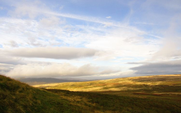
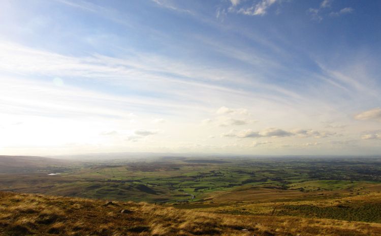
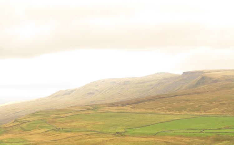
Ure Head had a remarkable view to the south and west of the Dales, and has remarkably easy access from the southern Dales for anyone in the area. I took a couple of quickly snapped shots before getting moving, as with the high wind I didn’t want to stop too long and chill.
The second day was planned as Ure Head – High Hall – Low West End – High Shaw Paddock (across the valley) – Swarth Fell – Wild Boar Fell – and back to Nateby. The steep ground between the fells hopefully would make for beautiful countryside, and hopefully a view of my whole day 1 walk from the other side of the valley. The descent from Ure Head was unremarkable, with a pleasant downhill until I could restock water and have some porridge with dehydrated milk and raisins. I must admit I didn’t think much of it when I packed it, but this fuelled me for the rest of the day. As I headed up the other side of the valley, I did see a couple of hikers in the distance, taking the more standard path to the south west whilst. I was working hard on the boggy ground, gave a wave, looking well wrapped up whilst I was being blown around by the gusts.
Swarth Fell itself is a beautiful summit plateau to relax on, with sublime views to the north east. By this point of the day it was beautiful sunshine yet still gale force winds, and coming back had to be on my list for the future. To the north of Swarth, a lovely descent opens up on to a saddle which again has spectacular views across the valley. I took a long break here, wanting to lose the two hikers who were setting a solid pace ahead of me. I took a few moments to change my damp socks and appreciated just how gorgeous the Dales can be.
The wind of Wild Boar Fell was the most intense of the two days, and I was glad of the shelter, due to having had to lean severely into the wind to avoid being blown over. The fell itself was beautiful, with views of the north Pennines, Lake District national park, and beyond.
I caught up the couple from before at the summit, where they were dawdling, happy to be out of the wind, and caught a well earned break for lunch. I sat there, admiring the view of Mallerstang Edge and decided I would like to go back another day without the high winds.
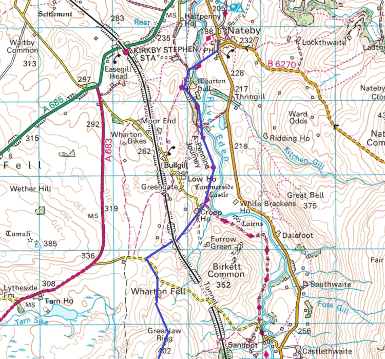
After getting out of the wind, I enjoyed the peaceful valley to the north as I took the Pennine Way route by Croop House. A good 4-5km of green fields, farms and riversides followed, at which point I was really keen to grab some food and rest my legs. It was still scorching hot, and the return in to Nateby felt fantastic now that I was out of the wind. Unfortunately, the Hikers Bar appeared closed, as was the pub, so the pint I had been looking forward to most of the afternoon was scuppered. Still, a very pleasant trip indeed, even if the feet were playing up during the second day.
Estimate 15km the first day with a start point of around 1pm, and 20km the second day but very slow going over bogs as part of that. Route below.