
This August I looked at the forecast prior to my birthday, and it’s usually a question of mixed success. You’d expect being born in August was an advantage for summer trips, with warm, lazy evenings – but no. It actually seems to mean every alternate year you are due a good downpour rather than weather for a BBQ. I had planned a trip to previous year to the Tan Hill Inn, the ‘highest inn in Britain’, with my family – something which turned to a dreary, soaking wet day, so this year I had my fingers crossed the weather gods would be in my favour.
Looking at the app on my phone, sun was forecast every day, not a patch of rain in sight, it seems my prayers were answered. I have replaced a lot of kit this year from older stuff, and have decided it was time to pick some of that kit off the shelf and get my boots muddy – the question was where…
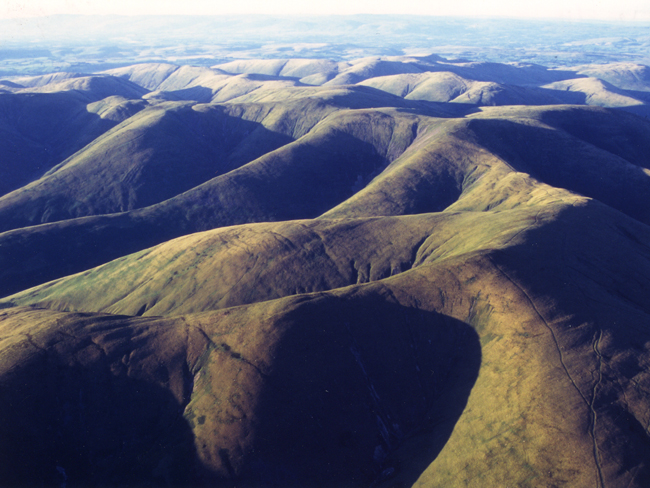
Having looked at a few maps over a cup of coffee, I settled on the Howgills. I’ve been wanting to complete the Nuttalls as a long term project, a list of 254 hills in England and Wales over 610m in height, a list which is slowly reducing week by week. So whilst heading off to the Lake District or North Pennines was an attractive proposition, I wanted to see what all the fuss was about the Howgills. Outdoorsy friends and forum users on UKC/walking forum keep mentioning how the Howgills have impressive fells, especially in winter, yet the solitude to let you enjoy nature without the crowds getting in the way. Something the Lakes definitely suffers from, especially on bank holiday weekends.
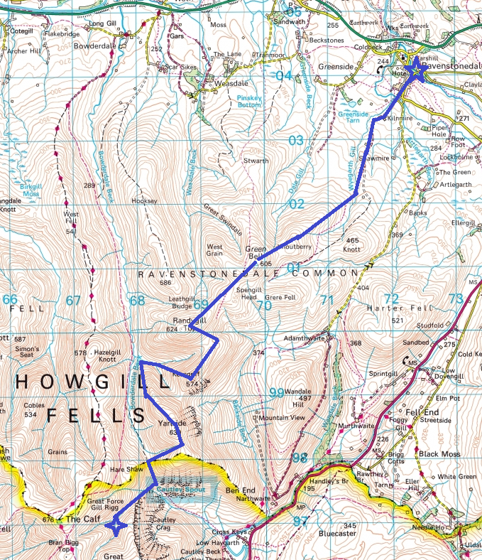
Looking at the maps of the Howgills, it’s immediately noticeable how difficult the access can be. You have one major path (The Dales Highway) through the fells running north to south, which ends at Sedbergh to the south, which takes you across saddles between the fells – and little else. The rest of the Howgills require sharp descents to access, and with the hot weather forecast, I knew this was going to mean heavy going. With it dry, I knew I could make good progress on the flat. my curiosity got the best of me and I started to sketch a route.
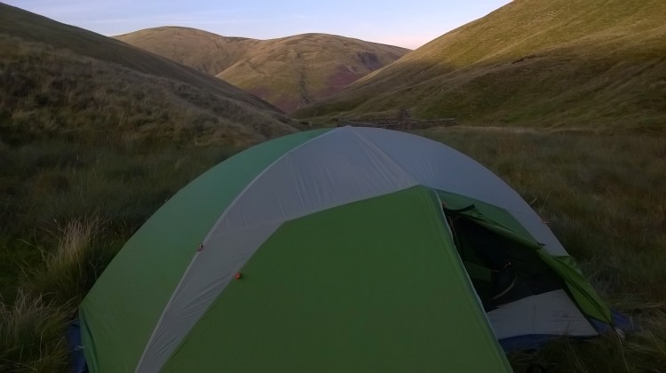
By the end of it, I had a monster couple of days planned, especially considering I’ve not done a wild camp for a while, and it would be the first test of a new dome tent, a ME Skyledge. I decided I’d rather make the most of the weather, even if it cost me a little skin on my heels, and planned to climb most of the Howgills in one go.
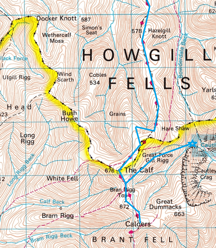
I intended to start with Green Fell from the North East, after parking in Ravenstonedale, and then continue towards Randygill Top (the first Nuttall of the weekend). Then keep heading towards Kensgriff, the steep Yarlside and then drop down to Cautley Spout for a camp near quick running water. The second day would be spent ascending the southern most Howgills – starting with Bran Rigg Top, then visiting Calders to the south, before turning north for The Calf. At this point, the intention was to swing to the north east, follow the saddle to Hazelgill Knott and West Fell, drop down to Bowderdale and turn east to follow the footpaths towards Ravenstonedale.
Packed up some gear and set off, eventually choosing to drop a sleeping bag (I only had a few larger synthetic ones and couldn’t find my tiny McKinley summer bag) and bring a cotton bag liner with an ajungiak cotton bivvy bag.
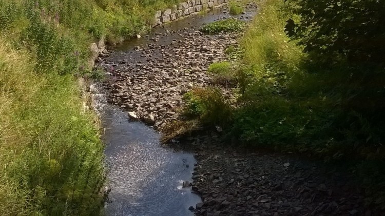
I arrived at around 11am, slung my 55l Montane Grand Tour across my shoulders and headed off, sun hat and shades out due to the heat of the sun. Presumably, the recent introduction of the area into the Yorkshire Dales National Park has made people far more keen to live there, and I passed quite a few houses under construction, huge things with views of the fells blessing their large windows. Not surprising, as it is a lovely little village with two pubs, shops and a stream running through it.
The route to Knoutberry, to the south of Ravenstonedale, was the usual mess of farmers tracks, with gates needing a little work and the track faint, and I switched to walking alongside the stream instead of bothering with indistinct paths. Knoutberry was a fairly windy summit, with pleasant views to the east, making a note to climb them in the future. This ended in a steep ascent of Green Bell, a fairly bland fell with superb views. This seemed a good spot for lunch, sheltering out of the wind behind the trig point. Just after finishing, I found the first walking party of the day, four hikers, probably two couples. We exchanged pleasantries, I asked where they were headed, and they replied that they did Randygill Top, and were now heading for Harter Fell before finishing. I assumed they must have had an early start and taken the Dales Way, and wished them well.
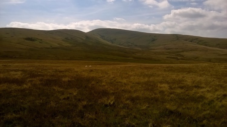
I continued south west towards Randygill Top, a hill with pleasant views to the south, showing the extremely steep northern slope of Yarlside, before dropping down out of the wind to the saddle between Kensgriff to the south east, before reaching Kensgriff’s cairn – only passing a few surprised sheep on the way. By this time it was mid afternoon and quite warm. I took one look at the ascent towards Yarlside from the summit of Kensgriff, a fell known for being an extremely arduous climb, and made the decision to skirt around to the north side and try to ascend with a slightly steeper ascent.
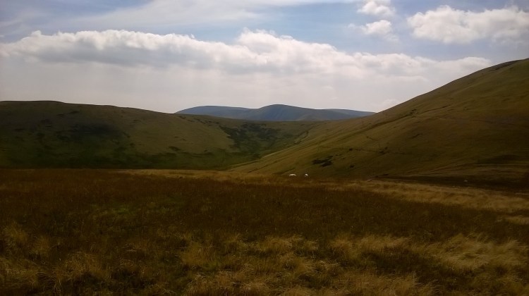
In hindsight, this was likely the harder route, and it was heavy going on an already scorching day. At the time, though, I had half an eye on my water supplies and wasn’t sure I could ascend Yarlside from the even steeper east side or whether it would leave me forced to double back. Dropping to the west gave me access to a fast running stream to restock the water bottles, before heading to the peak.
I arrived at the summit with the feeling that it couldn’t have come sooner, though I had used a fair bit of my water on the way up – and was greeted by gales as I crested the top, unfortunately stopping me from lingering to take many photos.
At this point it was getting on in the afternoon, I took a look at the map with a few marks for potential campsites, with a few areas near Cautley Spout which had potential. Considering it was dark around 9pm I knew I had plenty of time, but not if I had to double back for water, or double back to the bottom of the valley for a better site. I ended up taking a steep descent from Yarlside, intersecting with the valley floor path and then heading for the waterfalls themselves.
I had read when planning the walk that Cautley Spout was the highest waterfall in England – and considering I come from a county with High Force and Cauldron Snout, both impressive specimens, I was a little disappointed once I finally got to it. Perhaps it was due to there being precious little rain lately to reduce the flow, but I cracked on quickly to find a good site.

The waterfall itself has several hundred metres of ‘rolling’ waterfalls above it, with quick water churning rapidly downhill over a rocky bed, cut from the bottom of the valley over the years. I followed this up to a flat area, protected from the wind, where it joined another high stream, around 500m up, and decided to make camp.
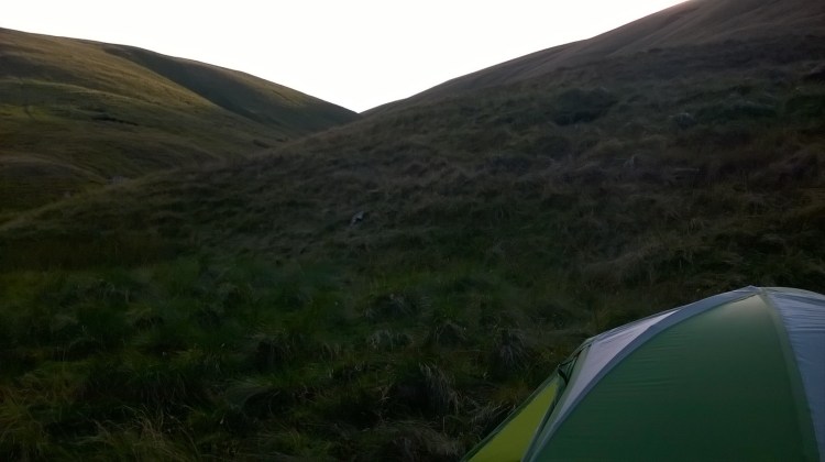
I took a ground sheet with me, which was a bit of an indulgence these days with ultra-lighters using the bare minimum – but was glad I did. -the only significant flat area was pretty damp. I stuck the mat in the tent to inflate whilst I enjoyed the evening view, the sunshine slowly receeding from the hills.
I had a pretty early night, looking for an early start the next day, got my thermal top and leggings on, and relaxed in my liner bag a little, with my cotton bivvy bag (with a waterproof bottom) on top for some extra insulation, put my iPod on and expected to drift off after a lot of steep walking miles done. Unfortunately, it soon became obvious it was going to be a cold night. The combination of a clear sky and camping at 500m was dropping the temperature from a conservative 20-22C during the day, to around 5C at night. I put my spare kit on and decided I’d have to take it as it came. I curled up, kept the iPod going all night and didn’t get much sleep.
Day Two
The light slowly appeared in the early hours, but I stayed put, I knew if I had to leave the tent I needed some sun to warm me up, and by 8 am I felt a little better. Leaving the tent was suddenly attractive, along with starting some breakfast porridge asap.
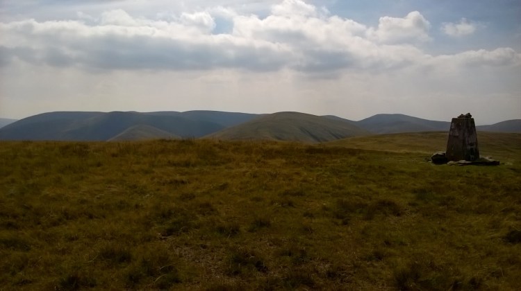
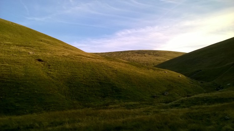
I warmed up, packed up and made a move, glad that the food and coffee had done its job, but also knowing a steep uphill would do a lot more to warm me up fully! I headed toward Bran Rigg Top straight up between both converging streams, before heading south to Calders, again in high wind, and continued north again to The Calf and the trig point.
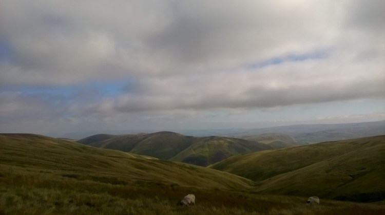
The Calf summit would have been beautiful on a still day, and food for any artist who enjoys a good landscape, though still in high winds I carried on to get out of the wind. I continued north east to a beautiful viewpoint at the head the valley’s stream, looking across the rolling fells was fantastic in the morning light. This was when I saw my first person of the day in the distance – who must have started early to be ascending that point by 10:30am!
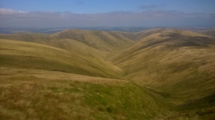
I now had a relatively easy hike over a succession of fells to clear, now late morning, all of them with fantastic views. It’s a shame I didn’t have much battery left to take photographs, but I would recommend anyone who has a half day to do the hike up to the Calf and back. Relatively easy walking, with one leisurely ascent at the start, and views which open up slowly and continue to do so all the way to the top of the valley. Gorgeous.
I passed a group of ramblers, around twenty, twenty-five of them, stopped for their lunch break. I came stomping over the hills, covered in sun-lotion, wearing my sunhat and no doubt looking rather tired after the sleepless night. With the views behind me and now on stone paths, to be honest I wanted to get back to the car due to my night of little sleep.
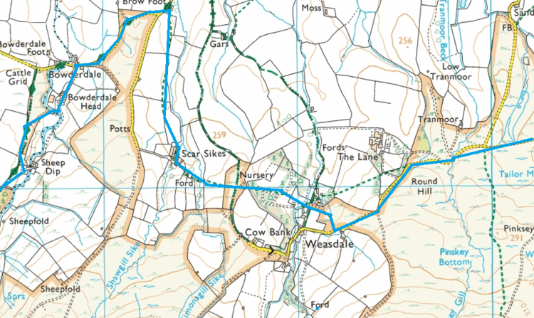
Bowderdale farm led on to around a kilometre of road walking, which I did unaccompanied other than a Yodel driver, flying around the corner to drop off a parcel at high speed, at one of the local farms. For a moment it occurred to me how many miles those delivery guys must be doing to deliver to people in the middle of nowhere. He flew past me on the way back, and I continued to Scar Sikes, through a functional plant nursery and back for some more road walking.
By this point I was pretty fed up, the combination of tired feet and lack of sleep wasn’t helping. I continued eastwards through several fields, finally returning to Ravenstonedale extremely tired and needing water rather badly! I dumped the pack in the car and drove to have a look at the pubs,
It was a fantastic couple of days, I saw fells I had yet to explore, and realised why some hikers swear by the Howgills when you want a quieter alternative to the Lake District.
A few learning points in gear choices, such as it’s always worth taking an insulating jacket regardless of the weather. If anyone is in the area, pull your boots on and go have a look.
